数量有限
提早预订,获得最划算价格
最低价保障
无额外预定费用
8天7夜自驾|冰岛环岛+黄金圈
4月下旬至10月上旬,可以在冰岛环岛自驾游。如果不想太赶路又没有太多时间,这个8天7夜的环岛行程是这个季节最经典的基础环岛线路。沿着著名的冰岛一号环岛公路,尽享沿途美景。
蓝湖温泉、黄金圈、野性南岸的黑沙滩、瓦特那冰川国家公园、杰古沙龙冰河湖、北部米湖、阿克雷里,这些你耳熟能详的冰岛最著名的目的地都被囊括在这个环岛行程中。如果你希望在观光接触上有更多特色体验,还可以在预定时选择增加一些额外项目,比如在黄金圈增加刺激的雪地摩托、在南岸的索尔黑马冰川增加冰川徒步(Sólheimajökull)、在杰古沙龙冰河湖湖中船游,如果你喜欢动物,还可以增加骑马、观鲸。
这个环岛自驾的行程只在4月底至10月初开放,是因为冰岛的东部、北部地区多山路弯路,冬季来的早,且风雪更大,在冬季有不小的危险性,加上冰岛冬季日照短,自驾的优势远不如夏季明显。所以出于安全考虑,我们必须对大家的安全负责,推荐大家在冬季不要环岛。
您可以选择舒适或高端级别的酒店,均含早餐、安排私人卫浴,车型则有二驱、普通四驱、高端四驱三种级别供您选择。
冰岛人口少,旅游行业乃至各行各业资源紧俏。您预定这个套餐,将不用烦恼策划、预定需投入的大量时间和精力,让Guide to Iceland的旅行专家帮您选择最适合的冰岛旅行资源,并提供给您详细的行程单。我们会为您安排好全程的住宿和租车,根据您的航班时间把蓝湖温泉和附加项目合理的安排在行程中,根据您对附加项目的需求进行行程微调。
如果你想来冰岛环岛自驾游,就赶紧预定这个8天7夜的经典线路,轻松出行,畅享在冰岛自驾的乐趣吧!
行程速览
- 运营日期 5月. - 10月.
- 长度 8 天
- 项目 冰川徒步, 浮潜, 岩洞, 雪地摩托, 观鲸, 观光, 温泉, 文化, 观鸟, 自驾
- 难度 容易
- 语言 English
- 亮点 蓝湖温泉,
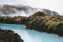
The Blue Lagoon is a geothermal spa and is the single most popular attraction in Iceland.
The water is rich in silica and sulphur that helps make your skin shine like a baby. The Blue Lagoon also operates a Research and Development facility that helps find cures for skin ailments using the mineral-rich water.
The temperature in the bathing and swimming area is very comfortable, and averages 37–39 °C (98–102 °F). There´s a restaurant there and it´s a truly romantic and beautiful place one should not miss while in Iceland.
黄金圈,The Golden Circle is a 300 km route to the 3 most popular natural attractions in Iceland. The Golden Circle consists of Geysir, Gullfoss and Thingvellir.
See this for Golden circle tours.
Geysir area
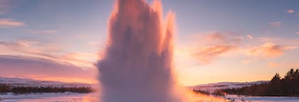
Geysir is a geyser that gives its name to hot springs all over the world. But although Geysir itself is not active anymore the area features spectacular hot springs such as the powerful Strokkur (spouting a vast amount of water every 10 minutes, regularly about 15-20 meters into the air), Smidur and Litli-Strokkur.
Gullfoss waterfall
The 'Golden Waterfall', is the second part of the Golden Circle, and one of the most beautiful and powerful waterfalls in Iceland, plummeting 32 meters into the river gorge of the popular rafting river Hvita. It is Iocated about 10 km from Geysir.
Thingvellir national park
The largest attraction of the Golden Circle is Thingvellir National Park. The Icelandic parliament was founded there in 930 and remained until the year 1798.
Today it is a UNESCO World Heritage Site and one of the most important places to visit in Iceland, not just for its historical and cultural values, but for also its magnificent landscape.
Thingvellir is surrounded by a beautiful mountain and volcano range and is the site of a rift valley, where the tectonic plates meet, marking the crest of the Mid-Atlantic ridge.
Of particular note at Thingvellir are the magnificent Almannagja gorge, and the beautiful lake Thingvallavatn, the largest lake in Iceland. The popular Gjabakkahellir lava cave is also in the area.
The fissure Silfra is located by Thingvallavatn, Iceland's largest lake, and is famous for its clear waters and popular for diving and snorkeling, as you can literally swim between continents.
南岸,From Reykjanesta and the next 100 km onwards, the south shore is characterized by lava formations constantly battered by the wild ocean waves (‘brim’ in Icelandic). For the next 300 km after that the shore consists of sands with hardly any harbours.
South Shore
Along with the powerful brakers, there is rich birdlife in the lava shore area. As for the sand shores, despite the lack of harbours, people would set off for fishing there anyway, at tremendous risk and this would indeed often result in great losses of life.
Among excellent places for a hypnotizing view of the massive white brakers, that may reach tens of meters into the air, are Reykjanesta, Grindavik, Strandakirkja, Eyrarbakki and Stokkseyri.
南部冰岛,South Iceland is the most popular part of the country and contains some of the most beautiful natural attractions in Iceland, among them the Golden Circle, some of Iceland's most famous active volcanoes as well as the beautiful Jokulsarlon glacier lagoon.
Geography
South Iceland is usually divided into the fertile South Icelandic lowlands between Hellisheidi and Eyjafjallajokull volcano on the one hand - and on the other hand the eastern part with the big volcanic glaciers Eyjafjallajokull and Myrdalsjokull (home of Katla) and flattened sands stretching towards the sea.
The South Icelandic lowlands
The South Icelandic Lowlands stretch nearly 100 km from Hellisheidi in the west towards Eyjafjallajokull in the east as a very flat and fertile farming land. From the shore the lowland stretches about km towards the inland. This is the best agriculture area in Iceland. The whole area is geologically very young, mainly of tuff type, formed during the Ice Age by the lava flows of the numerous volcanoes of the area. The area is indeed surrounded by volcanically active mountains on all sides. The glacier rivers of the area have helped filling the lavas with sand and clay, leaving it more and less smooth and fertile. Very strong earthquakes are found in this area as well.
The most active volcanoes of the area are Hekla and Eyjafjallajokull. No less active and not far off, but on the east side, is Katla, which we’ll adress in the eastern part-section. South of the mainland are the volcanic Westman Islands, famous for the 1973 eruption as well as the eruption in 1963, when Surtsey island was formed. Closely linked to the volcanic activity in the south is the geothermal heat found in many places, the best known being the Geysir area, which forms a part of the famed Golden Circle, which also consists of Gullfoss waterfall , Iceland's most famous waterfall as well as one of its most beautiful, located in the popular rafting river Hvita and Thingvellir National Park, comprising three of Iceland's most beloved natural attractions.
The earthquakes of the area bear witness to the fact that Iceland is still in shape. This is further evidenced by the endless number of fissures in the lavas, fractures in the mountains and certain pieces of lands sinking. The area of Thingvellir is the best known example of this, showcasing the continental drift. Thingvellir is a UNESCO World Heritage Site and the location of the old parliament, Althingi, (now situated in Reykjavik) and one of Iceland's most important sites.
Another of Iceland's most popular attractions is the beautiful Thorsmork valley, situated between Myrdalsjokull and Eyjafjallajokull.
Natural harbour-sites are hardly any on the South shore, due to sand produced by the glacier rivers. A few towns are found in the area, Selfoss being the biggest one, Hveragerdi is another, then there are Hella and Hvolsvollur, all conveniently located by the ring road. By the shore are three fishing villages; Thorlakshofn, Eyrarbakki and Stokkseyri. Thorlakshofn the only one of those that can accommodate modern ships and ferrys. The ferry to the Westman Islands sails from there. A new harbour has been built on the sandy coast opposite the Westman Islands. The whole south shoreline offers some of the most gigantic braker waves that you are likely to see.
Culturewise, in addition to Thingvellir, we reccomend the ancient bishop seat of Skalholt (weekends at Skalholt further offer rich music life). Also, Iceland's most famous saga, Njal's saga takes place in the South lowlands. We further recommend the large reconstructed turfhouse near Stong and the ancient excavated ruins.
For sports, horse riding is popular in the area as well as catching salmon or trout, hiking, and river rafting in Hvita.
The east part of South Iceland.
This is the area south and east of Myrdalsjokull. The volcanic glaciers Eyjafjallajokull (near the border of the eastern and western part) and Myrdalsjokull, dominate the view. The landscape has been shaped by volcanic eruptions and vast sands stretch to the sea. Some agriculture is found here, however, with the farms in a row alongside the mountains. A few large glacial rivers fall down in this area which also has striking waterfalls, such as Skogafoss and Seljalandsfoss.
Eyjafjallajokull is already well known for its 2010 eruption, disturbing air communication all over Europe for many days. Much more serious,however, would be an eruption from Katla, a volcano in the eastern part og Myrdalsjokull.
Katla’s last eruption was in the year 1918, when an enormous flood of water exploded from the glacier in a matter of minutes, threatening the local farmers of the area. Large amounts of ash and muddy material were brought to sea to form a new land of sand, Kotlutangi, later washed away by the sea. No people were killed in this eruption. Eruptions in Katla throughout the ages have further created the vast sand area Myrdalssandur. Sixteen eruptions have been recorded for Katla since 930 at intervals of 13-95 years and the volcano is being closely monitored, as time may draw near to its next eruption.
In the same volcanic system as Katla (geologically speaking), are the Lakagigar craters, northeast of Myrdalsjokull. Those erupted in the years 1783-84; producing the largest amount of lava known in historic times. The ashes hindered the sunlight from reaching down to the surface of Earth, resulting in cold climate over northern Europe.
In this area – what we call the eastern part of South Iceland -, there are many places worth visiting: Solheimajokull is a beautiful glacier in a walking distance (an outlet of Myrdalsjokull); Skogar has a very interesting museum of older time traditions and Skogafoss is only a few km away from there. One of Iceland’s most famous hiking routes, Fimmvorduhals, starts from Skogar. Southwest of the village Vik is one of Iceland’s most spectacular beaches, Reynisfjara. Together with the promontory Dyrholaey, which is the southernmost tip of the mainland of Iceland, it offers a breathtaking view with amazing rock formations, a black pebble beach, an abundance of birds and the powerful waves of the North Atlantic Ocean crashing on the beach.
Further east stretches the world's most vast sand plain, Skeidararsandur. North of the sand is the fascinating Skaftafell preservation area. At its east end, south of Hvannadalshnukur, Iceland's highest peak, is Ingolfshofdi cape, with its rich birdlife, old fishermen's shacks and its lighthouse. Following the shore further east is the incredibly beautiful and ice-filled Jokulsarlon glacier lagoon. Not far off is the region of Sudursveit, featuring the culture center and heritage museum Thorbergssetur, erected in the memory of Icelandic author Thorbergur Thordarson.
北部冰岛,North Iceland is very popular area in Iceland and contains some of the best attractions on the island. Akureyri is the capital of North Iceland and is the second largest "city" in Iceland. Around 20.000 people live in North Iceland.
The North coast has four major fjords (or bays) with mountain ridges between them and each of the fjords has corresponding agricultural districts.
The main districts are: Hunathing, Skagafjordur district, Eyjafjordur district and the amazing Thingeyjarsysla county, home to Lake Myvatn.
More attractions in the amazing Thingeyjasysla are mentioned below. Note that the first three areas are geologically speaking ancient formations, while Thingeyjasysla is recent and full of volcanic activity, young lava fields and tuff mountains.
Siglufjordur and Grimsey island are also part of the north but listed separately.
Eyjafordur
In Eyjafjörður is the capital of the North, Akureyri with 17.000 inhabitants. It is a very charming town and highly popular with travelers, so we advise you not to miss it. Many cruisers land in the port of the town.
The older part of Akureyri is particularly worth a stroll. If you like skiing or snowboarding, one of the best skiing sites in the country is located nearby.
We also recommend the botanical gardens there, fine restaurants and many interesting museums, such as Davidshus and Nonnahus, dedicated to the memory of poet David Stefansson and Jon Sveinson, author of the Nonnabaekur ('Nonni’s books').
Not far from Akureyri is the unique turf framhouse of Laufas, a museum and a prime example of the old architecture and farmlife. Also not far from Akureyri are the submarine geothermal silica cones of Strytur, a natural wonder and an excellent place for a dive.
One of Iceland's most beloved poets, Jonas Hallgrimsson was born in Eyjafjordur, at the farm Hraun in Oxnadalur valley and the knife-edged lava peaks there are particularly stunning. Also essential when traveling in the area is the beautiful and peaceful island Hrisey, often called 'The Pearl of Eyjafjordur'.
Siglufjordur
Siglufjordur has the distinction of not falling under the regular four part division, as it straddles the border of Eyjafjordur and Skagafjordur. Here we highly recommend the herring era museum and the folk music museum. Indeed, Siglufjordur hosts an annual folk music festival that is truly worth experiencing.
Hunathing
Among major attractions in Hunathing are the Regional Museum at Reykir in Hrutafjordur, the Seal Watching Center at Vatnsnes and the Arnarvatnsheidi heath, with a large numbers of ponds and lakes full of trout.
Skagafjordur
In Skagafjordur, the largest town of which is Saudarkrokur, we particularly recommend the historical bishop’s seat of Holar and the agricultural university there, the Glaumbaer museum, and Drangey island.
Thingeyjarsysla
Thingeyjarsysla county is the home of the beautiful waterfalls Godafoss and Aldeyjarfoss as well as the amazing Lake Myvatn with its fascinating pseudocraters and rich birdlife.
Near Myvatn is the chaotic lava field Dimmuborgir, a truly amazing sight (and paid homeage to by the Norwegian Black Metal band of the same name).
Husavik is the whale watching capital of the North so don’t miss that one either.
The Jokulsargljufur National Park is home to some of Iceland's most beloved natural attractions, Holmatungur, Hljodaklettar and the Asbyrgi canyon. In the river Jokulsa a Fjollum is Europe's most powerful waterfall, Dettifoss.
At the Melrakkasletta peninsula you can see fascinating birdlife and there is good trout fishing to be made there. Seals may be sighted as well as whales off the coast. The vegetation is rich and this is an ideal place to enjoy the midnight sun. Northern lights may also be spotted from late August to early April.
Grimsey
Far north, straddling the Arctic Circle is Grimsey island, the northernmost inhabited territory of Iceland, with a population of about 100 people. It is renowned for its fishermen, its rich vegetation and birdlife.
西部冰岛,West Iceland is home to Europe's most powerful hot spring, Iceland's most significant lava tube, fascinating glaciers, beautiful waterfalls, some of Iceland's most important historical sites and more. It has three main districts:
Borgarfjordur
Borgarfjordur has rich history, with Reykholt where Snorri Sturluson, author of Snorra-Edda and Heimskringla lived and featuring a medeval and cultural museum dedicated to his memory. In Borgarnes, the main village of Borgarfjordur, the Settlement Center can be found.The landscape is magnificent and includes the magical Hraunfossar waterfalls, Surtshellir lava cave, Deildartunguhver hot spring and Eiriksjokull glacier.
Snaefellsnes
The Snaefellsnes peninsula has its unique mountain ridge with the majestic Snafellsjokull glacier at its west end. The region around it is a national park, named after the glacier.
Breidafjordur
Breidafjordur is a natural reserve, a wide bay with countless small islands and home of thousands of birds. The inner part of Breidafjordur is the agricultural area Dalir. In Haukadalur is the old farm site Eiriksstadir, the home of Eric the Red, the first European to land in Greenland (in the year 984 AD). His son was Leif Ericsson, the first European to land in America (in the year 1000).
雷克雅未克,Reykjavik is the capital of Iceland and the northernmost capital of a sovereign state in the world.
Despite a small population (120.000 and more than 200.000 in the Greater Reykjavik area), it is a vibrant city that draws an ever increasing number of visitors. It is the financial, cultural and governmental center of Iceland. It also has a reputation of being one of the cleanest and safest cities in the world.
Geography
The city of Reykjavik is located in southwest Iceland by the creek of the same name. Throughout the ages, the landscape has been shaped by glaciers, earthquakes and volcanic eruptions and the area is geothermal. Much of the current city area area was subglacial during the Ice Age, with the glacier reaching as far as the Alftanes peninsula, while other areas lay under the sea. After the end of the ice age the land rose as the glaciers drifted away, and it began to take on its present form.
The coastline of Reykjavik is set with peninsulas, coves, straights and islands, most notably the island of Videy, and seabirds and whales frequent the shores. The mountain ring as seen from the shore is particularly beautiful. Mount Esja is the highest mountain in the vicinity of Reykjavik and lends its distinct feature to the whole area. This majestic mountain is also highly popular for climbing. Other notable mountains that can be seen from the seaside are Akrafjall and Skardsheidi and on clear days one may even see as far to the legendary Snaefellsjokull glacier, at the end of the Snafellsnes peninsula.
The largest river to run through the city is Ellidaa in Ellidaardalur valley, which is also one of Iceland‘s best rivers for salmon fishing.
Transportion
There are no trains or trams in Iceland, but most people travel by car. The city also operates a bus system. There are two major harbours in town, the old harbour in the center and Sundahofn in the east. The domestic Reykjavik Airport is located at Vatnsmyrin, not far from the city center and close to Oskjuhlid and Perlan. The international Keflavik Airport at Midnesheidi heath then lies around 50 km from the city. Cars, jeeps and bicycles can be readily rented in the city and many organized tours are also being offered.
What to See & Do in Reykjavik
The local arts scene is strong in Iceland, with both annual events and single ones, many of whom have hit the international stage. For the annual ones please check our articles Best Annual Events in Iceland and the Top Ten Festivals in Iceland. Major events taking place in Reykjavik include the Iceland Airwaves, Gay Pride, RIFF (The Reykjavik International Film Festival), The Reykjavik Literature Festival, Cultural Night, the Reykjavik Arts Festival, Food & Fun, the Reykjavik Fashion Festival and the Sónar music festival.
Among famous people from Reykjavik are artists Bjork Gudmundsdottir, Sigur Ros, writers Halldor Laxness (born in Laugarvegur) and Arnaldur Indridason and mayor Jon Gnarr. For more well-known and fairly-well known Icelanders, check our article on the subject.
You might also want to check our article on some of the many things to see and do in Reykjavik, such as visiting the city‘s many museums, exhibitions and galleries, checking out live music, visiting the Harpa music hall or the theaters, visiting the lighthouse at Grotta, the main shopping street of Laugavegur, visiting the old harbour and the flea market, going on a bird- and whalewatching tour or visiting Videy island. We also have a top ten list of things to do.
Make sure to visit the publis square of Austurvollur, one of the city‘s most popular gathering places, where you‘ll also find the national parliament, Althingi, the state church a statue of independence hero Jon Sigurdson, as well as cafés, bars and restaurants. Austurvollur was central in the 2008 protests, along with Laekjargata, home to the House of Government. You are also not likely to miss the great church of Hallgrimskirkja that towers over the city from the hill of Skolavorduholt, wherefrom you‘ll get a great view of the city.
Try a walk by the city pond, greet the many birds that frequent the area and visit the city hall, stationed by its banks. The Hljomaskalagardur is a beautiful park that lies by the pond, it ideal for a nice walk and sometimes concerts get held there. Further off is the campus of the university of Iceland, the Nordic house and the Vatnsmyri wetland, a particularly pleasant place, but be mindful of not disturbing the wildlife there and keep to the pathways.
For a nice swim on a warm day, we particularly recommend Nautholsvik beach.
Visit the Laugardalur valley, home to one of the city‘s best swimming pools, as well as the Asmundarsafn gallery, a beautiful botanical garden and a domestic zoo. A walk by the Aegissida beach, with it‘s old fishing sheds, in the west part of Reykjavik also holds a particular charm. The aforementioned Elllidaardalur valley is also a popular resort.
Another place that offers one of the city‘s best (and free) views is Perlan, up in Oskjuhlid hill. The hill itself is a popular resort, with over 176.000 trees and great opportunities for walking and cycling.
Travel to Alftanes to see the president‘s house at Bessastadir, which is also a historical site in it‘s own right, having been the educational center of Iceland for centuries. Nearby is a beautiful lava field, Galgahraun, well worth a visit, though there is currently an environmental struggle going on as to it‘s future state.
The city is furthermore a short drive from many of Iceland‘s major attractions, most famously the Golden Circle and the Blue Lagoon. In close vicinity you‘ll also find the Heidmork preservation area, a favorite passtime resort of the people of Reykjavik, as well as the Blue Mountains, one of Iceland‘s most beloved skiing venues.
Check our Best of Reykjavik guide further for tips on the best cheap things to do in Reykjavik, some of the best restaurants in the city, happy hours, the top ten value places to eat and our two articles on the famous Reykjavik nightlife; Nightlife in Reykjavik and Nightlife and mating.
Finally, we‘d like to stress that these are only some suggestions of the many things you might check out in Reykjavik. Whatever you choose to do, we hope you‘ll be able to make the most of your visit and we wish you a pleasant stay in our capital.
阿克雷里,Akureyri, ‘The Capital of the North’ is a town in the fjord Eyjafjordur in North Iceland. It lies just 100 km away from the Arctic Circle. It is Iceland’s second-largest urban area with a population of about 17,800.
Economy
Akureyri is an important fishing centre and port, but in the last few years tourism, industry, higher education and services have become the fastest growing sectors of the economy.
An international airport is located about 3 km from the center. A large number of cruisers also stop at Akureyri. One of Iceland's best skiing sites is found by Akureyri, at Hlidarfjall.
Traditionally Akureyri has survived on fisheries and some of Iceland’s largest fishing companies, like for example Samherji, have their headquarters there. Other large companies include Brim, Nordurmjolk, and Vifilfell hf, the largest brewery in Iceland.
FSA/Akureyri Hospital is a major employer in the area and is one of two major hospitals in Iceland.
Akureyri has excellent facilities for travelers and is located a short drive from many of Iceland’s top natural, cultural and historical attractions.
Nature & Landscape
Akureyri is surrounded by mountains, the highest one being Kerling (1538 m). The area around it has rich agriculture and a beautiful mountain ring.
The innermost part of the fjord, Pollurinn ('The Pool') further lends the town a special character. The climate in Akureyri is generally very pleasant.
The islands Hrisey in the middle of Eyfjordur and Grimsey, straddling the Artic Circle, both belong to the municipality of Akureyri. Hrisey is often called 'The Pearl of Eyjafjordur' and Grimsey 'The Pearl of the Artic' and these beautiful and peaceful islands are highly popular with travelers.
History & Culture
During World War II the town was an important site for the Allies and the town grew considerably after the war, as people increasingly moved to urban areas.
Akureyri has a strong cultural scene, with several bars and renowned restaurants. Folk culture in general is more prevalent there than in Reykjavik. During the summer there are several notable festivals in Akureyri and its surroundings.
Sites of interest in Akureyri include the brand-new Hof concert hall and Akureyri’s many museums, The Nature Museum, Nonnahus, a.k.a. Jon Sveinsson Memorial Museum, for the writer, David's house or David Stefansson Memorial Museum, for the poet, Akureyri Art Museum.
Akureyri also has several churches, Akureyrarkirkja being the most notable, as well as beautiful botanical gardens. The old town is particularly charming, ideal for a nice walk.
杰古沙龙冰河湖,Jökulsárlón is Iceland’s most famous glacier lagoon. Conveniently located in the southeast by Route 1, about halfway between the Skaftafell Nature Reserve and Höfn, it is a popular stop for those travelling along the South Coast or around the circular ring road of the country.
Geography
As a glacier lagoon, Jökulsárlón is a lake that is filled with the meltwater from an outlet glacier. In this case, it is Breiðamerkurjökull, a tongue of Europe’s largest ice cap, Vatnajökull.
It stands out, however, due to the fact that it also fills with icebergs breaking from the glacier, some of which tower several stories high.
These icebergs, other than their scale, are notable for their colouration. Although they are, as expected, largely white, most are also dyed electric blue in part, with black streaks of ash from eruptions centuries past.
When the icebergs finally make it across the lagoon, they either drift out to sea or wash up on the nearby shore. Because of the way they glisten against the black sands of Breiðamerkursandur, this area has been nicknamed ‘the Diamond Beach’.
In spite of being a rather recent formation, Jökulsárlón is the deepest lake in the country, with depths reaching 248 metres. With a surface area of 18 square kilometres, it is also growing to be one of the largest.
History
Jökulsárlón has not been around since Iceland’s settlement; it only formed around 1935. This was due to rapidly rising temperatures in the country from the turn of the twentieth century; since 1920, Breiðamerkurjökull has been shrinking at a dramatic rate, and the lagoon has begun to fill its space.
Today, the expansion of Jökulsárlón is accelerating. As recently as 1975, it was just 8 square kilometres, and now that size has more than doubled.
In the relatively near future, it is expected that the lagoon will continue to grow until it becomes a large, deep fjord.
Though a dark omen for Iceland’s glaciers and ice caps in general, the retreat of Breiðamerkurjökull has resulted in an incredibly beautiful, if temporary, site. This has not been overlooked by Hollywood.
Jökulsárlón has been featured in the James Bond films A View to Kill in 1985 and Die Another Day in 2002, 2001’s Lara Croft: Tomb Raider, and 2005’s Batman Begins.
In 2017, Jökulsárlón was enveloped into the Vatnajökull National Park, thus it is now fully protected by Icelandic law.
Wildlife
Because of the wealth of herring and capelin that the tides bring into the lagoon, Jökulsárlón is somewhat of a hot-spot for Iceland’s wildlife.
In summer, it is a nesting site for Arctic Terns; stay well away from this area, as these birds are notorious for the fierceness with which they protect their eggs, dive-bombing the heads of any they see as a threat. Skuas also nest on the lake’s shores in this season.
Seals can be reliably spotted here throughout the year, swimming amongst or else hauling out on the icebergs. Jökulsárlón provides them with a safe haven to rest and socialise, especially considering the waters of southeast Iceland are renowned for their population of orcas.
瓦特那冰川,Vatnajökull is the largest ice cap in Iceland and the third largest glacier in Europe, covering 8% of the island's landmass.
Facts about Vatnajökull
- Surface: 8,100 km2
- Average thickness: 400 - 600 m
- Maximum thickness: 1,000 m
- Height: 1,400 - 1,800 m
- Highest peak: 2,200 m (Hvannadalshnjúkur)
Information about Vatnajökull
Vatnajökull Glacier belongs to the greater Vatnajökull National Park, which encompasses the former national parks Skaftafell in the southwest and Jökulsárgljúfur in the north. Vatnajökull's highest summit is Hvannadalshnjúkur, which rests on top of the stratovolcano known as Öræfajökull.
Underneath the glacier rest some of the most active volcanoes in the country, the most notable being Grímsvötn, Öræfajökull and Bárðabunga. The volcanic activity of the glacial area occurs at intervals throughout the ages, and many geologists believe such a period is scheduled to happen in the immediate future. If their calculations are correct, it would mean a significant volcanic activity for Vatnajökull over the scope of the next half century.
The glacier boasts of over 30 outlet glaciers, which are channels of ice that flow out of ice caps but remain constrained on the sides to valleys. The major outlet glaciers of Vatnajökull include Dyngjujökull in the north, Breiðamerkurjökull and Skeiðarárjökull to the south; and Síðujökull, Skaftárjökull and Tungnaárjökull to the west.
Glaciers are in constant motion underneath their weight, as they form over centuries when the accession of snow exceeds its melting. Each year, due to the melting ice water, new ice caves form that disappear come spring.
- Click here for a selection of Ice Cave tours
Numerous rivers run out of Vatnajökull, making up some of the greatest glacial rivers in Iceland:
- Tungnaá (west)
- Köldukvísl (west)
- Þjórsá (west)
- Jökulsá á Fjöllum (north)
- Skjálfandafljót (north)
- Jökulsá á Brú (north east)
- Jökulsá í Fljótsdal (north east)
- Jökulsá í Lóni (south)
- Hornafjarðarfljót (south)
- Jökulsá á Breiðamerkursandi (south)
- Skeiðará (south)
- Núpsvötn (south)
- Hverfisfljót (south)
- Skaftá (south)
Vatnajökull National Park
The Vatnajökull National Park in its current state was established in June 2008. The park now covers an area of 14.141 km2, making it the second largest national park in Europe with a 14% coverage of the island of Iceland.
The combined forces of volcanic and geothermal activity, glacial rivers and ice make up the different features of incredible landscapes that together give Vantajökull National Park its unique qualities.
Rivers divide the highland plateau to the north of the park; an area that sees massive glacial flows in the summertime. The volcanic table mountain Herðubreið towers over this particular region, along with volcanoes Askja, Snæfell and Kverkfjöll.
The canyon Jökulsárgljúfur was carved out by glacial floods centuries ago. At the upper end of the canyon, you'll find Dettifoss, the most powerful waterfall in Europe. Further north, the horseshoe-shaped canyon Ásbyrgi is believed to have formed when Óðinn's horse Sleipnir stepped his foot down from the heavens.
East around Snæfell, wetlands and ranges are home to roaming herds of wild reindeer and abundant birdlife. Steep mountain ridges make up the south side of Vatnajökull, where outlet glaciers crawl in between the ridges onto the lowlands. The sandy plains of Skeiðarársandur also lie to the south as they reach out to sea. The glacial river Skeiðará runs through this vast desert.
One of Iceland's most visited landmarks is the Jökulsárlón glacier lagoon, which sits at the head of outlet glacier Breiðamerkurjökull. There, large icebergs that have broken off the glacier gather to float in the lake before ending up in the Atlantic Ocean, or on the nearby Diamond Beach.
- Click here for a selection of Jökulsárlón tours
The Future of Vatnajökull
The volume of Vatnajökull reached its peak around 1930 but has since been in a steady process of decline. Because of rising levels of global temperature, approximately over the last 15 years, Vatnajökull has on average lost about a metre of its thickness annually.
If temperature levels continue to rise, the glacier could be all but gone nearing the end of the next century, leaving only small ice caps on top of the highest mountain summits.
Vatnajökull and Jökulsárlón in Popular Culture
- HBO's Game of Thrones (season 2, 2012)
- Batman Begins (2005)
- James Bond: Die Another Day (2002)
- James Bond: A View to a Kill (1985)
米湖,Myvatn is a beautiful lake with many small islands in the north of Iceland, the fourth largest lake in the country. Along with its surrounding area, the lake is one of Iceland's most amazing natural attractions.
Some of the islands in Myvatn are pseudocraters, formed by steam explosions. The lake has rich birdlife and more species of ducks than anywhere else in the world. As for vegetation, it is one of the few places in the world that grows Marimo, also known as Cladophora ball, Lake ball, or Moss Balls in English, a species of filamentous green algae (Chlorophyta).
The Myvatn nature baths are also renowned throughout the world, a perfect place to relax, surrounded by breathtaking landscape.
Close to the lake is Dimmuborgir, a fascinating area of dramatic and chaotic lava. Norwegian symphonic metal band Dimmu Borgir takes its name from the the lava field, and it continues to inspire travellers from all over the world.
The Myvatn area is definitely one of the most beautiful places in Iceland. Don´t miss it!
黑暗城堡(Dimmuborgir),Dimmuborgir (e. ‘Black Forts') is a large area of chaotic lava, situated right east of Lake Myvatn, in North Iceland. With its dramatic view, Dimmuborgir is one of Iceland's most popular attractions.
The area is composed of various volcanic caves and rock formations, reminiscent of an ancient collapsed citadel. In folklore the Dimmuborgir lava field has been connected with hell, Satan was to have landed there after being cast from heaven and the Norwegian symphonic black metal band derives its name from the region.
众神瀑布(神之瀑布),Goðafoss waterfall is located the river Skjálfandafljót in north Iceland, the fourth largest river in Iceland. It is one of the most spectacular waterfalls in Iceland, falling from a height of 12 metres over a width of 30 metres.
The fall's name means either waterfall of the gods or of the 'goði' (i.e. priest/ chieftain). It is said that when the lawspeaker Þorgeir Ljósvetningagoði declared Christianity the official religion in Iceland, after his own conversion, he threw the statues of the old Norse gods into the waterfall.
黛提瀑布,Dettifoss, in the glacier river Jokulsa á Fjollum, flowing from the glacier Vatnajokull, is reputed to be the most powerful waterfall in Europe.
This thunderous fall has an average waterflow of 193 m3 per second. It is 100 meters (330 ft.) wide and plummets 45 meters (150 ft.) down to Jokulsargljufur canyon.
斯科加瀑布(森林瀑布),Skógafoss is one of the country’s biggest and most beautiful waterfalls with an astounding width of 25 meters (82 ft) and a drop of 60 meters (197 ft). Due to the amount of spray the cascade produces, a rainbow is present any time the sun emerges from behind the clouds.
Located on the Skógá river, this mighty cascade is clearly visible from Route 1 and is an excellent place to stop and stretch the legs while travelling Iceland’s South Coast. The river below Skógafoss holds a large char and salmon population and is thus a favourite spot for fishermen in the summer.
The land underneath the waterfall is very flat, allowing visitors to walk right up to the wall of water. Keep in mind, however, that this will get you drenched. Skógafoss can also be viewed from the top as a steep staircase leads to an observational platform above the cascade.
Geography
Skógafoss is located near the small village of Skógar, south of the Eyjafjallajökull glacier volcano. There you’ll find the Skógasafn folk museum, an open-air museum with both old wooden houses and turf houses, as well as a regional museum with various artefacts from this area.
A part of the Skógasafn Regional Museum is the Museum of Transportation, which showcases the history and evolution of transportation, communication and technologies in Iceland. There, you can see how this nation evolved from the age of the working horse to the digital communications of the 21st century.
The Skógasafn museum also includes a café and a museum shop, and in the village of Skógar, you will find both a hotel and a restaurant.
At the eastern side of Skógafoss, you will find one of Iceland’s most famed hiking routes; the Fimmvörðuháls pass. The 22 km (14 mi) trail takes you along Skógá river, between two glaciers, Mýrdalsjökull and Eyjafjallajökull, before ending in the beautiful Þórsmörk valley.
Folklore
A gold ring is on display at the Skógasafn museum. According to legend, the ring is from a chest that was owned by Þrasi Þórólfsson, one of the first Viking settlers in the area. Folklore states that before his death in 900 AD, Þrasi buried a chest filled with gold in a cave behind Skógafoss waterfall.
Many attempts were made to retrieve the chest after Þrasi’s death, and years later, locals managed to grasp a ring on the side of the chest. As they pulled, the ring broke off, and the treasure was lost forever. The ring was then given to the local church before it made its way to the museum.
塞里雅兰瀑布,塞里雅兰瀑布是冰岛南部最著名的一个瀑布,瀑布的水流相对比较苗条,但高度在冰岛名列前茅,高达63米。瀑布非常美丽,最特别之处在于一条通向瀑布水帘背面的小径,让人可以走道瀑布后面。
盖歇尔间歇泉,Geysir is a famous hot spring in Haukadalur valley in South Iceland. Part of the ‘Golden Circle', Geysir gives its name to hot springs all over the world.
Though Geysir itself is hardly active anymore, the area features spectacular hot springs such as the powerful Strokkur, which spouts a vast amount of water every 10 minutes, around 15-20 meters into the air, Smidur and Litli-Strokkur.
North of Geysir are fumaroles, i.e. unlike the hot springs the emit hot water, only steam and gas emanate from these. You may be able to observe bright yellow stains at the fumaroles, this is native sulphur, which crysallizes from the steam. At the southern part of the geothermal area, called Thykkuhverir, you‘ll find various mud pots. Such mud pots are actually fumaroles that boil up through surface water/groundwater and may become steaming fumaroles during dry spells, rather than the usual boiling mudpots.
About 2 km from Geysir is an old preserved natural pool called Marteinslaug. One can bathe in it and it has room for 3-5 people at a time, but care should be taken, as the area around the pool is very delicate. The temperature is 39-43°C, depending on how you are positioned in the pool. The water is slightly muddy, as the pool is built on soil, and the bottom is slippery due to algae, so caution is advised.
In Haukadalur there has also been tree planting in recent times and today the forest Haukadalsskogur is one of the largest in South Iceland. Aspen, various types of pine, and other plants have been tried out there and experiments and research continue. We also recommend visiting the tree museum, built in the memory of forester Gunnar Freysteinsson. There are good paths and roads in the forest and the wood is specially designed to accommodate wheelchairs.
Haukadalur has been a church site since ancient time. The current wooden church was last rebuilt in 1938 but the variety and appearance of the church dates back to 1842, making it one of the oldest of its kind in Iceland.
Haukadalur is indeed a historical place. It was settled during the age of settlement and scholar Ari “The Wise“ Thorgilsson grew up there. The first pastoral school in Iceland was also built there.
For accommodation, Hotel Gullfoss is about 7 km from the Geysir area, and closer still is the Hotel Geysir.
黄金瀑布(居德瀑布),Gullfoss (translated to ‘Golden Falls’) is one of Iceland’s most iconic and beloved waterfalls, found on the Hvítá river canyon in south Iceland. The water in Hvítá river travels from the glacier Langjökull, finally cascading 32m down Gullfoss’ two stages in a dramatic display of nature’s raw power.
Because of the waterfall’s two stages, Gullfoss should actually be thought of as two separate waterfalls. The first, shorter stage of the waterfall is 11m, whilst the second stage is 21m. The canyon walls on both sides of the waterfall reach heights of up to 70m, descending into the 2.5km long Gullfossgjúfur canyon (geologists indicate that this canyon was formed by glacial outbursts at the beginning of the last age.)
In the summer, approximately 140 cubic metres of water surges down the waterfall every second, whilst in winter that number drops to around 109 cubic metres. With such energy, visitor’s should not be surprised to find themselves drenched by the waterfall’s mighty spray-off.
Gullfoss makes up a part of the highly popular Golden Circle tour, alongside Geysir geothermal area and Þingvellir National Park.
History
In the early days of the last century, Gullfoss was at the centre of much controversy regarding foreign investors and their desire to profit off Iceland’s nature. In the year 1907, an English businessman known only as Howells sought to utilise the waterfall’s energy and harboured ambitions to use its energy to fuel a hydroelectric plant.
At the time, Gullfoss was owned by a farmer named Tómas Tómasson. Tómas declined Howell’s offer to purchase the land, stating famously “I will not sell my friend!” He would, however, go on to lease Howells the land, inadvertently beginning the first chapter of Icelandic environmentalism.
It was Tómas’ daughter, Sigríður Tómasdóttir, who would lead the charge. Having grown up on her father’s sheep farm, she sought to get the lease contract nullified, hurriedly saving her own money to hire a lawyer. The ensuing legal battle was an uphill struggle; the case continued for years, forcing Sigríður to travel many times by foot to Reykjavík if only to keep the trial moving. Circumstances became so difficult that Sigríður threatened to throw herself into the waterfall if any construction began.
Thankfully, in 1929, the waterfall fell back into the hands of the Icelandic people. Today, Sigríður is recognised for her perseverance in protecting Gullfoss and is often hailed as Iceland’s first environmentalist. Her contribution is forever marked in stone; a plaque detailing her plight sits at the top of Gullfoss.
Restaurant / Cafe
Besides Gullfoss, visitors can enjoy the views from Gullfoss Cafe, a locally run delicatessen that serves a wide variety of refreshments and meals. The menu has options to tantalise everyone’s taste buds; hot soups, sandwiches, salads and cakes. There is also a shop on site where visitors’ can browse and purchase traditional Icelandic souvenirs.
迪霍拉里,The 120 meter high promontory Dyrholaey is the southernmost part of the mainland, only a short drive south of the Ring Road. It offers a breathtaking view and features spectacular outcrops and rock formations.
A notable attraction is the massive arch that the sea has eroded from the heartland, giving the island its name (‘dyr’=door’). One daredevil pilot even flew through it!
Dyrholaey has an abundance of birdlife, the most common being puffins and eider ducks. You can also enjoy the black beach, where the waves can provide an impressive sight. As these can be very wild, we do however advise uttermost caution.
辛格维利尔(辛格韦德利),Thingvellir is one of the most important sites to visit in Iceland for its landscape, history and cultural value.
The Icelandic parliament was founded in Thingvellir in 930 and remained there for centuries.Thingvellir is surrounded by a beautiful mountain range and is the site of a rift valley, marking the crest of the Mid-Atlantic range. Today it is a natural park, listed as a World Heritage Site by UNESCO and considered a vital part of the ‘Golden triangle’ (with Geysir and Gullfoss). Of particular note is the magnificent gorge Almannagja, which marks the eastern boundary of the north American plate and into which the beautiful waterfall Oxararfoss falls.
Other notable attractions within the park include the beautiful lake Thingvallavatn, the largest lake in Iceland, the Silfra fissure, one of the world's top dives, and Gjabakkahellir, one of Iceland's most interesting lava tubes.
赫伦瀑布群(熔岩瀑布),Hraunfossar in Borgarfjordur district is a series of beautiful waterfalls formed by rivulets streaming from a short distance out of the Hallmundarhraun lava field.
The lava field flowed from an eruption of one of the volcanoes lying under the glacier Langjokull. The waterfalls pour into the Hvita river from ledges of less porous rock in the lava. These are some of the most magnificent falls found in Iceland and not to be missed.
德尔达图赫菲,Deildartunguhver, by Reykholt, in Borgarfjordur district, has the highest flow rate for a hot spring in Europe.
The flow rate of Deildartunguhver is 180 liters/second and water emerges at 97 °C. The place is also unique for being the only place in the country where the hard fern grows.
斯卡夫塔山,斯卡夫塔山是冰岛Öræfasveit地区的一个自然保护区,它曾经是一个国家公园,2008年,和杰古沙格鲁夫尔(Jökulsárgljúfur)国家公园合并为如今的瓦特那冰川国家公园(Vatnajökull National Park)。
斯卡夫塔山地区的植被非常有特色,它们生长在沙地与冰川形成的特色地貌上,给整个地区带来盎然生机和独特的自然风光。从斯卡夫塔山游客中心可以沿徒步路径通向斯瓦蒂瀑布(Svartifoss,意为黑瀑布,又译为魔鬼瀑布)、Hundafoss瀑布,以及斯卡夫塔山冰川,远处是Kristinartindar山和Morsardalur山谷。
对于户外爱好者,斯卡夫塔山是前往冰岛最高峰-华纳达尔斯赫努克火山(Hvannadalshnjúkur)的最佳营地选择。
斯卡夫塔山游客中心(Skaftafell Visitor Center)
在斯卡夫塔山的游客中心,您可以找到此地区最完备的信息,以及它的历史、地理知识。您可以了解以此为出发地的各个徒步线路、观光建议、住宿选择等。
霍芬镇(赫本镇),Hofn a Hornafirdi, is a fishing town in southeast Iceland, with a population of 1641 (as of 2011). It has a strong harbour and its main industries are fishing and tourism.
Of note are several interesting museums and the annual Humarhatid (lobster festival). The area is also rich and varied birdlife and migratory birds from Scotland land here around April and leave around August/September.
朗格冰川,The mighty Langjokull (“The Long Glacier“), in the midwest highlands is the second-largest glacier in Iceland, at 935 km2. For jeep and snowmobile trips, Langjokull is the most popular glacier in Iceland and skiing and hiking is possible as well. We stress that under no circumstances should one travel alone on Langjokull, as there are many cracks in the glacier. Experience of the area, whether that of yourself or of those traveling with you is all important.
Highland tracks
Two main highland tracks, connecting the north and the south, lie alongside the glacier, Kaldidalur road and Kjalvegur (a.k.a. Kjolur road). The Kaldidalur road stretches from Thingvellir northwards to Husafell (in Borgarfjordur district), between Langjokull and Ok shield volcano. Kjalvegur lies east of Langjokull and west of Hofsjokull glacier, starting near the famous Gullfoss waterfall to the south and the Svartakvisl stream by the Hveravellir geothermal area to the north.
The Landscape of Langjokull
Langjokull is about 50 km long and 15-20 km wide. The volume of the glacier is 195 km3 and the ice is around 580 m thick. The glacier reaches its highest point at the northernmost part of the glacier, which is called Baldjokull, rising around 1450 m above sea level.
Counting west and southwards from there, outlets extending from the main glacier are Thristapajokull, Flosajokull, Geitalandsjokull, Flosajokull, Geitlandsjokull and West- and East Hagafellsjokull furthest south, separated by Mt. Hagafell. On the eastside from north to south are Leidarjokull, Kirkjujokull, Nordurjokull, and Sudurjokull.
The glacier lies over a massif of hyaloclastite mountains that rise highest in the south and the east. The tops of these mountains can be seen in certain places on the glaciers. To the northeast are Hyrningur (1320 m), Peturshorn (1358) m), Fjallkirkja (1248 m) and Thursaborg (1315 m), a mighty series of immense rock pillars rising high to the sky. In the southern part of Langjokull, between Lonsjokull and Vestri-Hagafellsjokulll is the 995 high Klakkur.
Notable nearby mountains
The main mountains that lie close to Langjokull to the north are Krakur and the Burfjoll mountain range, slightly eastwards. East of Baldjokull are Hafjall and the Thjofadalafjoll mountain range. Hrutfell with the Hrutfellsjokull glacier cap (1396 m) lies east of Fjallkirkja and is the most impressive mountain of the Kjolur area, along with Kjalfell (1008 m), further northeast.
On the south eastern side of Langjokull, between the outlets Nordurjokull and Sudurjokull lies Mt. Skridufell (1235 m) and south of Sudurjokull is the shield volcano Skalpanes. Further east, i.e. south of Hvitarvatn is the 1204 m high Blafell and south of Skalpanes is the impressive palagonitic mountain range Jarlhettur. Among the most prominent mountains south of the Langjokull glacier is Hlodufell at 1186 meters and the Skjaldbreidur shield volcano further east.
Among the most prominent mountains to the west of Langjokull are Hafrafell, south of Eiriksjokull, North- and South Hadegisfell, Ok volcano, Prestahnukur volcano, and Stora- and Litla Bjornsfell.
Nearby glaciers
Glaciers located near to Langjokull are Eiriksjokull, to the west, the highest mountain of West Iceland, and Thorisjokull, further southwest. Hrutfellsjokull lies on the east side of Langjokull.
Between Thorisjokull and Geitlandsjokull is a valley called Thorisdalur. Along with stunning views it features prominently in Icelandic folk tales and the outlaw Grettir the strong of Grettis saga fame is further reported to have resided there for one winter.
Glacier-fed rivers & lakes
Two glacier rivers, both bearing the name of Hvita (‘White River’) trace their sources to Langjokull. The first is the mighty Hvita in Arnessysla county, home to Iceland‘s most famous waterfall, Gullfoss, the beautiful Bruarhlod canyon and one of Iceland‘s most popular rafting rivers. The source of this river is Hvitarvatn lake, east of Langjokull. The outlet Nordurjokull reaches the lake and lends it a distinctly glacial colour. Sudurjokull used to reach it as well but has retreated in recent times.
The other Hvita glacier river, in Borgarfjordur, also has its source in the area, by Eiriksjokull glacier. In this river are the beautiful waterfalls Hraunfossar and Barnafoss. Indeed, many of the hot springs in Borgarfjordur receive ground water from Langjokull. Sub-surface water also flows south to Lake Thingvallavatn, reappearing in springs in and around the lake. A few rivers flowing north to Hunafloi bay also have their sources there.
To the south, Eystri-Hagafellsjokull feeds a lake called Hagavatn and several smaller river flow from there to lake Sandvatn. In turn, rivers flow from this lake to two major rivers i.e. Hvita in Arnessysla & Tungufljot. Tungufljot later joins up with Hvita and Hvita itself merges with Sogid river as Olfusa and this river then flows towards the sea.
Volcanism
There are at least two active volcanic systems under Langjokull glacier, whose calderas are visible from the air. The best known of these is the geothermal area of Hveravellir, east of Baldjokull. Also to the east lies the Kjalhraun lava field, which flowed about 7800 years ago.
To the northwest of the glacier is another system that produced the vast Hallmundarhraun lava field, through which Hvita in Borgarfjordur runs, with its stunning falls. Also in the area is Iceland‘s longest lava cave, the fascinating Surtshellir.
Southwest of Langjokull is the Presthnukur lava field, its fissures extending under Langjokull. South of the glacier is the Lambahraun lava field and further east, i.e. south of Thorisjokull, lies the Skjaldbreidarhraun lava field and the Skjaldbreidur shield volcano.
Compared to other regions in Iceland, the area is considered relatively calm, with only 32 eruptions in the last 10.000 years.
Global warming
Langjokull is shrinking fast and concerns have been raised about the glacier due to the effect of global warming. Some researchers feared that if climate change continues at its current rate the glacier may be gone in about 150 years.
维克镇,Vik in Myrdalur valley is the southernmost village on the Icelandic mainland, located around 180 km from the capital Reykjavik.
Vik is important as a service center for the inhabitants and visitors of the marvellous Reynisfjara beach.
Reynisfjara is widely considered one of the most beautiful beaches on earth (see for example Islands Magazine). This black pebble beach boasts an amazing cliff of regular basalt columns called Gardar, which resembles a rocky step pyramid and out in the sea are the spectaculary shaped basalt sea stacks Reynisdrangar. The area has rich birdlife, including puffins, fulmars and guillemots.
布伦迪欧斯小镇,Blönduós is the largest urban area of Húnaflói bay in northwest Iceland, with a population of around 880 people. It is a service centre for the local area and a common stop for travellers of the ring road.
Economy, accommodation and services
Blönduós’s main economy is acting as a serving centre, particularly for dairy products, as well as fishing and light industy and tourism. A creamery and a butchery are both operated at Blönduós, as well as a hospital and a health service. The town has a hotel and a guesthouse, as well as summerhouses and a camping area and offers general commerce and services.
Attractions and activities
Birdwatching is popular in the area, as well as horse riding tours and the nearby lakes and rivers are some of the best in the country for fishing trout and salmon. Among these is the river Blanda, one of Iceland's longest rivers. In it is the beautiful island Hrútey, rich with vegetation and is a habitat for many bird species, such as geese. The Yndisgarður is a nice park with a variety of beautiful plants. A small golf course is also located in the town. The town is further a good set off point when travelling in Húnaflói bay.
You might also want to check out the handicraft museum, the Sea Ice Exhibition Centre and the textile museum, the only one of its kind in Iceland. The local church, i.e. 'the new church' with its interesting architecture, is also worth a look, inspired by nature and made to resemble a volcanic crater. The older church, built in 1894 is a real beauty, built in Romanesque style from ca. metre thick granite blocks. The ceiling is painted with a thousand stars and the church has a thousand small windowpanes. The altarpiece was made by Jóhannes S. Kjarval, one of Iceland's foremost painters.
凯瑞斯火山口(Kerið),Kerid is a volcanic crater lake in Grimsnes in South Iceland. It is a popular stop when traveling the Golden Circle.
It is believed that Kerid was originally a cone volcano that erupted and and emptied its magma reselve. Once the magma was depleted, the weight of the cone collapsed into an empty magma chamber, later to be filled with water.
The Kerid caldera is composed of red volcanic rock and is around 55 m deep, 170 m wide and 270 m across.There is little vegetation in the steep-walled crater, save for one wall with a gentler slope which is covered with deep moss. This wall is fairly easy to descend.
The lake itself is fairly shallow and is striking in its beauty. Opaque and aquamarine, surrounded by the red crater walls, Kerid offers a great contrast of colours and a highly impressive scenery.
Reynisdrangar石柱群,Reynisdrangar are rock formations situated near the shore of Reynisfjara beach by the coastal village Vík í Mýrdalur on the South Coast of Iceland.
The formations are large and impending sea cliffs, made up of the rock type basalt, that serve as a vital part of the area’s allure as they shoot dramatically out of the ocean under the looming cliffs of Mt. Reynisfjall.
- Visit Reynisfjara and Reynisdrangar on these South Coast Tours
Dangerous Waves
The village of Vík only houses around 300 permanent inhabitants, but on a daily basis, travellers scouting the South Coast make their way there to visit what has been voted as one of the most beautiful non-tropical beaches in the world. The beach of Reynisfjara, however, can be highly dangerous if proper caution is not taken. As is evident from how the waves of the Atlantic Ocean crash upon Reynisdrangar, the currents here are strong, and sneak waves can easily carry anyone that’s standing too close out to sea. The beach is not for wading, but for admiring, and especially the mighty surf bursting on the base of these rocky cliffs.
Folklore
There is an Icelandic folk tale that explains the origin of the pillars’ eerie appearance. According to legend, a couple of trolls were busy dragging a stranded three-masted ship to shore when the sunlight hit them and turned them into pillars of rock for all eternity. In fact, numerous rock formations in Iceland carry with them tales of trolls or elves, and one has only to look at them to fathom why.
Surroundings & Wildlife
An alternative view of the bewitching cliffs and their surrounding sea can be enjoyed by venturing up Mt. Reynisfjall, by a road to the west of the village. The mountain furthermore functions as a puffin colony every summer, from April to September, meaning guests can enjoy the view in good company. Other birds can be seen gliding around the cliffs such as Arctic terns, fulmars and seagulls.
- See also: Puffin Watching Tours
Capital Region,The Capital Region refers to Reykjavík and its bordering towns. It holds well over half of the country’s population, in spite of taking up less than 1% of the country’s landmass.
The towns surrounding the capital are Kópavogur, Hafnafjörður, Garðabær, Mosfellsbær, Seltjarnarnes and Kjósarhreppur. Combined with Reykjavík city itself, these municipalities account for around 220,000 people.
Although each area is its own municipality, they cooperate on issues like transport, and by doing so, keep the region well connected.
南岸,The South Coast of Iceland is the country's most visited sightseeing route, along with the Golden Circle.
The famed South Coast shoreline stretches from the greater Reykjavík area and is dotted with natural wonders such as cascading waterfalls, volcanoes both active and dormant, black sand beaches and glacier lagoons.
Geography, Nature & Wildlife
Iceland is divided into eight geographical regions. Out of these, the Southern Region is the largest, as it spans over 24.000 square kilometres with its administrative centre in the municipality of Selfoss.
What is known as the South Coast embodies the shoreline of this particular region. The area consists of a lowland that is mostly composed of marshlands, bays and cultivated pastures that are met by a series of black beaches where the estuaries to the east and west of the district close off the coastal body.
Underneath the soil rests a vast lava field, known as Þjórsárhraun. Its edges reach several hundred metres offshore where the ocean waves crash upon them, thereby protecting the lowland from the invasion of the sea. This results in the South Coast being unusually lacking in the deep fjords that so distinctly characterise the rest of Iceland's shore line.
The region boasts vibrant bird life during all seasons. It is not only rich with both marshland birds and seabirds but also migrating birds such as the North Atlantic puffin. Some species stay throughout the harsh Icelandic winter, including the northern diver, the loom and various species of gulls and ducks.
Highlights of the South Coast
The South Coast offers an unprecedented array of natural wonders that draw thousands of visitors each day. When driving the route from Reykjavík City, the highlights in their correct order are:
- Seljalandsfoss Waterfall
- Vestmannaeyjar; The Westman Islands
- Eyjafjallajökull Glacier Volcano
- Skógafoss Waterfall
- Sólheimajökull Glacier
- Dyrhólaey Peninsula
- Reynisfjara Black Sand Beach
- Reynisdrangar Sea Stacks
- Coastal Village Vík í Mýrdal
- Skeiðarársandur Glacial Sand Plain
- Vatnajökull National Park
- Jökulsárlón Glacier Lagoon
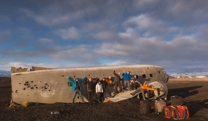
These attractions count for but a fraction of what the South Coast has to offer. The vast sand plains of Sólheimasandur are home to a crashed DC-3 Plane Wreck, and close to Seljavellir by the Skógar Village there's Seljavallalaug, one of the oldest swimming pools in Iceland.
- Explore the many wonders of the area on these South Coast Tours
Diamond Beach,The Diamond Beach is the name of a strip of black sand belonging to the greater Breiðamerkursandur glacial plain, located by the Jökulsárlón glacier lagoon on the South Coast of Iceland.
Breiðamerkursandur
Breiðamerkursandur is a glacial outwash plain located in the municipality of Hornafjörður. The sand stretches approximately 18 kilometres along Iceland’s South Coast, more specifically from the foot of Kvíárjökull Glacier to the famed glacier lagoon Jökulsárlón, that nests by the foot of Breiðamerkurjökull Glacier. Both glaciers count amongst the 30 outlets of Vatnajökull, Iceland’s largest ice cap.
The outwash plain was formed when three of Vatnajökull’s outlet glaciers, Breiðamerkurjökull, Hrútárjökull and Fjallsjökull, flowed forward due to volcanic activity and ground the rocks of the underlying surface, creating and pushing forward the glacial sediments. Such sand plains are a common part of the Icelandic landscape, due to the island being volcanically active as well as boasting numerous ice caps. The terminus (the tip of a given glacier) also dug deep into the ground and left what is now the Jökulsárlón glacier lagoon.
Jökulsárlón Icebergs
The Jökulsárlón glacier lagoon is one of the most famed and visited attractions in Iceland. Floating on the lagoon are enumerable ice bergs that have broken off the resident glacier, creating an ever-changing scenery of incredible allure.
The river Jökulsá connects the lagoon to the Atlantic Ocean, meaning that these icebergs eventually drift out to sea where they are polished by the waves before floating back to the black sands of Breiðamerkursandur. The name "Diamond Beach" comes from the white ice on the black sand appearing like gemstones or diamonds, as they often glisten in the sun and sharply contrast their jet black surroundings.
- Find Jökulsárlón Tours here
- Find South Coast Tours here
一号环岛公路,Iceland has one main ring road: Route 1. This ring road goes all around the island and is 1332 km long (828 miles). The road connects the capital, Reykjavík, to the second biggest city in Iceland, Akureyri, in the north of the country. Other notable towns that are connected via the ring road are Borgarnes, Blönduós, Egilsstaðir, Höfn, Kirkjubæjarklaustur, Vík, Hella, Hvolsvöllur, Selfoss and Hveragerði.
A number of popular tourist attractions are also found by the ring road, such as Jökulsárlón glacier lagoon, Lake Mývatn and the waterfalls Seljalandsfoss, Skógafoss and Goðafoss.
The ring road consists mainly of paved two lanes road (one each direction). Some parts of the ring road are still unpaved however. In various places the road contains single lane bridges, especially in the east part of the country. The speed limit is 90km per hour on the paved section of the road (lower when it passes through towns), but 80km per hour on gravel.
The road was only completed in 1974, with the opening of Iceland's longest bridge, that crosses Skeiðará river in southeast Iceland. In 1998 a tunnel below the fjord Hvalfjörður shortened the drive around Iceland by about one hour (or 45km along a winding fjord). Hvalfjörður tunnels are the biggest tunnels in Iceland, 5,8 km and 165m below sea level. The ring road has another tunnel called Almannaskarð in the southeast by Höfn and by 2017 the Vaðlaheiðar tunnels should be open in north Iceland, shortening the distance between Akureyri and Mývatn.
Some sections of the ring road are original 1940's country roads, and a number of sharp curves, blind curves, blind summits as well as single lane bridges mean that people need to drive cautiously. In wintertime most of the ring road is kept open, with the exception of a short passage in the east part of the country that may be closed due to heavy snow (a detour is needed to travel from the north to the east during wintertime).
Guide to Iceland would advise people to drive cautiously on the ring road both in summer and wintertime, but also to explore other roads leading from it to multiple attractions.
EastfjordsThe Eastfjords of Iceland is a 120 km long stretch of coastline from Berufjörður, in the south, to the small fishing village of Borgarfjörður Eystri, in the north.
Out of Iceland’s total population of 335,000 people, only an estimated 3.2% live in the East Fjords. Locally referred to as "Austurland," or "Austfirðir," the total area covers 22,721 square kilometres (8,773 sq mi).
Often overlooked by visitors, the Eastfjords represent the very best of what Iceland has to offer, from fantastical scenery, remote fishing villages and sparkling lakes to dense forests and traditional farms. Boasting the sunniest weather in the country, as well as some of Iceland’s most well-known wildlife, this region is perhaps best known for its herds of wild reindeer, its breathtaking coastlines and its promise of tranquil solitude.
Papey
Papey (“Friar’s Island”) is an uninhabited island located off the east coast of Iceland. The island is approximately 2 sq km with its highest point measuring 58 m above sea level. Boat trips to Papey depart every summer from Djúpivogur.
The island is named after Gaelic monks (“The Papar”) who are thought to have inhabited the island long before the Norse settlement. What is known for sure is that Papey was lived upon from the 10th century until the year 1966, when the island’s residents finally moved to the mainland. For centuries, Papey’s resident’s had supported themselves on fishing for shark, hunting seals and puffins and tending to their farmstead. In later years, the residents would also harvest down from Eider Ducks living on the island.
Today, visitors to Papey can enjoy the large puffin colonies that still live on the island, as well as the remnants of the former settlement; a lighthouse, church and weather station all still exist much as they did in 1966.
Seyðisfjörður
Those arriving in Iceland by ferry from mainland Europe or the Faroe Islands will make port at Seyðisfjörður, a town famous for its ornate wooden architecture, Scandinavian influence and historical herring-fishing industry. In fact, much of the timber used to develop Seyðisfjörður was shipped over by Norway ready-made in the 18th century.
Populated by around 700 people, Seyðisfjörður is surrounded by pounding waterfalls, flat-top mountains and serene hiking tails, complimented by gorgeous panoramas over the adjacent fjord. Other activities available from or near Seyðisfjörður include scuba diving, skiing, sea angling, paragliding and horseback riding; there is even a number of cultural exhibits including the Fjardarsel Power Plant Museum and the Skaftfell Centre for Visual Arts.
Lagarfljót
Lagarfljót (otherwise known as Lögurinn) is a thin lake in the east of Iceland, found just nearby to the region’s largest town, Egilsstaðir. Shaped like a long pencil, the lake reaches depths of 100 metres (330ft) and covers a total area of 53 square kilometres (20 sq mi), measuring almost 25 kilometres (16 mi) in length. Lagarfljót’s widest point is 2.5 km (1.6 mi).
Folklore dictates that the lake has long been home to Iceland’s very own version of the Loch Ness Monster; locals refer to this cryptid, serpentine creature as Lagarfljótsormurinn, or the Lagarfljót Worm. Sightings of the monster date back all the way to 1345 and have continued well into the 21st century, the latest having been recorded on video in 2012. In the past, sightings of the creature have thought to be an ill-omen, preceding a natural disaster such as a volcanic eruption or an earthquake.
Folklore also dictates that the lake is home to an enormous skate that resides in the shallows. This skate is said so poisonous that should a rider's horse step on it, the horse's foot will have to be cut off by the knee immediately.
Other Attractions
The East Fjords are packed with fantastic cultural landmarks, such as Hallormsstaðarskógur, the country’s largest forest, found just on the eastern shore of Lagarfljót. If you enjoy pleasant walks through nature, you could also visit the hiker’s paradise, Borgarfjordur Eystri, the supposed homes of elves’ and Iceland’s ‘hidden folk’.
Visitors could also enjoy the black sand beach off the charming fishing village of Breiddalsvik and take a trip to the longest and widest valley in Iceland, Breiðdalur. For something a touch more relaxing, one could also take a soothing dip in the swimming pool at Selárlaug; the pool is surrounded by mountains and beautiful views over the fjord, making this one of the more authentic experiences available in the region.
开始时间 : 灵活
到达冰岛凯夫拉维克国际机场后取车,工作人员会把车交给您,并向您解释如何在机场还车及安全驾驶等注意事项。在您离开冰岛前,也是在凯夫拉维克国际机场还车。您还可以选择在首都雷克雅未克取车、还车。
冰岛境内7晚住宿 (舒适级别、品质级别两种级别可选,私人卫浴、含早餐,具体信息请阅读每日行程及住宿信息)
8天租车:大众Polo或同级别车型 (预定时可升级车型)
车险:基础碰撞险、超级碰撞险、碎石险
GPS定位导航系统
详细、实用又有趣的行程单,覆盖了行程中涉及到的冰岛自然、历史和文化
经验丰富的冰岛旅行网旅行专家帮您确认行程
税
蓝湖温泉门票(预定时可选择增加)
燃料
午餐/晚餐
建议携带
驾照
保暖衣物
游泳衣
相机
小贴士
自驾团可以选择以冰岛国际机场或以首都雷克雅未克市区为起点及终点。
您需要持有合法的驾驶执照,有一年以上的驾龄(驾照需办理英文公证件)。
取车需要出示信用卡进行授权担保。
在Guide to Iceland定自驾套餐,我们可以免费提供行程单送签信,作为您申请签证的辅助材料。预订后,请提供您的航班等旅行信息,大约需要7-14个工作日后,您可收到送签信。
如果您需要加急,我们需要收取一定的加急费用,您可以复制此链接到浏览器http://cn.guidetoiceland.is/book-holiday-trips/visa-letter-fast-track 完成加急费用的付款,之后把您的套餐订单号和签证信加急费用订单号一起发给我们,我们可以在收到全部信息后4-6个工作日为您完成签证信。
蓝湖温泉为冰岛热门景点,为确保服务质量而控制入场人数,旺季期间可能存在门票供不应求的情况,建议确认日期后尽快预订套餐。预订成功后,客服专员会根据您的行程设计入场时间。若已订满,则为您进行相应调整,安排同样精彩的行程。
每日行程
行程日 1 - 到达:冰岛凯夫拉维克国际机场-雷克雅未克

到达冰岛凯夫拉维克国际机场后,会有租车工作人员在机场接机大厅等待,把车交给您,并向您解释如何在机场还车及安全驾驶等注意事项。接下来您便可以驾车前往首都雷克雅未克的酒店。
如果时间尚早,您可以游览市区,利用今天剩余的时间逛逛博物馆、艺术廊、走访雷市著名的地标,在咖啡厅、餐厅坐一坐补充能量。
如果您的航班在下午4点前到达冰岛,可以选择取车后直接前往蓝湖温泉。蓝湖温泉在凯夫拉维克国际机场和首都雷克雅未克之间,这样安排最能节省宝贵的行程时间,不走回头路。如果离境日的航班时间在下午,也可以选择离境日的上午去蓝湖。如果两天都不合适,我们会合理的安排在其它日子。预定时,您还可以选择把蓝湖温泉从舒适门票(含浴巾、一杯饮品、面膜泥)升级为高级门票(舒适基础上再增加拖鞋、浴袍、蓝湖Lava餐厅定位及一杯气泡酒,且排队时间短)。
行程日 2 - 黄金圈-冰岛南岸

第二天,您将来到冰岛广为人知的黄金圈景区,这里以众多自然奇观而名声大振。
黄金圈三大站的第一站是辛格维利尔国家公园(Thingvellir National Park),在这里您可以行走在欧洲-美洲两大板块的大西洋中脊的裂谷,享受脚踏两大洲的成就感,在史费拉裂缝(Silfra)进行浮潜,探索这个曾在冰岛历史上扮演过重要角色的地方。
下一站是Haukadalur地热小镇,该小镇以间歇泉而闻名。在这里您可以看到史托克Strokkur间歇泉和盖谢尔间歇泉。
接着,驾车向前几公里,便可到达冰岛最著名的景点-黄金瀑布(Gullfoss),周围有一条小道可以通向瀑布边缘,站在那里,您可以最直观最真实地感受到瀑布的雄伟气势和自然的力量。
离开黄金圈后,来到备受青睐的Kerið火山口(这也是您驶上环岛公路,到达南岸前不可错过的地方)。接下来,您会经过壮丽璀璨的塞里雅兰瀑布(Seljalandsfoss),和与之齐名的斯科加瀑布(Skógafoss)。继续向南,沿着临近维克镇的海岸线,停驻在由于火山喷发造成的奇异黑沙滩,一睹魔幻般Dyrhólaey岩门石洞和雷尼斯德兰格玄武岩石柱群。
可选额外项目:
1.朗格冰川雪地摩托:如果您喜欢刺激,就一定不要错过雪地摩托,这是冰岛最受欢迎的户外项目之一。这个项目的集合地点在黄金大瀑布的信息中心外停车场,所以适宜加在这一天的行程中。(最低年龄8岁, 需要您持有有效驾照,如无驾照只能做乘客)
2. 丝浮拉大裂缝干衣浮潜:体会在两大地质板块间遨游的超然体验,冰岛最酷的特色项目之一。(浮潜项目需要您会游泳并年满16岁)
3. 骑马:2小时轻松骑马,无需经验,最低年龄7岁。
注:这一天只能增加一个额外项目,否则时间不够用。
行程日 3 - 斯卡夫塔山冰川 - 钻石冰沙滩

第三天,您将去往位于瓦特纳冰川国家的斯卡夫塔山Skaftafell地区,在这里既可以欣赏风景,还可以参加各种各样的户外活动。您还可以选择出发前先去索尔黑马冰川参加冰川徒步项目。
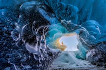
出发前,您还可以选择前往米达冰川内的卡特拉冰洞,探索冰川内部奇妙景色。
如果您喜欢徒步,斯卡夫塔山地区有多条徒步线路可供选择,满足您的不同选择偏好和需求,其中一条就通往美丽的斯瓦提瀑布(Svartifoss)。
当您回到环岛主路,首先映入眼帘的就是杰古沙龙冰湖(Jökulsárlón)-这里不仅是冰岛最著名的景区之一,也是最顶级的摄影天堂;您可以选择参加付费项目-冰湖船游,穿梭于宁静、形状各异的巨大冰山之间。在冰湖对面,是一片“钻石冰沙滩”,搁浅在黑沙滩的冰石让你觉得宛如来到了《爱丽丝梦游仙境》中的梦幻世界。
行程单中还有更多小众景区可选择游览。
可选额外项目:
1. 米达冰川卡特拉冰洞:最低年龄12岁
2. 斯卡夫塔山冰川徒步:最低年龄10岁
3. 杰古沙龙冰河湖两栖船游:船游在每年的5月至9月之间运营,但是也可能会受到天气的影响。如果入夏早、入秋晚,4月和10月也有一定的可能会可以船游,但是这个完全取决于当时的天气状况。
4. 杰古沙龙冰河湖快艇船游:6月至9月运营,最低年龄10岁。
小贴士:霍芬镇(Höfn,又名赫本镇),这里是很著名的吃冰岛龙虾的地方。如果您是美食爱好者,记得提前定位。
行程日 4 - 东部峡湾

第四天,您将沿着东部峡湾地区北上,沿途经过秀丽静谧的峡湾小镇。东部峡湾蜿蜒曲折,海岸线美不胜收。每一个拐角处都是另一片天地,一路上您将路过多个小渔村,可以按照自己的喜好选择停留、游览。
东部峡湾地区的村镇是冰岛开发程度最低的地区,您可以了解冰岛古老的历史和文化,夜晚留宿东部地区的中心-埃伊尔斯塔济镇(Egilsstaðir)或周边地区。
行程日 5 - 北部米湖-阿克雷里

第五天,您将驶向冰岛北部的米湖区。北部米湖区以其独特的地热景色闻名,包括Námaskarð地热区、Skútustaðagígar伪火山口、Dimmuborgir黑色城堡火山岩群和Krafla火山(人气颇高、到访者众多的冰岛火山)。
结束了一天的长途跋涉和观光,可以去米湖天然地热温泉泡温泉,缓解一天的疲劳。
如果您希望多走访一些地区,还可以北上到被称为欧洲观鲸之都的小镇-胡萨维克,乘船出海赏鲸。
可选额外项目:
1. 米湖天然温泉(6月1日至8月31日,早9点至午夜12点营业;4月-5月及9-10月,中午12点至晚10点营业。您可以提前再米湖天然温泉官网订票,也可以现场订票)
2. 胡萨维克观鲸团
3. 胡萨维克观鲸+观海鹦船游旅行团:最低年龄7岁
行程日 6 - 北极海岸

第六天,参观童话般的阿克雷里。阿克雷里与其说是一个城市,更像一个可爱的海边小镇,这里有许多俏皮的商店、博物馆,以及世界最北的植物园,是行程中一个调整步调、放松的好机会。
接着,继续向Skagafjörður峡谷进发(该峡谷以数量惊人的冰岛马而闻名);穿过山岳连绵、景色优美的Tröllaskagi渔村(这里是Siglufjörður峡湾古老的鲱鱼渔村),放松身心远眺周遭风光。
可选额外项目:
1. 北部冰岛一小时骑马旅行团(最低年龄为7岁)。
2. 阿克雷里观鲸团。
行程日 7 - 一号环岛公路沿路风光

第七天,您可以探索冰岛西部的众多景区,包括位于博尔加内斯(Borgarnes)古冰岛人定居博物馆和Deildartunguhver-欧洲最大的天然地热泉。继续前行,不可错过的还有赫伦瀑布(Hraunfossar,又名熔岩瀑布)和儿童瀑布(Barnafossar)。历史爱好者还可以参观位于雷克霍特(Reykholt)的Snorrastofa,这里是13世纪Snorri Sturluson书写Heimskringla萨迦文学的地方。
如果希望有更多时间在首都购物休闲,今天可以早点出发,直接返程首都,体验世界最北首都的独特文化。
可选额外项目:
1. 朗格冰川冰川隧道:探索世界首个冰川内的人工隧道。
2. 火山岩洞洞穴探险:地理地质爱好者的天堂。
3. 火山内部遨游:冰岛是全世界唯一一个可进入火山内部的国度,这是冰岛夏季最受欢迎的特色项目。5月15日至10月15日之间运营。(最低年龄12岁)
行程日 8 - 离境

今天在您离境前,需去凯夫拉维克机场还车;如果您的航班时间在傍晚,还可以增加一些额外项目,让行程更丰富。可以把蓝湖安排在离境前,作为本次自驾的最后一个小高潮,被火山石包围的蓝湖温泉宛如仙境, 湖水中富含着矿物质,对皮肤非常有益,也具有一定的疗愈效果。您可以在这里彻底放松身心,为冰岛之行画上圆满句号。
欢迎再来!
住宿
下面我们列出了这个自驾套餐中的可选住宿级别。在每日行程中,您可以看到每一天具体的首选酒店。舒适级别住宿为单人预订安排单人间,多人预订将安排双人间或三人间的组合。如果您多人同时出行但是希望安排单人间,请联系客服进行单间差升级。品质住宿会为单数人数预订提供一个单人间,余下提供双人间。 青少年、儿童与家长共享房间时,可享受产品的青少年、儿童价格。如果因为人数超额需要额外安排房间,需按成人价格计算。 我们会从Guide to Iceland优选的酒店中为您安排您预订时可选的最佳选择。冰岛全国的酒店质量水平差异较大,且严重的供不应求,您定的越早,效果越为理想。一些地区无品质级别的住宿,如果您选择品质级别,无品质住宿地区的住宿将被安排在舒适级别住宿中,我们的品质级别升级差价只增加了可升级的部分,为您合理安排最佳酒店。如果您有特别需求,可联系我们的客服,我们会尽力满足您的需求。注:特别安排将会有额外的房型或服务费用。选择日期即可查询位置并预订。
车型
下面您能看到我们的自驾套餐提供的车型选择。我们为您提供的车绝大部分情况下都是两年内的新车,配置GPS定位系统,以及基础碰撞险(CDW)、超级碰撞险(SCDW)、碎石险(GP)。预订过程中,您可以选择手动或自动挡车。
取消保险
购买取消保险,您将可以享受更灵活的取消政策。只要您提前48小时以上,发送邮件至英文客服邮箱info@guidetoiceland.is,就可以获得此产品的全额退款(每人5000克朗的保险费用不可退,邮件请用英文说明订单号和取消要求)。 注:此保险只适用于取消整个产品预定,而不能拆分取消分项住宿、租车、旅行团等。 保险本身费用不可退或用于其它预定。
评价

夕达洋
非常感谢Guide to Iceland!我来过冰岛3次了,但是做自驾行程还是没底,很多意想不到的小地方,不在本地的确不了解。Guide to Iceland帮了大忙,租车对保险的推荐、检查车的注意事项也很有用。虽然是第三次来冰岛,依然去了很多以前没去过,甚至听都没听说过的景点。冰岛太美啦,夏天自驾,那感受,简直了。

Alex
我們參加了6月下旬出發的8日7晚自駕環島遊套餐。為配合自訂行程,我們要求在住宿方面作出調動,Guidetoiceland不但滿足了我們的要求,更為我們離開冰島前一晚,訂了接近Reykjavik的酒店,確保我們有足夠時間前往機場,真的欣賞他們細心的安排。此外,各酒店的位置、設施和早餐都使我們感到十分滿意。 扣了一些分數是因為訂車時出了一些問題,我們原先想訂一輛9人豪華車,但最後只得兩部5人舒適車,原來計劃由兩位司機輪流駕駛便不能實現了。 最後要多謝Lagoon Car Rental。我們兩組人因先後飛往不同地點,交車後早離隊的團員按服務規定由租車公司送往機場,而部份人則要自行乘的士返回數公里外的酒店。租車公司知道情況後,亦把我們一并送返酒店。冰島人外表給人冷漠的感覺,內心則是熱情好客的!

王帆
非常棒