

描述
概要
描述
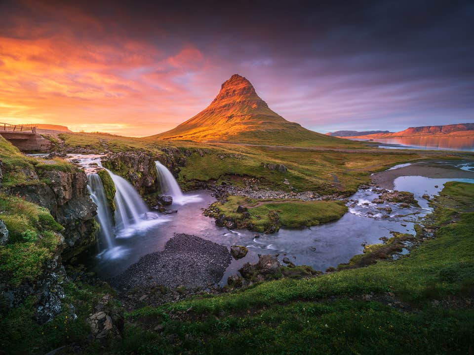
探索冰岛的最佳风光,尽在这趟内容丰富的10日自驾环岛游与斯奈山半岛之旅。对于想深入了解冰岛热门景点与秘境的旅行者来说,这将是一场非同凡响的旅程,也是广受好评的公路旅行之一。
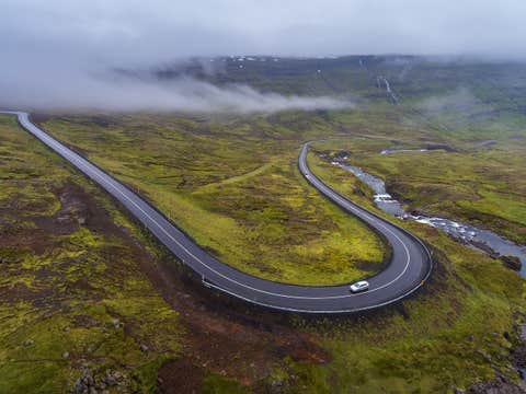
您的冰岛自驾之旅将在凯夫拉维克国际机场或雷克雅未克取车后正式开启。从此刻起,您将拥有完全的自由,尽情探索这个国家令人屏息的自然奇观。
在这次多日自驾游中,您可以自由决定行程与出发时间,无需顾虑巴士时刻表或导游安排。每一站都能随心停留,按照自己的节奏深入体验冰岛的魅力。
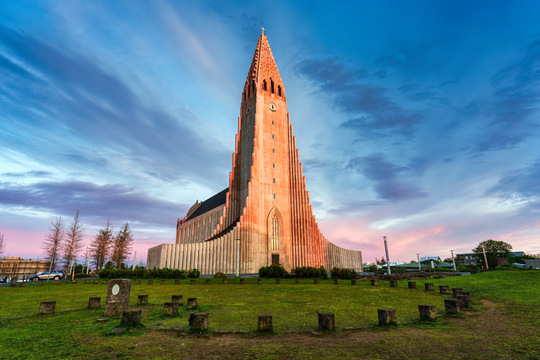
这款自驾行程不仅助您节省开支,更不会错过任何精彩体验。您将完整环绕冰岛一圈,行经环岛一号公路,探访斯奈山半岛、著名的黄金圈,以及标志性的蓝湖温泉。
此行特别安排在夏季进行,借助午夜阳光延长的日照时间,您可沉浸在金色暮光中,悠闲欣赏如梦似幻的自然风光,展开一场充满冒险与浪漫的公路旅程。
作为冰岛旅游专家,我们已为您精心策划好所有细节。您无需耗费数周时间做功课,这份贴心定制的行程助您轻松开启旅程。
从抵达到离境,我们都已为您妥善安排。住宿将由我们精挑细选,并可根据您的预算与舒适需求进行个性化调整。
在冰岛旅行网,我们希望您能尽情领略冰岛最纯粹的自然美景,带着满满活力与感动离开这片土地。
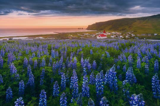
为提升您的体验,我们还特别挑选了远离人潮的秘境景点。预订后,您将收到一份详尽的10日环岛行程表,内容可灵活搭配冰岛最佳活动与特色游览项目,价格也极具竞争力。
您可选择在辛格维利尔国家公园体验“穿越两大洲”的浮潜、在朗格冰川上雪地摩托驰骋,或深入米达尔斯冰川探秘冰洞。如果您是冒险爱好者,还可加入熔岩洞探险、冰川徒步、骑马或赏鲸等行程,让旅程更加精彩。
在这10天里,您将尽享无数壮丽景色与丰富活动,准备好预订这场梦幻之旅吧!
最重要的是,预订本行程无任何风险。我们提供灵活的预订选项,您可在出发前24小时以上免费取消并获得全额退款,真正让旅程无后顾之忧。您还将配备一位专属旅游顾问,协助您量身定制行程,并随时为您解答问题。
别错过环游冰岛、游览斯奈山半岛与黄金圈的绝佳机会。立即选择日期,查询可预订情况吧!


