
描述
概要
描述
在这趟为期4天的冰岛冬季自驾之旅中,深入探索雷克雅未克(Reykjavik)、黄金圈(Golden Circle)以及南岸(South Coast)的精华景点吧!如果你希望在冬季自由探索冰岛最精彩的风光,同时追逐梦幻般的北极光(Northern Lights),这条高评分线路将为你带来一段难忘的史诗级体验。
有了完善的行程规划,你无需花费数周时间做攻略。本地旅游专家精心设计了这条内容详尽且可灵活调整的路线,确保你不错过冰岛的任何必去景点或隐藏秘境。清晰标注的地点与贴心的内部建议,将助你开启一段真正难忘的旅程。
虽然行程规划周全,但每一站停留多久由你自己决定。自驾出行,没有匆忙的跟团节奏,你可以按照自己的步调,尽情感受冰岛的魅力。
从抵达冰岛到离境返程,这趟冰岛自驾游为你安排好一切。行程包含租车服务以及每一站精心挑选的住宿,还可根据需求升级,更加舒适惬意。
你的冰岛冬季公路之旅将从凯夫拉维克国际机场(Keflavik International Airport)或雷克雅未克(Reykjavik)取车开始。无论从哪里出发,你都能驾驶一辆适合冰岛冬季路况的新车,并享受免费的车载Wi-Fi。
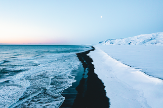
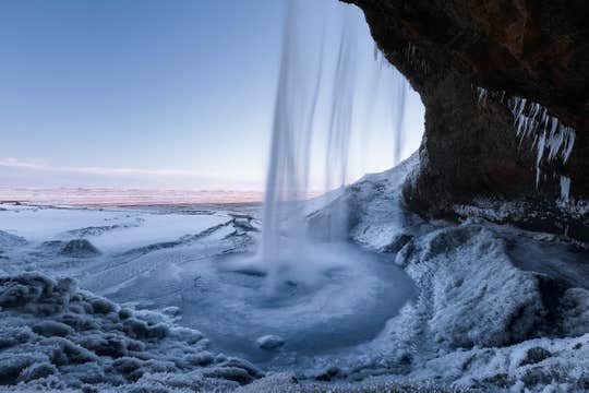
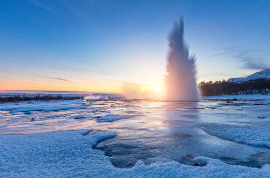
在旅途中,你将深入探索黄金圈(Golden Circle)和南岸(South Coast),欣赏喷涌的地热间歇泉、冰封的瀑布以及火山黑沙海滩。沿途将造访多处标志性景点,包括盖歇尔地热区(Geysir Geothermal Area)、黄金瀑布(Gullfoss Waterfall)、塞里雅兰瀑布(Seljalandsfoss)以及雷尼斯黑沙滩(Reynisfjara Black Sand Beach)。
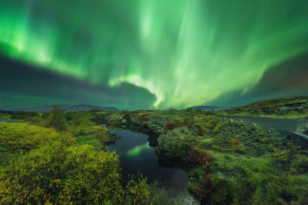
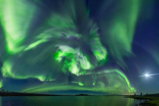
夜幕降临时,不妨尝试追逐神秘的北极光。这种难以预测的自然奇观通常在每年9月至次年4月点亮冰岛的夜空,而本次行程的时间安排正是为了最大程度提升你看到极光的机会。
在旅程的最后一天,你将有充足的时间探索雷克雅未克(Reykjavik)。漫步在Laugavegur购物街,逛一逛商店、餐厅、酒吧和咖啡馆。别错过首都的地标景点,如哈尔格林姆斯教堂(Hallgrimskirkja)和哈帕音乐厅(Harpa Concert Hall)。
除了观光,你还可以为行程加选丰富的体验项目,例如骑冰岛马、冰川徒步、雪地摩托、冰洞探险,或前往蓝湖温泉(Blue Lagoon)放松身心。这些热门体验都可用极具性价比的价格加入行程,让旅途更加精彩。
在纵览冰岛最受欢迎的景点之后,你将把租车归还至雷克雅未克(Reykjavik)或机场,然后搭乘航班返回家中。
这趟公路之旅确保你全程舒适无忧。你将拥有一位全天候待命的私人旅行顾问,为你提供协助。此外,如行程出现任何不可预见的变化,你最晚可在出发前24小时以上取消预订,并获得全额退款。
立即预订这趟4天冰岛冬季自驾之旅,用精彩的观光与刺激的冒险填满你的假期。选择出行日期,查看可订情况,开启你的冰岛之旅吧!


