
描述
概要
描述
探索冰岛的环岛公路,在终极的6天自驾游中感受冰岛的无限魅力。这趟夏季公路旅行行程非常适合时间有限的旅行者,让你尽情探索冰岛的顶级景点,包括瀑布、黑沙滩、冰川和温泉。
通过这个冰岛自驾套餐,你无需花费数周时间来规划理想的公路旅行行程。我们的本地旅行专家将为你打理一切,让你安心享受6天冰岛之旅,涵盖最热门的景点和隐藏的秘境。
本冰岛旅游套餐包括一辆租车和环线路线上五晚的住宿,均可根据你的预算和偏好自由定制。所有实用细节都已安排妥当,你将开启一段精彩绝伦的六日之旅。
你的夏季行程将沿着环岛公路展开,途经冰岛的南部、东部、北部和西部,每一片区域都拥有截然不同的自然风貌。通过这个套餐,你将一一领略。
在六天内驾车环游整条环岛公路,你将游览从南部的黑沙滩与冰河湖,到东部偏远峡湾,再到北部地热奇观的一切风光。
旅程从向北出发开始,你将探索米湖(Myvatn)周边的火山地貌、壮观的众神瀑布(Godafoss),以及有“冰岛北部之都”美誉的迷人小镇阿克雷里(Akureyri)。
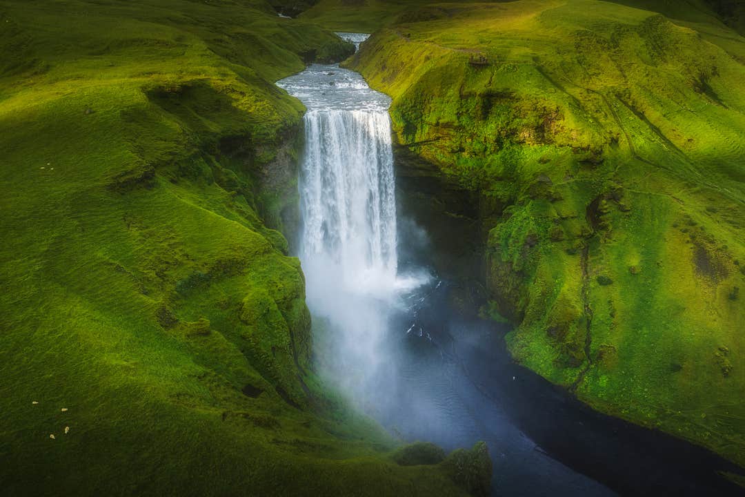
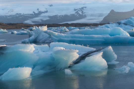
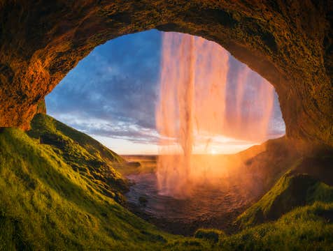
接着,你将沿着风景如画的峡湾和偏远的海岸地区向东行进,最终抵达风景震撼的南海岸。亮点包括斯科加瀑布(Skogafoss)、雷尼斯黑沙滩(Reynisfjara),以及以漂浮冰块与“钻石冰沙滩”而闻名的杰古沙龙冰河湖(Jokulsarlon)。
返程至雷克雅未克前,行程将包含一天的“黄金圈”之旅——冰岛最具代表性的景观路线之一。你将造访辛格维利尔国家公园(Thingvellir National Park)、漫步于盖歇尔地热区(Geysir Geothermal Area),并近距离欣赏气势磅礴的黄金瀑布(Gullfoss)。
最棒的是,这条为期6天的环岛路线完全可定制——你可以自由决定行程快慢、停留地点以及参与多少冒险活动。我们也为你精挑细选了一系列超值的一日游与体验项目。
可选活动包括:驾驶雪地摩托驰骋于朗格冰川(Langjokull)、探访闪耀着蓝光的卡特拉冰洞(Katla Ice Cave),或从冰岛观鲸之都——胡萨维克(Husavik)出发参加观鲸之旅。
若你喜爱刺激体验,还可以尝试双人滑翔伞飞跃南岸、在斯卡夫塔山(Skaftafell)冰川徒步,或在丝浮拉裂缝(Silfra Fissure)浮潜,在晶莹剔透的水中穿越两大地壳板块之间。你也可以骑冰岛马畅游自然风光,或在各地地热温泉中放松身心。
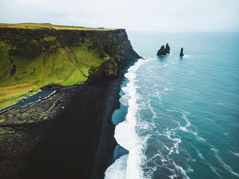
夏季的冰岛公路之旅,还提供了绝佳机会观察海鹦,尤其是在南部的悬崖与海蚀柱一带。此外,极昼现象让你拥有更长的日照时间,尽情充实你的行程,留下无数难忘回忆。
这趟6日环岛之旅广受欢迎绝非偶然:它完美平衡了行程安排与即兴自由。同时,整个旅程中你将获得一位全天候的私人旅行顾问支持,随时为你解答问题与提供协助。
享受灵活与安心:如行程变动,可在出发前24小时以上免费取消并获得全额退款。
在不到一周的时间内,踏上专属定制的6天自驾之旅,探索冰岛传奇的环岛公路。现在就选择日期,查询可预订时间吧!


