
描述
概要
描述
通过这条精心规划的8日行程,深入体验冰岛的精华之美,最大化利用你的旅行时间,涵盖最经典的景点与鲜为人知的秘境,带来一次难以忘怀的冒险之旅。
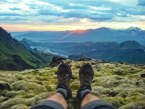
夏季是探索冰岛的最佳时节。 此时拥有全年最长的日照时间、温和的气温,让你能在一天内游览更多景点。午夜太阳带来延长的白昼,使你无需匆忙即可探访多个标志性地点。与其他季节不同,夏季道路全面开放,你可以前往偏远地区和隐藏景点,这些地方在其他季节往往难以抵达。野生动物爱好者还可以在悬崖边看到筑巢的海鹦,甚至有机会在沿海邂逅鲸鱼。
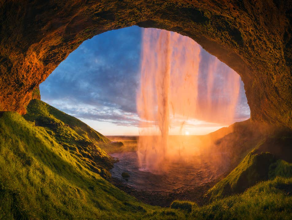
准备好迎接一生一次的体验吧:徒步欧洲最大的冰川、深入一座真实的火山内部、在漂浮的冰山之间航行,以及在午夜阳光的映照下走到轰鸣瀑布的背后。无需花费数周规划行程,当地专家将为你量身打造完美路线。本套餐融合丰富的本地经验,确保你不错过任何一个必看景点。
你将获得一份详尽的每日行程安排,涵盖震撼人心的景点与精心挑选的住宿,并可根据个人喜好进行调整。如需进一步定制行程,你的专属旅行顾问在预订后随时为你服务。
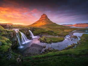
这条行程将带你游览冰岛最令人屏息的风景,包括传奇的黄金圈(Golden Circle)、震撼人心的雷尼斯黑沙滩(Reynisfjara Black Sand Beach),以及波光粼粼的杰古沙龙冰河湖(Jökulsárlón Glacier Lagoon)。本次冰岛夏季跟团游还将带你走出热门地标,向北探索地热奇观米湖(Lake Mývatn),或向西前往常被称为“冰岛缩影”的斯奈山半岛(Snaefellsnes Peninsula)。
你还可以通过添加刺激的活动,让旅程更加难忘:在丝浮拉裂隙(Silfra Fissure)于两大洲之间浮潜、驾驶雪地摩托驰骋在朗格冰川(Langjökull Glacier)之上,或深入迷人的蓝色冰洞探险。若你追求极致的冰岛体验,更可进入斯瑞努卡基古火山(Thrihnukagigur)休眠的岩浆房——这是世界上唯一可以步入火山内部、亲眼见证时间仿佛凝固之境的地方。若偏好轻松行程,你也可以漫步在雷克雅未克(Reykjavik)温馨的咖啡馆中,选购特色纪念品,或前往斯奈山半岛探访迷人的渔村与传奇的教会山(Kirkjufell)。
这款畅销冰岛夏季跟团游适合各个年龄层的旅行者,将冒险体验、壮丽风光与高度灵活性完美结合。同时还提供超值价格、免费取消及全额退款保障,让你安心预订。冰岛夏季行程需求极高,名额有限——现在就预订你的梦想冰岛夏日之旅吧!


