
描述
概要
描述
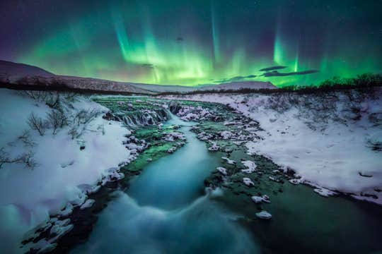
在这个为期四天的冬季套餐中,探索让冰岛享誉全球的美丽自然,重点体验黄金圈观光路线和蓝湖地热温泉。如果你想探索令人叹为观止的景观,欣赏神奇的北极光,并乘坐雪地摩托穿越雪原,今天就预订这个套餐吧。通过这个冰岛四天冬季度假套餐,省去数周的旅行规划和研究。一群本地旅行专家精心设计了这个行程,从你抵达至离开无需任何担忧。
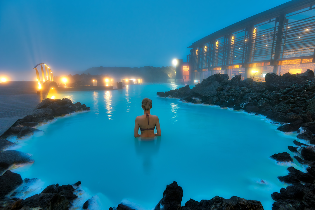
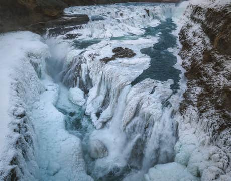
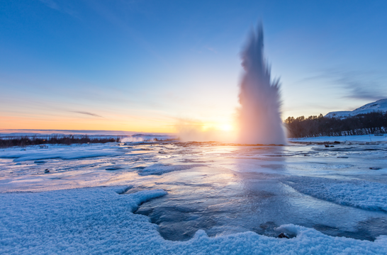
行程亮点包括世界闻名的蓝湖温泉、丰富多样的黄金圈观光路线以及冰岛首都雷克雅未克。在黄金圈观光路线期间,你将近距离欣赏其三大最美景点:辛格维利尔国家公园、盖歇尔地热区和黄金瀑布。
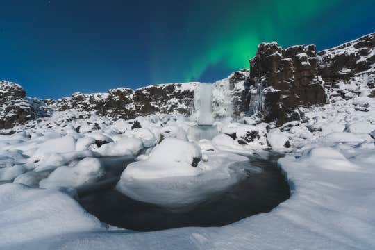
除了观光,你还将享受额外的活动为旅程增添乐趣,例如在蓝湖地热温泉中享受地热沐浴、在朗格冰川上体验刺激的雪地摩托之旅,以及追寻梦幻般的北极光。这些活动已包含在套餐价格中。
此外,你可以在旅程的第三天额外付费选择更多可选的导览活动。例如,你可以参加南岸的导览活动,包括冰川徒步,或者从雷克雅未克出发观鲸。这些可选活动非常适合寻求刺激的旅行者,想要置身于多样的地质奇观并近距离观察野生动物。
或者,你可以选择在城市里度过一天,探索购物街或欣赏充满活力的文化场景。如果你想要一次教育冒险,可以尝试雷克雅未克的艺术画廊或博物馆,例如国家博物馆和雷克雅未克艺术博物馆。
友好的本地导游将在黄金圈观光和活动期间陪伴你。在你游览每个地点或参与活动时,导游会分享深刻的见解、激动人心的民间传说和小知识,丰富你的体验。他们还是冬季地形的导航专家,无论是驾驶在结冰的道路上还是在有限日光下旅行。你的导游将确保你充分利用旅程,即使天气出现意外变化。
这个冬季冒险套餐还包括在雷克雅未克的三晚住宿、详细的行程安排、抵达和离开的机场接送,以及随时为你提供帮助的个人旅行顾问。如果你的旅行计划突然变更,你可以在出发前24小时以上取消预订并获得全额退款。
通过参加这个为期四天的冰岛冬季旅行,获取关于冰川、热气腾腾的温泉和北极光的特别回忆。现在选择日期检查可用性吧。
