An amazing Tour to Askja and Holuhraun Lava Field in the Highland of Iceland
In August 2016 I joined an 11-hour-tour of the highland of Iceland to visit Askja caldera and the Víti explosion crater. I had joined this tour exactly 2 years earlier after a big earthquake and landslide in July 2014, which resulted in the water level of Lake Askja rising 2 meters.
Just after my visit, a volcanic eruption started, which lasted for 6 months! So I was eager to see the newest lava field in Iceland, Holuhraun.
We met up with the guide, Erlendur, at Mývatn very early in the morning as we had a long, exciting day ahead of us.
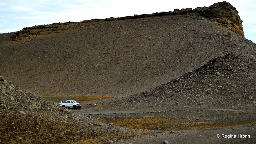
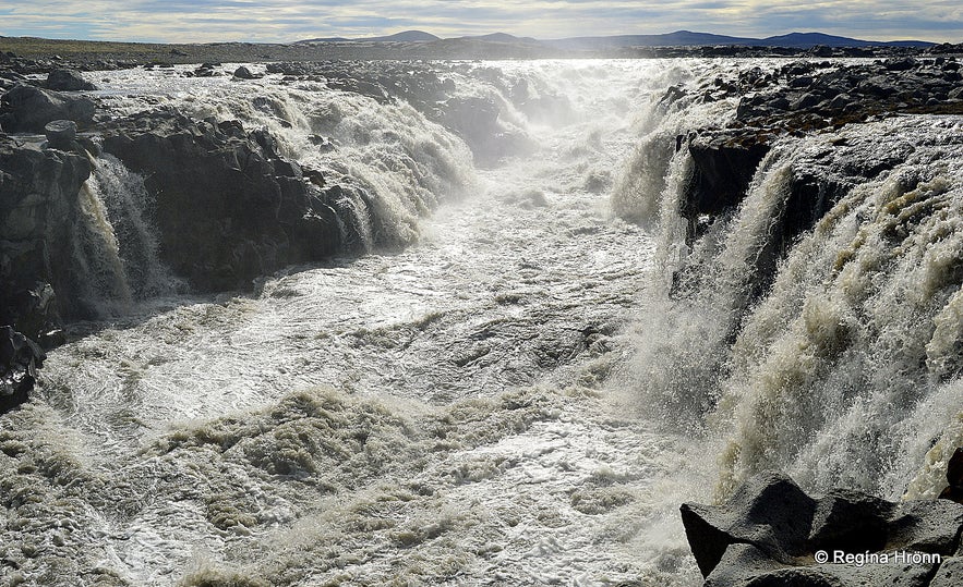
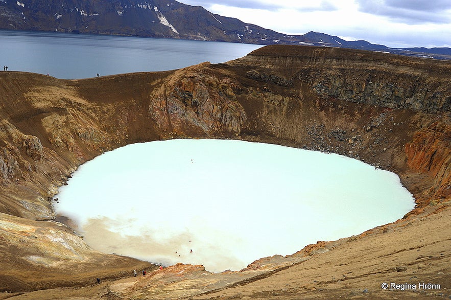
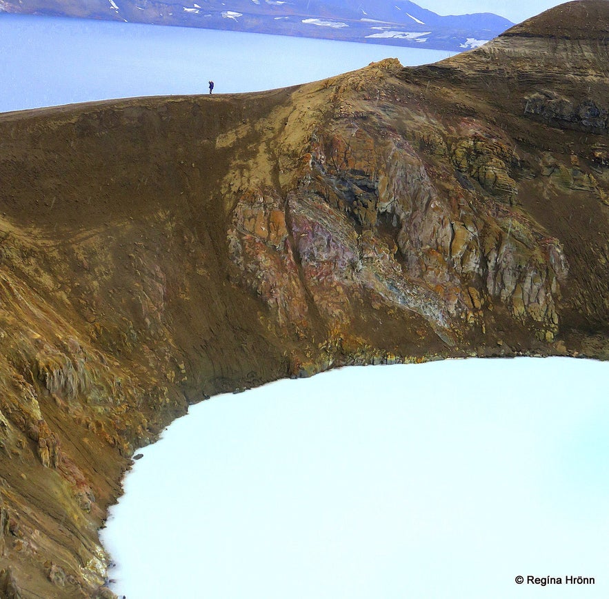
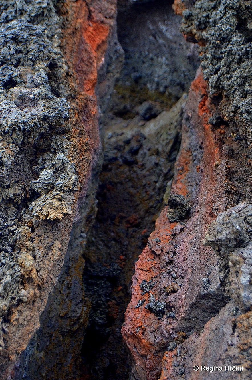
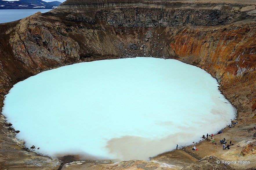
Top photo: Víti explosion crater
Hrossaborg crater
We headed straight towards the highland, got off ring-road 1, and onto the mountain road F88. There are several unbridged rivers on the way so a 4x4 is needed for the highland. From ring road 1 there is a 100 km distance to Askja.
Our first stop was at Hrossaborg, a 10,000-year-old crater that looks like an amphitheater. Our driver-guide drove into the crater where he let some air off the tires (33 psi to 15 psi) to give the tires a wider grip. With the deflated tires it is not possible to drive faster than 60-70 km/h or the tires will overheat.
Being driven into a crater is quite an experience - in my photo above you can see how big it is. Scenes from the film Oblivion were shot here and Tom Cruise was flown in a helicopter to Hrossaborg for the shootings of his scenes.
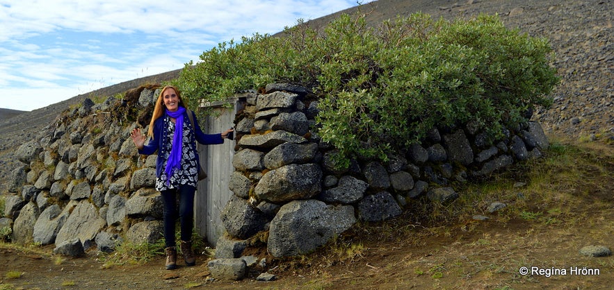
By Tumbi hut
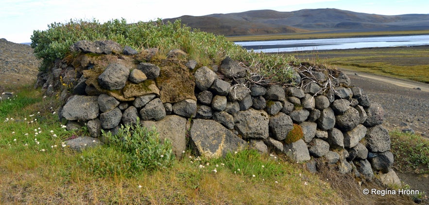
Our next stop was at a small hut made out of rock with a corrugated iron roof with a birch tree on top. This little hut in the wilderness goes by the name Tumbi (other names Miðfellskofi or Fellnakofi) and was erected by the farmers of the Mývatn area sometime between 1925-1930, as a shelter for the searchers of sheep in the wilderness.
The hut was named after one of the men who erected it, Tómas Sigurtryggvason from Litluvellir in Bárðadalur, but Tumbi was the nickname of Tómas.
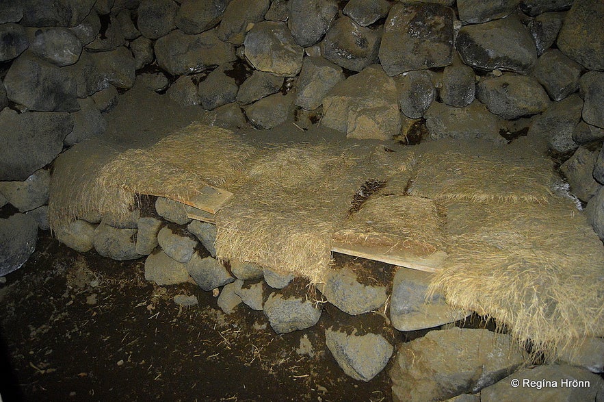
Inside Tumbi hut
One of these searchers of sheep, Benedikt Sigurjónsson, often called Fjalla-Bensi or Bensi of the Mountains, stayed in a "hole" in the ground close to Tumbi back in 1925 during a major storm. Nobody knows exactly where that hole was, but it was most likely in some tuff east of Mt. Miðfell.
It was advent when he had to stay alone in the wilderness with the dog Leo and the leader ram Eitill (which was of a special stock of Icelandic sheep, which leads the herd).
Tumbi hut
Fjalla-Bensi was an experienced searcher of sheep and in 1925 it was his 27th advent search for sheep.
And it was for the sake of these sheep that Fjalla-Bensi risked his life at this time of year - he did not want them to freeze to death in the wilderness - and these were not even his own sheep - I would say that there is a great liking here between Fjalla-Bensi and the Good Shepherd himself.
These sheep had been left behind after the fall round-up as they had either hid in the wilderness or ran away when the rest of the sheep was rounded up.
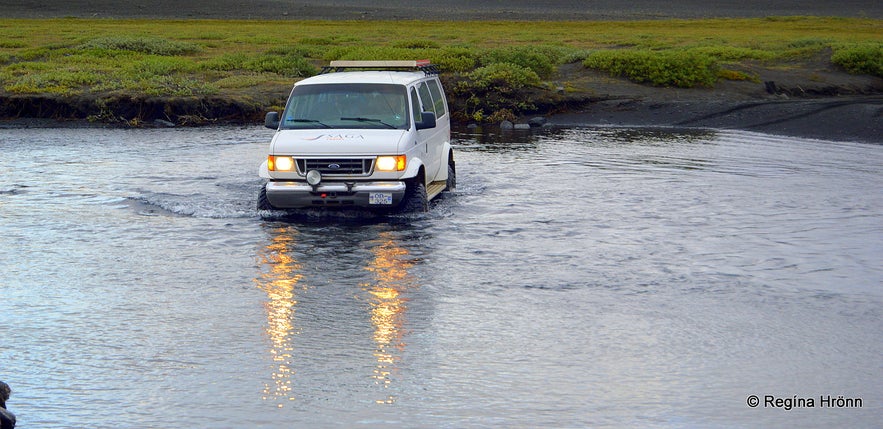
Crossing the river Grafarlönd
A very popular book was written on this incident in 1936, called Aðventa or the Good Shepherd, by the noted Icelandic author Gunnar Gunnarsson. This book was first published in Leipzig and has since been translated into 10 languages - it is a truly interesting read.
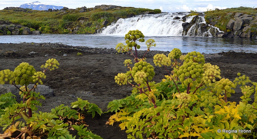
We now drove into the highland of Iceland. The gravel roads are bumpy and our driver had to cross several rivers. First, we crossed one river, Grafarlönd, and stopped by Gáski waterfall. It is a lovely name for a waterfall, meaning Playful :)
We stopped here for some 10 minutes to admire this small oasis and the waterfall.
Gáski waterfall
It is ever so refreshing to drink water straight from such rivers. Do bring your water bottle and fill up on cold fresh water for the trip into the highland.
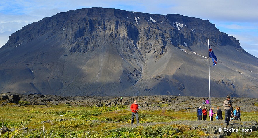
We now arrived at a beautiful oasis, Herðubreiðarlindir streams, named after the Queen of Icelandic mountains, Mt. Herðubreið - our national mountain.
We made a stop at Herðubreiðarlindir streams, which have got green and lush vegetation as opposed to the barren landscape of the highland. My country for sure is a country of great contrasts.
Herðubreiðarlindir and Mt. Herðubreið
Herðubreiðarlindir streams are on the edge of the Ódáðahraun lava field, the most extensive lava field in Iceland, stretching over 4,440 km2.
In my photo above you will see the majestic Mt. Herðubreið. It is a table mountain, 1682 meters above sea level - and at the top, there is a shield volcano crater. This mountain and the surrounding areas, including Herðubreiðarlindir streams, belong to the Herðubreið Nature Reserve, which was declared as a protected area back in 1974.
Our guide, Erlingur, walked with us up to Eyvindarkofi - the Shelter of Fjalla-Eyvindur. Eyvindarkofi is the reconstructed shelter of one of our best-known outlaws, Fjalla-Eyvindur or Eyvindur of the Mountains, who stayed at Herðubreiðalindir streams in 1774-1775.
Eyvindarkofi - the Shelter of Fjalla-Eyvindur at Herðubreiðarlindir
Fjalla-Eyvindur was an outlaw for 20 years and lived in the wilderness with his wife, Halla. I have visited more of Fjalla-Eyvindur and Halla's hiding places in Iceland, what a rough life these outlaws must have had :(
Fjalla-Eyvindur and Halla had been apprehended in Sprengisandur and brought to Reykjahlíð at Mývatn, where they were held captive. Fjalla-Eyvindur asked to attend mass and fled into the highland in a massive fog during mass. Halla hadn't wanted to go to mass with him and thus he had to leave her behind in Mývatn.
By Eyvindarkofi - the Shelter of Fjalla-Eyvindur at Herðubreiðarlindir
Fjalla-Eyvindur regarded this year of his hiding as being the worst year during his many years as an outlaw. Halla wasn't with him, it was dreadfully cold and he didn't have any fire to keep him warm and had to live on raw horse meat and Angelica roots.
But here he had fresh water, as in this oasis clear water comes straight from the lava. Fjalla-Eyvindur had built his hut on a spring and had only to lift one lava rock to reach freshwater.
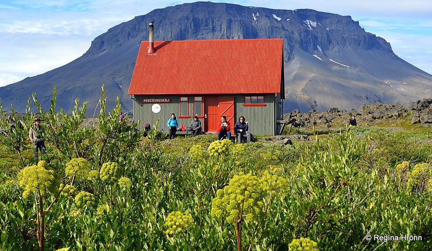
Herðubreiðarlindir oasis and Mt. Herðubreið
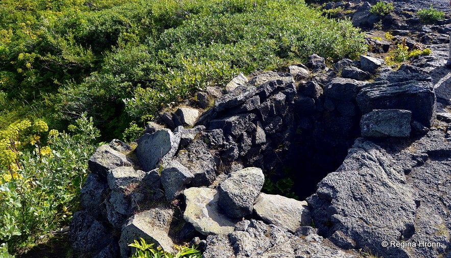
The shelter is made of rocks by the wall of a rift - only one fathom long and half a fathom wide. The ridge beam was made out of the spine of a horse. What a place for a human being to live in - alone for a whole winter!
Fjalla-Eyvindur was able to steal 7-9 horses during this harsh winter, or else he would have starved to death.
You will find a hut at Herðubreiðarlindir and toilet facilities.
Gljúfrasmiður waterfall in Jökulsá á Fjöllum
Our next stop was by the small waterfall, Gljúfrasmiður falls, in the glacial river Jökulsá á Fjöllum, which is the second-longest river in Iceland (206 km).
Jökulsá á Fjöllum literally means the Glacial River in the Mountains. It is a very forceful glacial river coming straight from Vatnajökull glacier, Europe's largest ice cap by volume.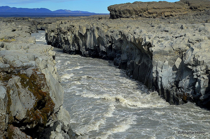
Jökulsá á Fjöllum by Gljúfrasmiður waterfall
Further north this roaring glacial river cascades down the most powerful waterfall in Europe, Dettifoss waterfall, plus several other smaller waterfalls, like Selfoss, Hafragilsfoss, and Réttarfoss.
During my visit to the highland back in 2014, I took a video of Gljúfrasmiður falls, but on that day it was rain and fog in the highland. In the video, you can hear and see the power of this ice-cold glacial river.
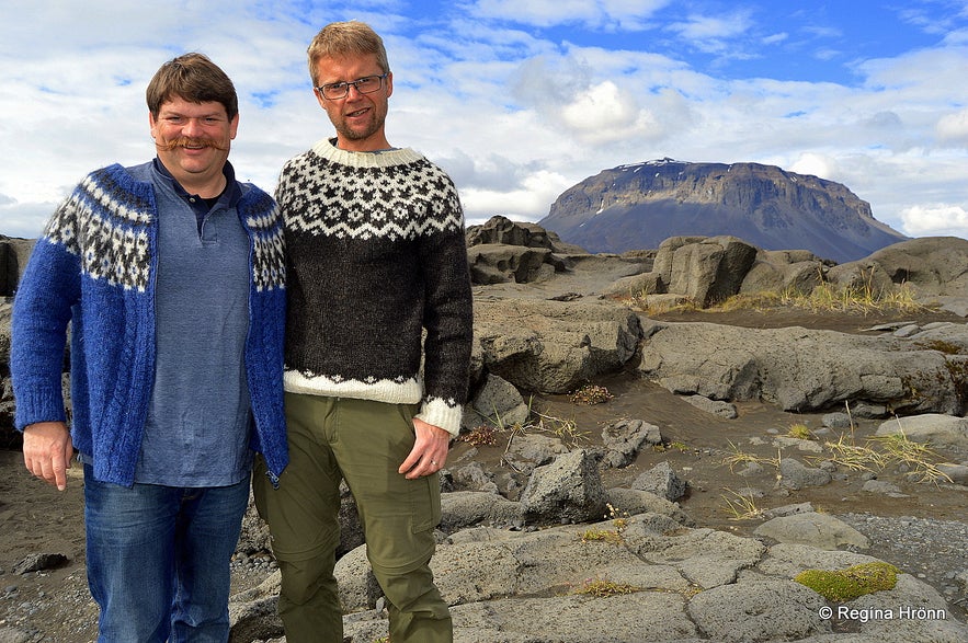
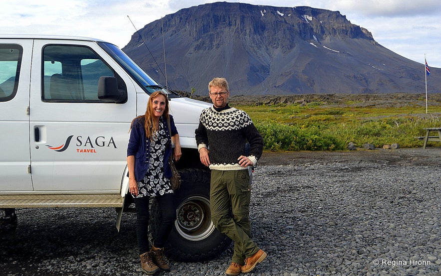
I took a photo of my husband and our guide, Erlingur, both of them wearing lopapeysa, the traditional Icelandic woolen sweater - you can see the Queen of the Icelandic mountains behind them.
Erlingur is such a lovely guide. He lives in Akureyri and drove from his hometown very early in the morning to pick us up at Mývatn. As this tour is a slow tour then we didn't feel rushed in any way during these 11 hours. My husband is a magician, so he was entertaining the other passengers on the tour during the long drive through the highland of Iceland, giving Erlingur a break to focus on his driving.
And I also chipped in from time to time when I had some knowledge on this part of Iceland, which I wanted to share with the other passengers ;) It felt like we were just friends travelling together in Iceland - and that is what slow travel is all about.
My husband and our guide Erlingur wearing the traditional Icelandic sweaters
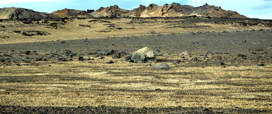
We drove for some time on the winding and bumpy gravel road. All of a sudden the landscape changed and turned yellow. We were now driving through the lava field Vikrahraun - Tephra lava, which flowed back in 1961.
It was like we had entered Sahara - apart from the black lava sticking out - quite a scenic landscape.
The tephra weighs next to nothing - it is amazing picking it up.
Askja was chosen in 1965 and 1967 for the training mission and the preparations for the collection of rock samples by the astronauts of Appollo 11 for the Moon landing.
And a NASA scientist has said that the barren and lunar-like highland of Iceland was a unique analog of Mars.
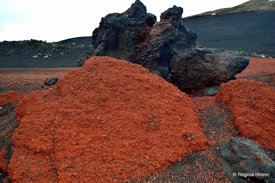
Colourful lava on the way to Askja
By 1 pm, after having driven 115 km, we had reached the mountain huts at Dreki by Drekagil canyon. As it was lunchtime we had a 30-minute lunch at Dreki and then drove to Askja, which is only 8 km away from Drekagil.
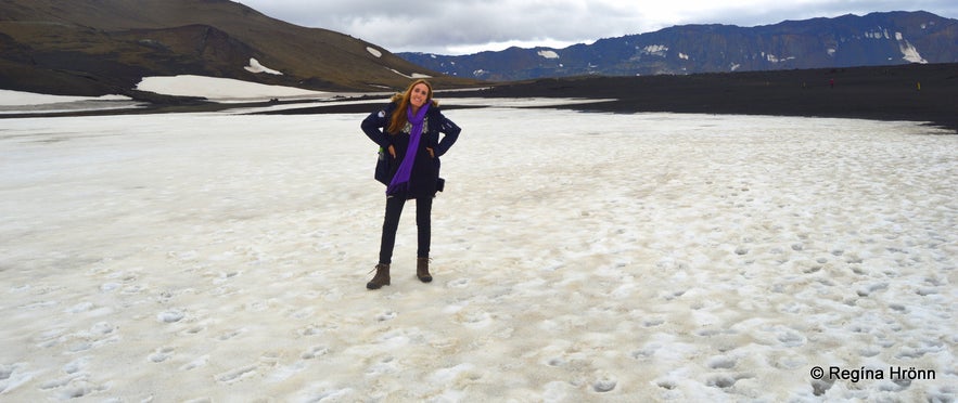
We left the jeep at the parking lot and hiked to Lake Askja and Víti explosion crater. It is an easy hike, about 30 minutes long each way. There is snow on parts of the trail, so do wear good hiking shoes on this trip and dress warmly.
I can tell you that I am not a fan of snow in the summertime, so it was quite surreal seeing this change in the landscape.
Hiking in the snow in the middle of summer
After 30 minutes we reached the big explosion crater of Víti with its whitish opaque blue water. Víti is actually the Icelandic word for hell! Seeing Víti open up is a WOW moment for sure. The crater is 150 meters in diameter filled with a 22-26 degrees C geothermal, sulfurous lake, in which one can bathe.
We didn't bathe in it, were allowed to do so if we wanted to, but opted out this time around, even though I had my swimsuit on under my clothes. If the other passengers had wanted to dip in then I would have done so as well, but I didn't want to go down there by myself and keep the group waiting.
Hopefully, someone will like to join me for a swim on my next trip to Askja.
Víti explosion crater at Askja
There were a lot of people sliding down to the geothermal water and some were swimming in it. And what a beautiful setting in which to take a swim. The colours in the crater are so beautiful - here you will find a multitude of geothermal colours and strange lava formations in abundance.
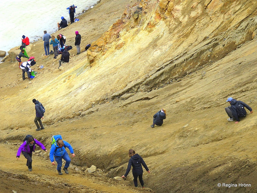
I could see how people were struggling and sliding down into the explosion crater and some of them were having difficulties climbing up the slope. And I could just picture myself in their shoes sliding down, the klutz I am and needing help to get up again ;)
When it is raining the path down into the crater is very slippery and muddy and one goes down into the crater at one's own risk. Good hiking shoes are necessary here and a walking stick would prove helpful in the slope. Or just an umbrella.
People struggling on the way down to Víti crater
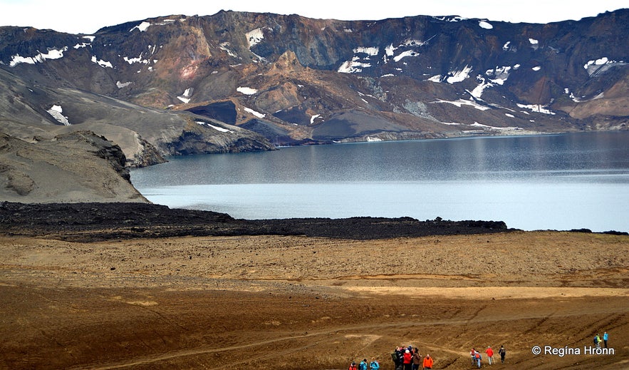
Öskjuvatn or Lake Askja and Víti explosion crater got created in a massive volcanic eruption back in 1875. The volcanic ash fall from the eruption destroyed the farmland of several farms in East-Iceland.
After the eruption, a great number of Icelanders gave up on living in Iceland and emigrated to Canada.
Lake Askja, which is the second deepest lake in Iceland - some 220 metres deep - is situated in the crater of Askja volcano.
Lake Öskjuvatn
During our visit, the weather was so calm and the surroundings were so serene. This area must have looked quite differently during the earthquakes back in 2014! Seeing that there is so much tranquillity here drones are not allowed.
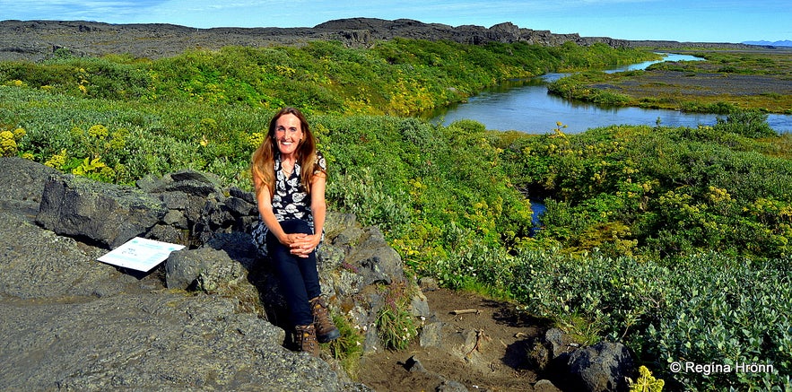
I love roaming around in this area and walked out on the rim of the explosion crater (see my photo below).
I love this photo as I look like I am alone in the world - surrounded by this breathtaking landscape.
Walking on the rim of the explosion crater Víti
We stayed at this amazing spot in the Icelandic highland for two hours and then headed back to the jeep. This area will for sure leave no man untouched.
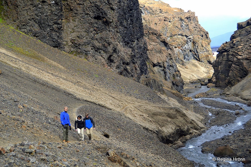
We stopped again at Drekagil - Dragon Canyon by Dyngjufjöll mountains as we wanted to hike up to the waterfall in the canyon. The canyon gets its name from two dragons in the canyon - they watch over the canyon - do look out for them!
Hiking in Drekagil canyon
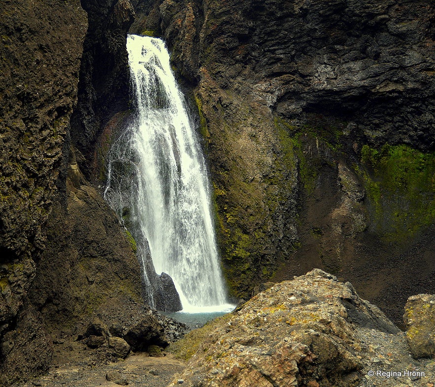
The hike into the canyon is only 10 minutes long. It is a bit rocky and narrow, but the waterfall at the end of the canyon is so beautiful and the surroundings are what I can only describe as ruggedly beautiful.
The waterfall at the end of the canyon is called Drekafoss - the Waterfall of the Dragons. It is 30 meters high and plummets into the canyon in such majestic settings.
When I visited this area back in 2014 there was too much water in the river for us to hike into the canyon, and I was so eager to see Drekafoss waterfall this time around that I almost ran on the trail to the end of the canyon ;)
Drekafoss waterfall in Drekagil canyon
After hiking in Drekagil canyon we went on our way to one of Iceland's newest lava fields, Holuhraun. This lava field is located some 15 km away from Drekagil.
We left the gravel road and drove unto a trail in the vast desolate sands of this area. Here it came in handy to have deflated tires as the jeep kind of floated on the sand.
Holuhraun lava field
There was a volcanic fissure eruption here from the 29th of August 2014 until February 27th, 2015. The lava from the fissure eruption covered more than 85 km2 of land making it the largest one since the Laki eruption back in 1783-1784.
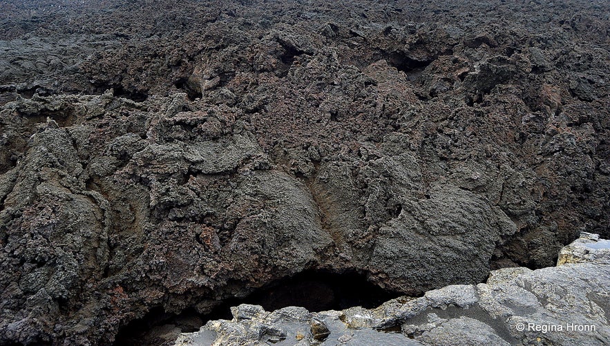
There is an older lava field by Holuhraun since an eruption in 1797. So here you can see old lava and brand new lava side by side. The Holuhraun lava is new and therefore prickly and very unstable and fragile.
So stay on the marked trails and take care if you pick up a piece of lava. Use gloves or it will scratch your hands. This sharp lava made a big scratch in the leather of my brand-new hiking shoes.
Holuhraun lava field
If you look into the rifts of the lava you will see a multitude of colours, but the aa-lava or block lava as it is called is mainly black in colour.
You can see Jökulsá á Fjöllum running next to Holuhraun and during the eruption, Jökulsá á Fjöllum changed its course when the lava flowed into the river. The first year after the eruption there was a hot pool by the end of the lava where people would dip in and have a bath by the lava.
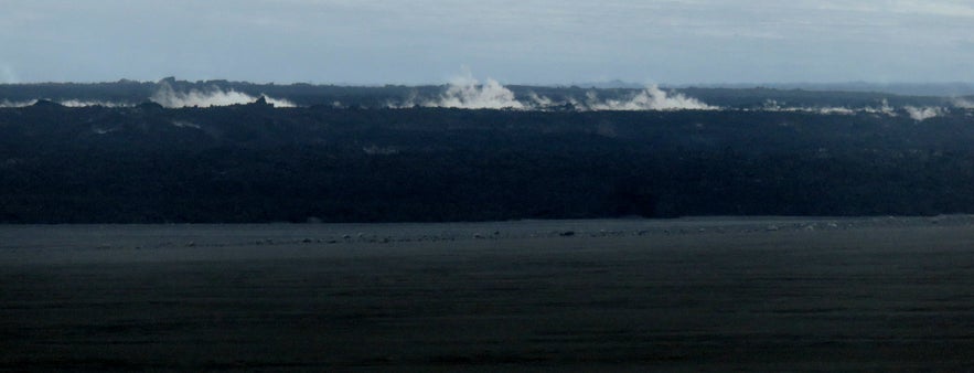
On our way to and from Holuhraun, we could see steam coming from the hot lava in some parts. My photo below is shot through the windows of a moving car while driving on sand, but I add it here so you can see what the new lava field looks like.
Holuhraun lava field - photo from a moving car on uneven ground
We didn't spend a long time at Holuhraun but the little time we spent there was precious to me as it is not every day that I get to walk on such a new lava field in the highland of my country!
Now we have an even newer lava field as in March 2021 it started erupting on Reykjanesskagi peninsula in SW-Iceland:
The Volcanic Eruption in Geldingadalir Valley on Reykjanesskagi in SW-Iceland
Skínandi waterfall in Svartá river
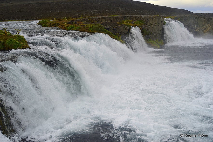
After visiting Holuhraun we drove to a beautiful waterfall in the vicinity, Skínandi - Shining falls in the spring river Svartá - Black river.
We hiked to the waterfall through a lava field and black sand (an easy hike) for 1.7 km back and forth - some 20 minutes each way. By Skínandi waterfall you will find one of the beautiful oases in the highland, Svartárbotnar, with lush vegetation which complements the black surroundings.
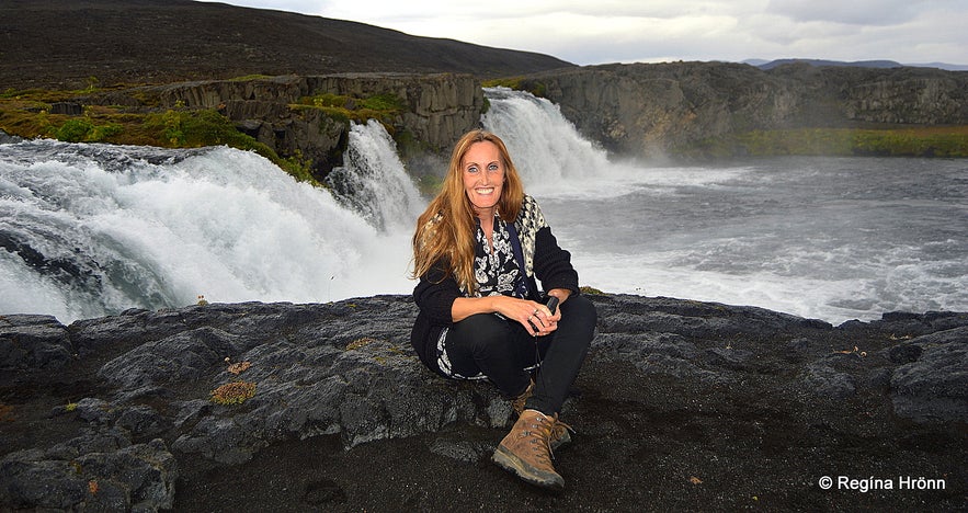
I had never seen this waterfall before so I was very happy, as I have been in love with waterfalls since I was a little girl, so seeing and greeting "new" waterfalls in my country makes my heart soar :)
There was a danger of this beautiful waterfall disappearing or being damaged by the lava flow at Holuhraun, but fortunately, it didn't happen.
Svartá river appears suddenly from the sandplain not so far from Skínandi waterfall - I always find it amazing to see rivers appear from the ground like this.
From its source, the Svartá river runs only a couple of km east before it runs into the glacial river Jökulsá á Fjöllum. Svartá river is the biggest spring river which runs into Jökulsá á Fjöllum, which in turn creates the most voluminous waterfall in Iceland, Dettifoss waterfall.
Very happy by Skínandi waterfall
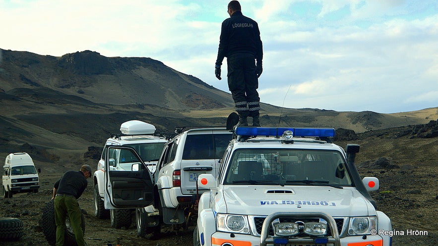
On our way back to Dreki and back home we saw a police jeep on the road and a policeman standing on top of the roof of the police jeep! What was going on? I prayed that an accident hadn't taken place in the highland.
It turned out to be the mountain police, who was helping another tour company, as one wheel of their jeep had fallen off!
The Icelandic mountain police in the highland
We were thinking of driving around them as they were blocking the road, but didn't dare to do so as that would be off-road driving, which is illegal in Iceland - and the mountain police is really strict on people driving off-road.
Driving off-road will result in a high fine and you will be ordered to repair the damages, so always stick to the roads!
Our guide, Erlingur, offered to help the other tour company transport their passengers back to Mývatn.
The drive back was so much fun with these 6 additional travellers - 2 couples in the group were newly-weds, who were on their honeymoon in Iceland :)
With Erlingur our guide on the tour
This 11-hour-tour is amazing and highly recommended.
Here you will experience the highland of Iceland, see vast lava fields, some of which are still steaming, see lovely waterfalls and a roaring glacial river, get to know the characters of the highland, and visit, and maybe bathe in, an explosion crater named Hell!
You can join the tour to Askja with Saga Travel.
The other tours I joined while visiting North Iceland:
The Extraordinary Ice Sculptures in Lofthellir Cave in Mývatn North-Iceland
The Spectacular Diamond Circle in North-Iceland
A Unique Lava Walk through the colourful Lava Field Gjástykki at Krafla in North-Iceland
A Wonderful Day of exploring the Mývatn Area in North-Iceland
Have a lovely time visiting Askja and the highland of Iceland :)
其他有意思的博客
冰岛最浪漫的角落
对于很多人,遥远的冰岛有着世界尽头的神秘,有着区别于巴黎、马尔代夫、自成一体的浪漫。没有埃菲尔铁塔和蒂凡尼,没有热带沙滩,而是在冰川、火山、苔藓地的背景下蜜月旅拍、婚拍,甚至举办一场冰岛婚礼。来冰岛旅行,多是要跨千山万水、飞跃大洋大陆,很有一点“万水千山陪你走过”的史诗感。难怪很多人说,光是冰岛二字,就足够浪漫了。 冰岛虽然不大,但是地貌极其丰富,不同的自然景观自然有不同的气质。这一篇,就挑阅读更多从极光观测到摄影-到底该不该来冰岛看极光
很多朋友都想来冰岛看极光,但是冰岛到底适不适合看极光呢?几月、什么季节能看到极光?是不是一定要参加北极光旅行团?如何能拍摄出美丽的极光照片呢?在冰岛住了好几年了,从刚开始逢极光必出门,到如今家里阳台就能看极光,我对在冰岛看极光的了解和经验,也算得上大半个专家了,且听我娓娓道来吧。 到底该不该来冰岛看极光呢?最坦诚的答案是,不要只为了看极光而看极光。 极光原理 太阳活动→太阅读更多
迷失冰岛的米湖游览推荐|不只有温泉的地热宝藏区
我在冬夏秋均到访过米湖,看过米湖的不同面。一直以来,米湖到底值不值得去是很多游客争论的问题。有些人觉得这里是来冰岛旅行的必去目的地,有些人则说米湖“太丑了”,连照片都不想多拍几张。那米湖到底值不值得来呢?到底怎么玩呢? 米湖的风景 北部的米湖,因地理位置相距首都雷克雅未克略远,很多来冰岛的短途游客选择放弃,其实米湖应该是和黄金圈、南岸沿线至冰湖齐名的冰岛景色,这里冷热相融,可谓最冰岛,尤其阅读更多

将冰岛最大的旅行平台下载到您的手机中,一站式管理您的整个行程
使用手机摄像头扫描此二维码,然后点击显示的链接,将冰岛最大的旅行平台添加到您的手机中。输入您的电话号码或电子邮件地址,以接收包含下载链接的短信或电子邮件。

