I went on a truly memorable 14-hour guided tour of the highland of Iceland. Our destination was Askja caldera and the Víti explosion crater. There had been an earthquake and landslide in July by Askja and the water level of Lake Askja was now 2 meters higher than before.
I was in luck to have been able to visit this area early in August, as on the 29th of August the earthquakes started for real and a volcanic eruption started, which lasted for 6 months!
We drove from Akureyri town towards Mývatn at 6:30 in the morning and picked up more passengers there. We then headed straight towards the highland, got off ring-road 1, and onto the mountain road F-88.
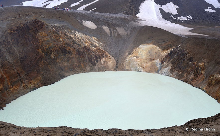
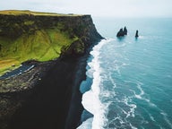
Top photo: Víti explosion crater
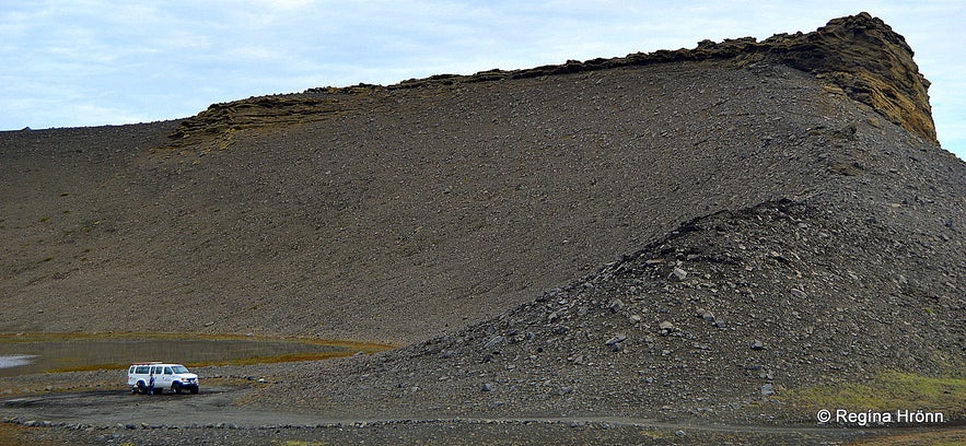
Hrossaborg crater
Our first stop was at Hrossaborg, which is a 10,000-year-old crater in the shape of an amphitheater. Our driver drove straight into the crater, got out, and let some air off the tires (33 psi to 15 psi) to give the tires a wider grip. This is also done when we drive our jeeps up on the glaciers.
Hrossaborg means Horse Castle as it was used as a natural shelter for horses. The crater is quite extraordinary and the sandstone adds to the mystery of the crater. Scenes from Tom Cruise's film, Oblivion, were shot at Hrossaborg.
We were now ready to drive into the highland of Iceland. The gravel roads here are bumpy and there are several rivers to be crossed. Our guide was well trained in crossing rivers having driven on this tour countless times, but jeeps often get stuck in the middle of the rivers and have to be towed out.
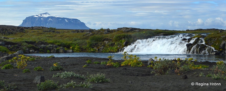
Gáski waterfall
We made a stop by a small, but lovely waterfall by a river we had just crossed. It is called Grafarlönd river.
The landscape in the highland is barren and lunar-like and at Askja NASA trained Apollo astronauts in 1967.
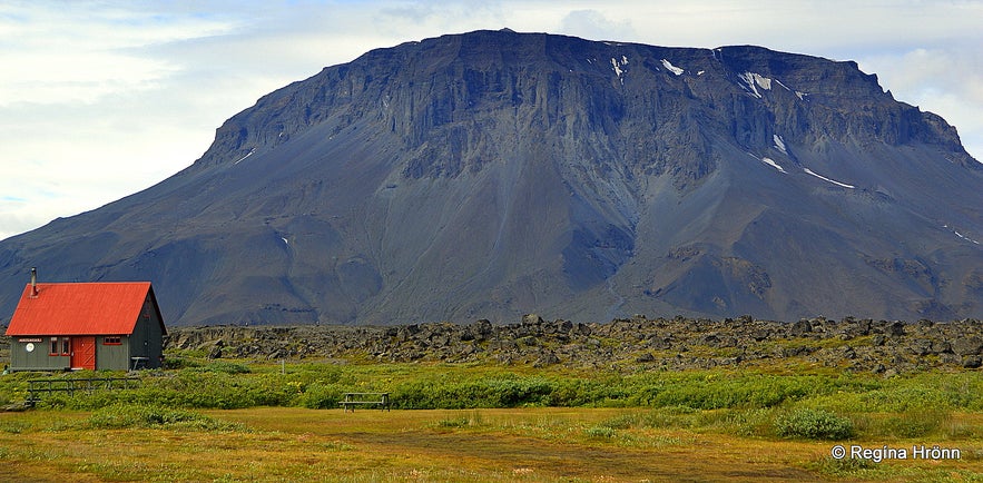
All of a sudden a beautiful oasis opened up, Herðubreiðarlindir oasis, which got its name from the Queen of Icelandic mountains, Herðubreið. We made a stop at Herðubreiðarlindir, and I was astounded by its green and lush vegetation and the beauty of this place in the middle of this barren wilderness.
Mt. Herðubreið and Herðubreiðalindir
Our guide walked with us up to Eyvindarkofi or the Shelter of Fjalla-Eyvindur, which is the remaining shelter of one of our best-known outlaws, Fjalla-Eyvindur (Eyvindur of the Mountains) who lived here in 1774-1775. Fjalla-Eyvindur was an outlaw for 20 years and lived in the wilderness with his wife, Halla.
I have visited more of his hiding places in Iceland and it always surprises me how these outlaws were able to survive the cold Icelandic winters.
See also: Hveravellir - the beautiful Oasis in the Highland of Iceland
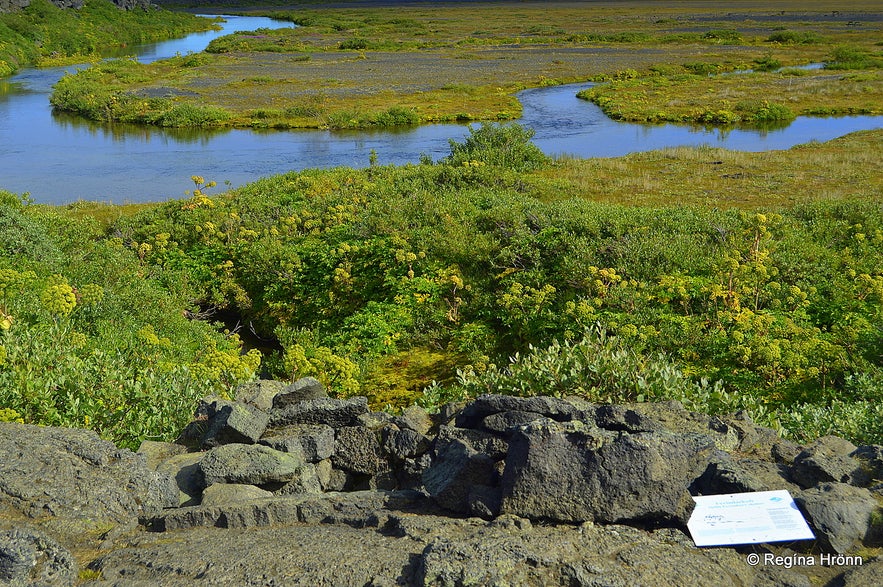
Herðubreiðarlindir oasis and the shelter of Fjalla-Eyvindur
According to Fjalla-Eyvindur this year of his hiding was the worst he experienced during his years as an outlaw. It was dreadfully cold and he didn't have any fire to keep him warm and had to live on raw horse meat. But here he had clear water, as in this oasis clear water comes straight from the lava.
There is a hut at Herðubreiðarlindir and toilet facilities. It costs ISK 500 to use the facilities, but do make use of them as it is not a given thing that one can find a toilet in the middle of the wilderness.
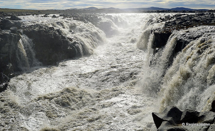
Gljúfrasmiður waterfall in Jökulsá á Fjöllum
Our next stop was by the small waterfall, Gljúfrasmiður falls, in the glacial river Jökulsá á Fjöllum, which is the second-longest river in Iceland (206 km). Jökulsá á Fjöllum means the Glacial River in the Mountains.
It is a roaring grey glacial river coming straight from Vatnajökull Europe's largest ice cap by volume.
Further north the glacial river creates the most powerful waterfall in Iceland, Dettifoss waterfall, plus several other smaller waterfalls. The river is so powerful that I felt sudden fear standing so close to it.
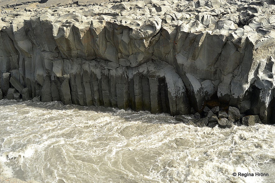
Basalt columns by Jökulsá á Fjölllum at Gljúfrasmiður waterfall
I took a video of it, just to remember how powerful this glacial river really is. Jökulsá á Fjöllum has been in the news a lot lately as we feared that a volcanic eruption was about to take place in Bárðarbunga, a major volcano in the Vatnajökull glacier.
If that were to happen there would be massive floods in Jökulsá á Fjöllum, which will create chaos in this area and further north.
We crossed this glacial river a couple of times on our trip, but it is bridged in 3 places.
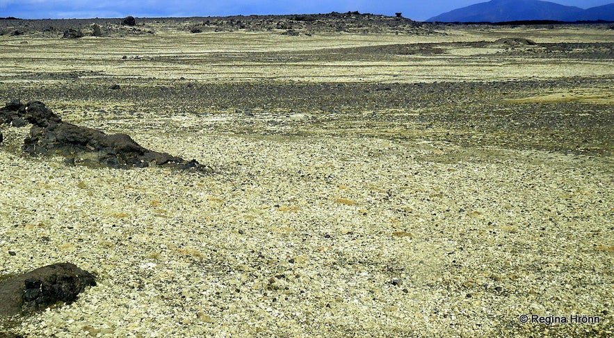
We now drove for an hour through the wilderness on a winding, bumpy road. After driving through the very grey landscape it all of a sudden changed and turned yellow. We had now entered the part of the highland called Vikrahraun or Tephra lava from a lava flow back in 1961.
The landscape was covered in yellow tephra. And black lava was sticking up from all the tephra, quite scenic.
The driver stopped and let us out to touch the tephra. It is amazingly light. While standing there I felt such strong ties to my country. I had been travelling for 3 weeks and seen all kinds of beautiful landscapes, but in the vast wilderness of my country I felt this strong connection and said to myself: "Now, THIS is Iceland".
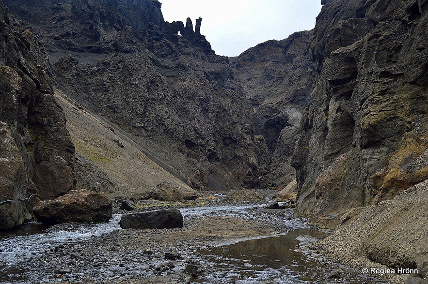
Now we were getting close to our destination and our next stop was at the amazing Drekagil- Dragon Canyon by Dyngjufjöll mountains, where we stopped to have lunch in one of the huts there.
Due to the heavy rain, the rivers had flooded and we couldn't hike into the canyon, as was planned. But our guide told us about the waterfall and the two dragons in the canyon, from which the canyon draws its name.
If you look closely then you can see the image of 2 dragons in the upper part of my photo. I hope you can spot them. You can see the waterfall in the canyon, which I visited on my second trip to Askja back in 2016.
Drekagil canyon
There is a hut by Drekagil canyon, called Dreki, with sleeping accommodation. If you plan on staying there remember to bring food as there is no food for sale there.
We left one of the passengers, who travelled with us on this tour, at Dreki and he was planning on staying there for a couple of days.
He had only brought a sandwich with him as he thought he could buy food at the hut. Our guide had to bring him food on his next trip to Askja, which was 2 days later.
Hiking to Askja
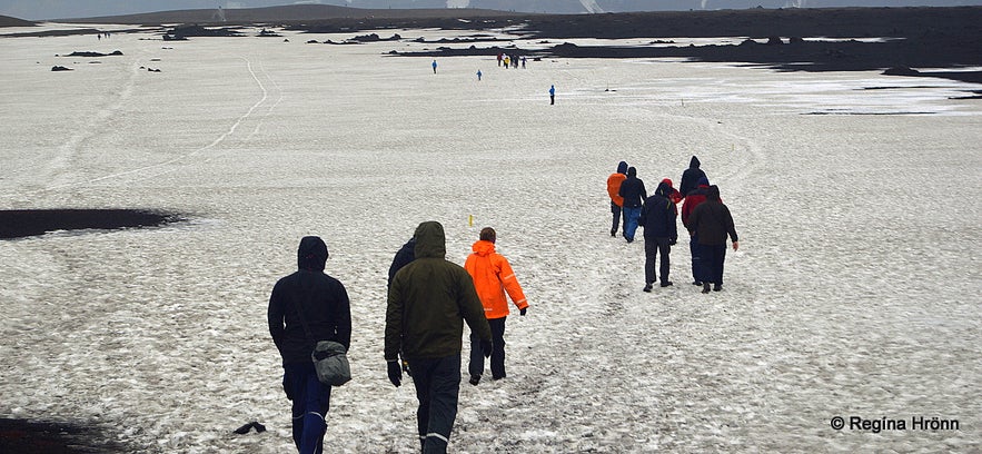
After having lunch at the smaller hut by Dreki, we drove to Askja, which is only 8 km away from Drekagil canyon, and left the jeep by the parking lot. The hike to Lake Askja and Víti explosion crater is an easy one, about 30 minutes long.
When we visited there was still a field of snow on the path.
There was heavy rain and wind and the temperatures were low. I didn't bring waterproof trousers and got soaking wet.
Víti explosion crater by Askja
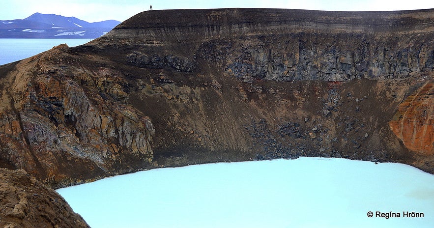
When I finally laid my eyes on the Víti explosion crater I was in awe. The big crater of Víti with its whitish opaque blue water is like out of this world. The crater is 150 meters in diameter and in it is a 25-30 degrees C hot geothermal, sulfurous lake, in which one can bathe.
There had been an earthquake and landslide by Askja on July 21st, with a wave estimated to have been as high as 50 meters with water from Lake Askja flowing into the Víti explosion crater.
This resulted in the water level of Lake Askja now being 2 meters higher than before. When we visited it was not allowed to go for a swim in the crater.
Víti explosion crater by Askja
Too bad, as I had been looking forward to that and was wearing a swimsuit underneath my clothes. Hopefully, on my next visit, I will be able to go for a swim in the Víti explosion crater.
Öskjuvatn or Lake Askja and Víti explosion crater got created in a massive volcanic eruption back in 1875. After the eruption, a lot of Icelanders emigrated to Canada.
Víti explosion crater by Askja the following year when it was allowed to swim in the crater again
Lake Askja is situated in the crater of Askja volcano and is the second deepest lake in Iceland (220 m). We got such heavy rain on this tour that my photos don't do this beautiful place justice.
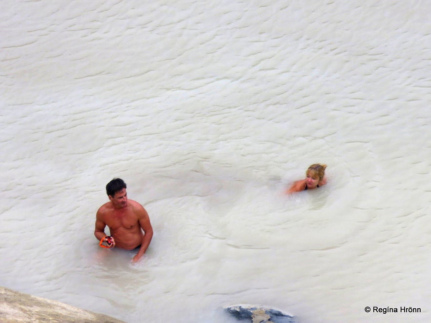
So I am going to add a photo from my last trip to Askja here above. You can see that by that time people were swimming in the Víti crater.
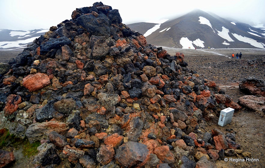
You will find a monument by Askja, erected in memory of the German scientists Walter von Knebel and Max Rudloff, who visited Askja in 1907 to study the area.
The monunment by Askja
During their explorations of this area, they went in a small boat on Lake Askja to explore the lake and disappeared. It was like the earth had swallowed them up.
Ina von Grumbkow, the fiancée of Walten von Knebel, came to Iceland with an expedition, but it was never discovered what happened to the 2 scientists. A truly sad story.
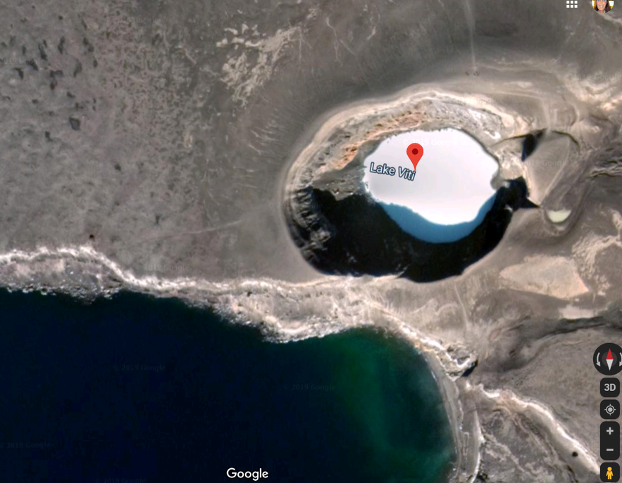
Here below you can see the path to the left of Víti leading to the monument. I zoomed in as much as I could on Google maps so that the path would become visible.
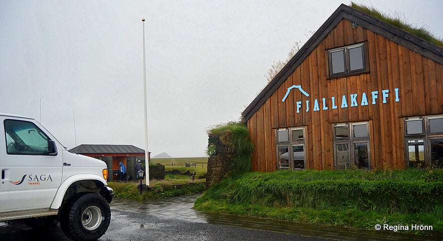
We spent an hour by Askja and then headed back. We took a different route back, crossed Jökulsá á Fjöllum glacial river on a bridge by Upptyppingar, and made a stop at Fjallakaffi - Mountain Café in Möðrudalur, which is the highest located settlement in Iceland.
After 14 hours on the road, we were back in Akureyri by 20:30 at night. It was an amazing trip, highly recommended. I had wanted to visit Askja for many years, so I am very happy I made it before the roads were closed because of the Holuhraun volcanic eruption.
As Askja is only accessible during the summer months and had been closed due to the landslide, I was in luck to have been able to visit it early in August.
Then it was closed again because of the volcanic eruption which lasted for 6 months.
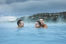
People swimming in Víti
In August 2016 I visited this area again and now a new location has been added, Holuhraun lava field, where you can walk on the new lava.
You can read about it in my travel-blog An Amazing Tour to Askja and Holuhraun Lava Field in the Highland of Iceland.
We got much better weather on that tour and people were allowed to bathe in Víti crater.
Have a lovely time at the amazing Askja :)


