In this travel-blog I want to show you Öndverðarnes cape - the westernmost point of the Snæfellsnes peninsula in West Iceland.
I have visited Öndverðarnes several times over the years and it amazes me how many ruins can be found here. This blog is a side-blog of my 5-part travel-blog series about the interesting Snæfellsnes Peninsula.
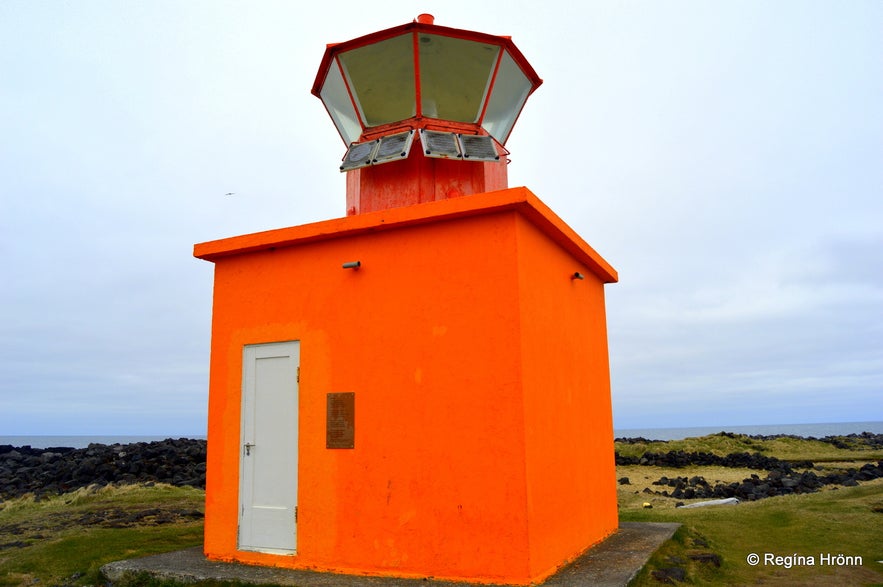
What you will first notice as you enter this area is the small orange lighthouse (only 5-meter tall), Öndverðarnesviti, built in 1973, with a couple of parking spaces next to it.
Top photo: Öndverðarnesviti lighthouse at Öndverðarnes
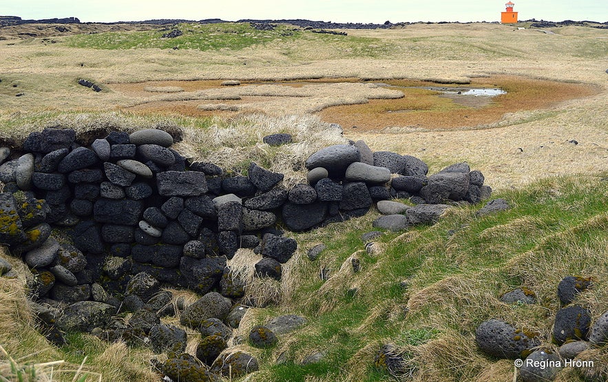
Ruins at Öndverðarnes
In 2007 a coach driver, driving 40 tourists around, lost control of the coach and seesawed on the edge of the rocks. Nobody got hurt, but it must have been a scary experience.
Öndverðarnes used to be a vibrant fishing station back in the olden times with fishery and a lot of fisherman's huts. Here was also a farm and a chapel, which is long gone now.
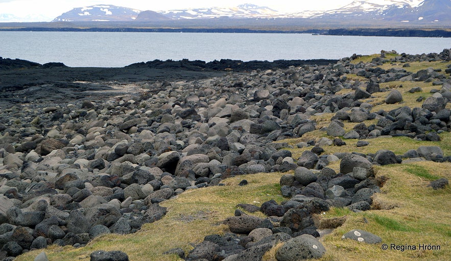
Ruins at Öndverðarnes
Since 1945 Öndverðarnes has been deserted, but you can see the ruins of the huts all over when you walk behind the lighthouse.
You will see ruins of fishermen's huts, fish storage huts as well as farm ruins.
I walked around this area thinking about how vibrant it must have been back then, now everything is quiet, all the stories, conversations, laughter, and tears from at least the 13th century until the 20th century - all gone, and only the ruins are left.
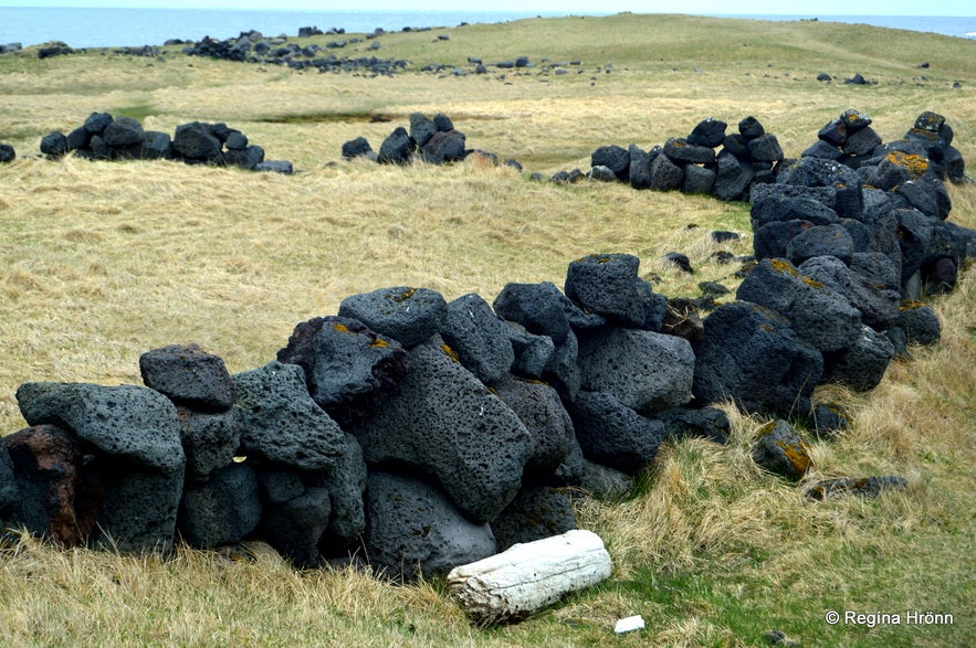
Ruins at Öndverðarnes
I can get quite sentimental when I visit such areas. And, looking out at sea and exploring the rocky lava shoreline makes me marvel at how strong and healthy these fishermen must have been!
In one spot you will encounter a skillfully made ancient stone well called Fálki or the Gyrfalcon.
It was the only water supply on the Öndverðarnes peninsula.
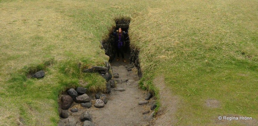
The well Fálki at Öndverðarnes
According to legend, there are three water holes in the well, one with fresh water, another one with healthy holy water, and the third one provides ale.
I have also read that instead of the holy water, one of the 3 wells provided brine.
There are 17-18 steps down to the well, which is dark and narrow...
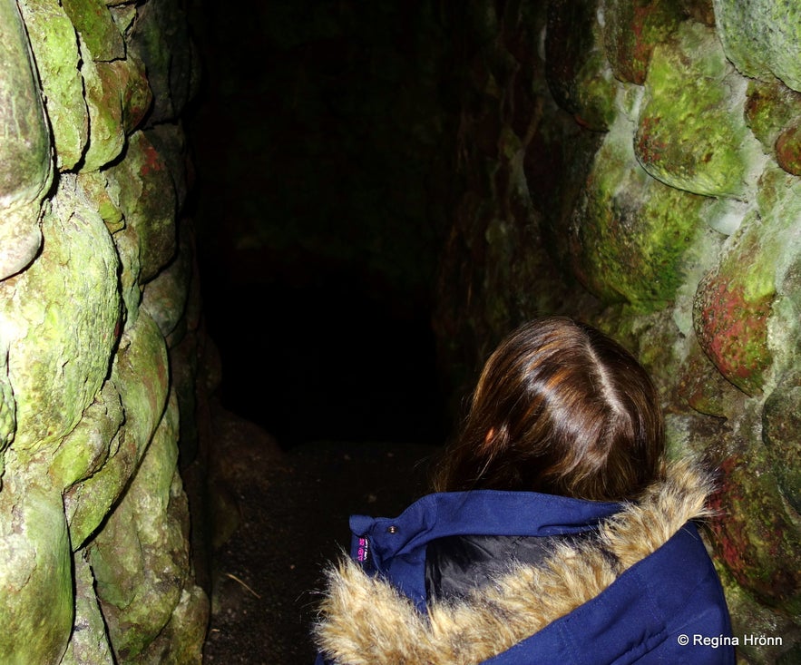
At the well Fálki at Öndverðarnes
We don't know the origins of this well or who built it, but it is clearly very old, and declared protected.
The yellow sign to the left of the well with the letter R and "friðlýstar fornleifar" written on it means that the well is protected.
You will see this sign in several places in Iceland, by archaeological ruins and burial mounds, protected caves etc., and I have shown you many such places in other travel-blogs, f.ex.:
Ancient archaeological ruins and Viking burial mounds in Iceland
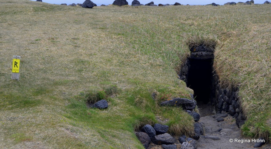
The well Fálki at Öndverðarnes
When you walk by the shoreline of Öndverðarnes, or should I say above it as it is so rocky, it is hard to believe that this was the landing for many small rowing boats. Both the inhabitants of this area and other fishermen would row from this landing.
When the rowing boats came ashore with their catch they had to be careful not to scratch their boats against the rocks on the beach.
The fishermen would drag their boats up the shore, high enough for the sea not to reach them. Marks can be seen in the stones from the keels of the boats. What a hard task this must have been.
Above the landing, a sign has been put up explaining how this was done. I always appreciate such signs and would like to see them in more areas.
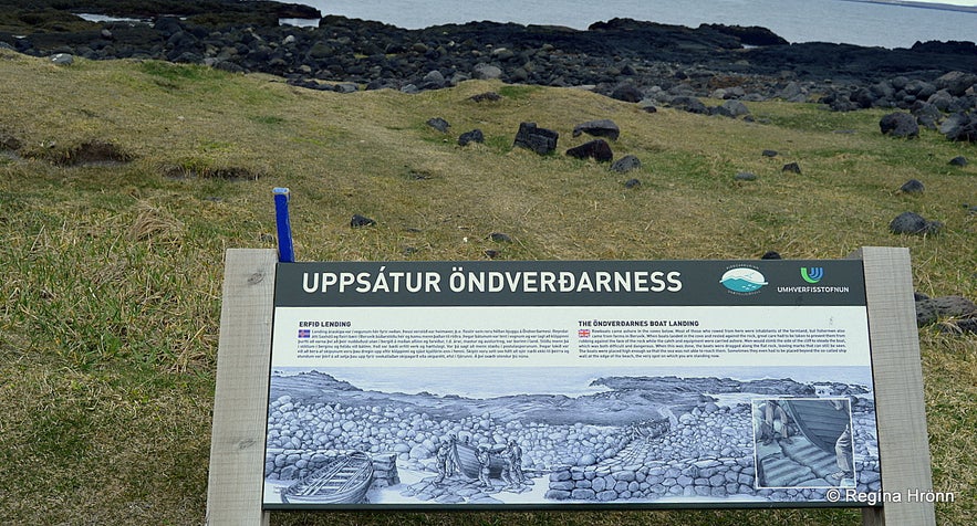
Uppsátur Öndverðarness infromation sign
I found one account on Öndverðarnes cape in Þjóðsögur Jóns Árnasonar - the Folklore of Jón Árnason and translated it into English:
"Öndverðarnes is the name of the farm on the westernmost protruding cape on the Snæfellsnes peninsula. There lived a man called Sigurður, who was skilled in verse-making and was thought to be able to perform magic with his poetry (kraftaskáld).
One cold and frosty winter ice formed on the sea across the whole peninsula, so there was no rowing from Öndverðarnes nor another place under the Snæfellsjökull glacier (undir Jökli).
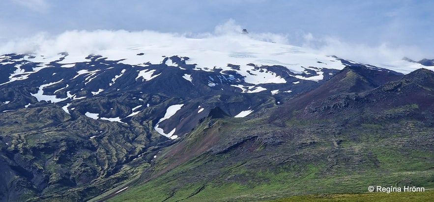 Snæfellsjökull glacier
But in this area, there is no food to be had apart from what could be caught in the sea, and the people living in this area beneath the glacier (Jöklarar) are hit very badly if they cannot go fishing due to bad weather or other calamities.
When the ice had been blocking this area for a while and nobody could go fishing, Sigurður composed a magical poem. (I am going to add some of these magical verses from the poem here in Icelandic - RHR):
"Sunnanvind á sjóinn
sendi af landátt gróinn
svo maurungs rífi upp móinn
magnefld vargfuglsklóin
með hríðum.
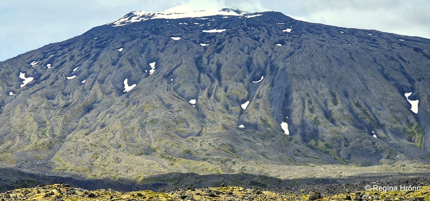 Snæfellsjökull glacier
Rjúki reyðarpallur,
rifni svo Heimdallur
að eldris jötunn allur
öskri burðarsnjallur
af bræði.
Bráðni ís og brotni,
bið ég þess af drottni,
sem ryk fyrir stormi rotni,
rýrð svo bjargar þrotni
af sjónum."
The day after Sigurður had composed this poem the frost yielded and a storm from land made the ice come apart and drift west out to the ocean. The inhabitants of this area (Jöklarar) were relieved and thanked Sigurður's poem for their rescue.
(Translated into English from Þjóðsögur Jóns Árnasonar - the Collection of Folklore of Jón Árnason).
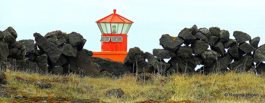
Öndverðarnes lightouse
The 4-km-long sea-shore south of Öndverðarnes is the notorious pitch-black lava wall, called Svörtuloft on which I have written another travel-blog:
The Majestic Skarðsvík, Saxhólsbjarg & Svörtuloft - Snæfellsnes in West Iceland
To visit the westernmost point of the Snæfellsnes peninsula drive west on the main road on the peninsula, road 54, and change to Útnesvegur road number 574.
There are a couple more sights in this area, one of which is another old well - Írskrabrunnur or the Well of the Irish.
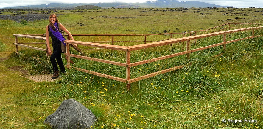 Ískrabrunnur - the Well of the Irish
You can rent a car and drive to the Snæfellsnes peninsula or join one of the guided tours to the peninsula.
If you want to read up on the Magical Snæfellsnes Peninsula then I have written an I-V part travel-blog on what there is to see and do on the peninsula.
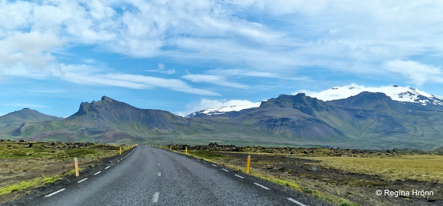
Mt. Hreggnasi and Snæfellsjökull glacier
Here are the links to my travel-blogs on Snæfellsnes; there is so much history and places of interest everywhere you look:
The Magical Snæfellsnes peninsula - part I
The Magical Snæfellsnes peninsula - part II
The Magical Snæfellsnes peninsula - part III
The Magical Snæfellsnes peninsula - part IV
The Magical Snæfellsnes peninsula - part V
This travel-blog is a side-blog of The Magical Snæfellsnes peninsula - part II.
Have a lovely time visiting the beautiful Snæfellsnes peninsula :)


