The Mysterious Snæfellsnes National Park Day Tour - West-Iceland
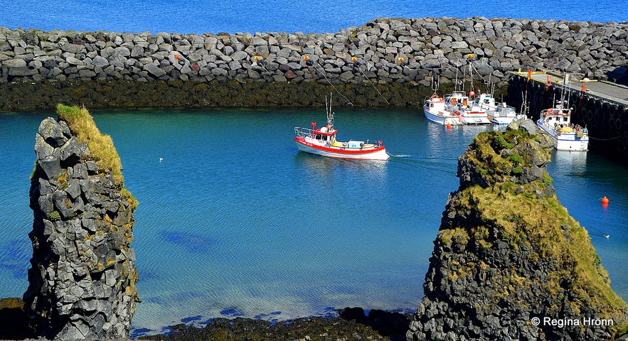
Snæfellsnes peninsula is one of my favourite locations here in Iceland, it is absolutely magical with so many interesting, beautiful sights. You will see stretches of lava fields, amazing gorges, and waterfalls, lovely hamlets, basalt columns in abundance, mineral springs, and volcanoes - just to name a few of the amazing sights on the Snæfellsnes peninsula!
I have written a 5-part series of travel-blogs on Snæfellsnes peninsula, but as many people have been asking me about guided tours to this area I decided on checking out a guided tour. I chose the Mysterious Snæfellsnes National Park Day Tour with Nicetravel.
Top photo: Arnarstapi
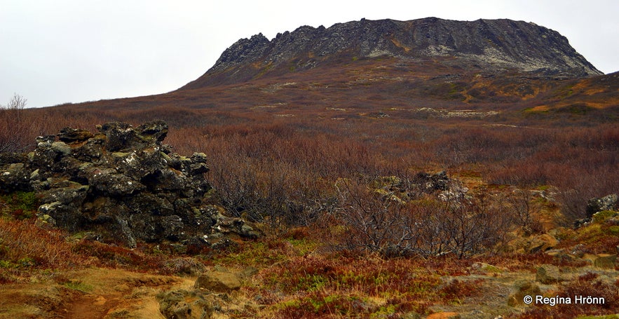
Eldborg volcanic crater
Eldborg crater
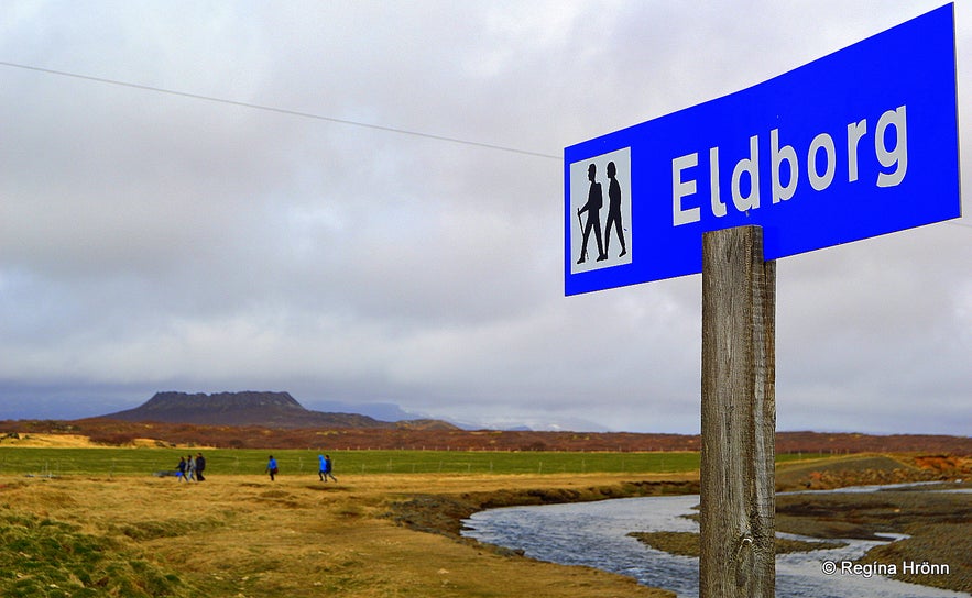
Our first stop was at Eldborg crater. I had wanted to hike up to this crater for many years, but as I was always in a hurry to visit some other places in Snæfellsnes then I had always left this hike for a later day.
Nicetravel doesn't always visit the same places in Snæfellsnes on their tours and this was actually the first time they included Eldborg crater in their tour! I was thrilled to be able to finally go on this hike. We stopped the bus on the parking lot of Snorrastaðir farm and hiked from there.
Eldborg crater is believed to have been most active 5000-8000 years ago. The name Eldborg means the City (Fortress) of Fire. This beautiful volcano was preserved back in 1974.
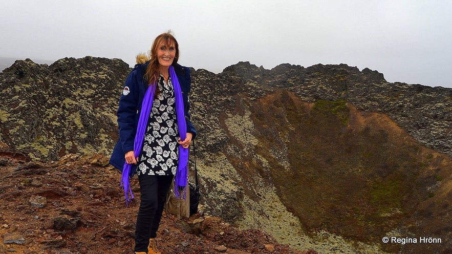
On top of Eldborg crater
The hike back and forth is around 6 km and it took us 1.5 hours to hike both ways with brisk walking.
The major part of the hike is easy, but be careful to not trip over rocks and roots on the trail. It is only when we got up to the roots of the volcano that it started getting really rocky (rough lava fields), but there were chains to help people climb up the steps to the top of the crater.
It is possible to see ravens that nest inside the crater, but I didn't spot them on our hike.
The height of the crater is 100 meters above sea level and the ascent is 60 meters. The crater is 50 meters deep and 200 meters in diameter. I had been ill with the flu for 5 weeks on this day in May and was in no shape for a hike, but up I went although I was the last one and very raggedy looking in the photo ;)
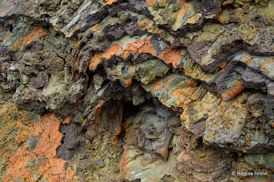
Colourful lava at Eldborg
On my way down from the crater I noticed the beautiful colours of the lava. I just couldn't stop taking pictures of it. I love taking pictures of lava and seek out colourful or oddly shaped lava, so I was thrilled to see all these different colours in the lava at Eldborg.
You can see the distance to the Eldborg crater in my photo above. The hike in itself is a delight as you can see this beautiful volcano drawing closer and closer. Eldborg, unlike many other volcanoes in Iceland, is in the "traditional" shape of what many of us think a volcano should look like.
I find it to be so beautiful and am so happy that I was finally able to hike to the top of it :)
Hiking to Eldborg crater
See also our latest volcanic eruption in Iceland: The Volcanic Eruption in Geldingadalir Valley on Reykjanesskagi in SW-Iceland
I have written a special travel-blog about the hike to Eldborg crater: A Hike to the perfectly shaped Eldborg Scoria Crater on Snæfellsnes in West-Iceland
Seal-spotting at Ytri-Tunga
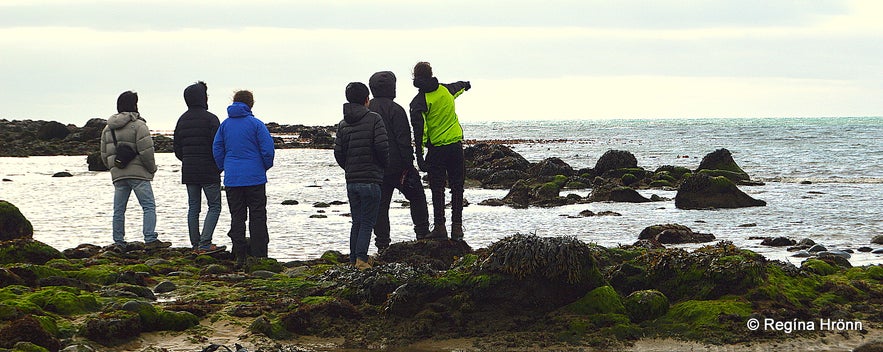
Seal-spotting at Ytri-Tunga
Our next stop was at Ytri-Tunga farm, where seals can often be spotted - it is actually a well-known beach for seal-spotting. It is a beautiful beach with pink sands, but pink sand beaches are rare in Iceland and the Snæfellsnes peninsula and the Westfjords are amongst the few places where pink/yellow beaches can be seen.
Other beaches in Iceland are black and I always find it to be so exotic to visit the pink/yellow beaches of the Snæfellsnes peninsula. Before I visited the first sunny beach abroad when I was 11 I thought all beaches were black!
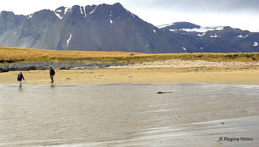
Seal-spotting at Ytri-Tunga
We saw the heads of some big seals, but I didn't bring my zoom camera with me, so I didn't get any good photos of the seals. But if you look up the google photos from Ytri-Tunga then you can see the seals. I love spotting seals, they are so beautiful and curious.
Arnarstapi
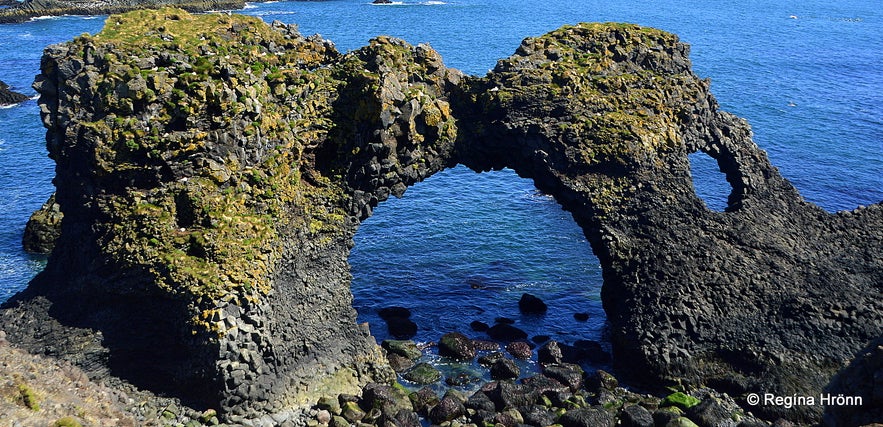
Gatklettur arch rock at Arnarstapi
Our next stop was at Arnarstapi, which is one of my favourite places on the Snæfellsnes peninsula. Here you will see bird cliffs with kittiwakes, fulmars, gulls, and the Arctic tern in abundance. In my opinion, the most beautiful harbour in Iceland is at Arnarstapi.
We stopped by two observation platforms and in my photo above you can see Gatklettur "Arch Rock". Quite magnificent! And there are so many beautiful basalt columns in this area, that I consider this a must stop while travelling in Snæfellsnes. The coastline here is amazing!
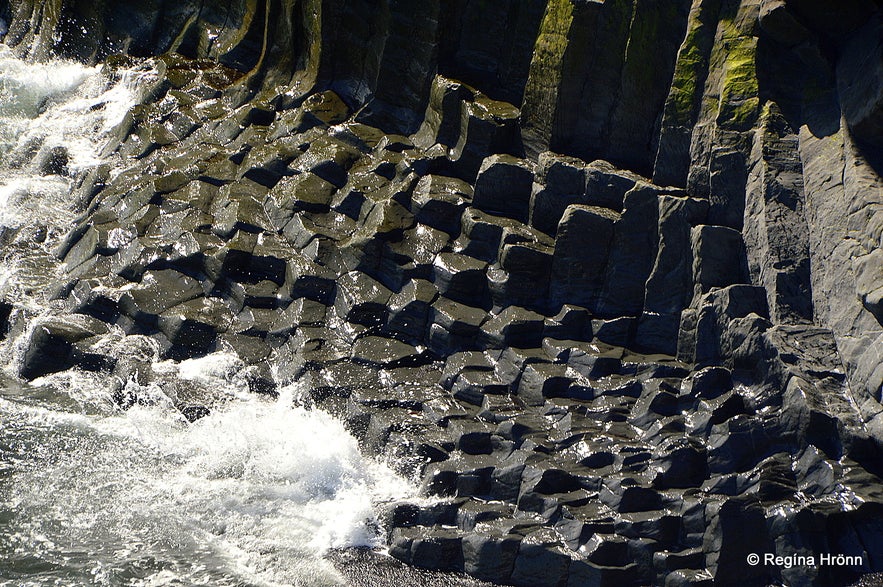
Basalt columns at Arnarstapi
There is a huge stone structure of Bárður Snæfellsás at Arnarstapi by one of our sculptors, Ragnar Kjartansson. Bárður Snæfellsás was/is half a man and half a troll and is considered to be the protector of Snæfellsnes.
Folklore is related to Bárður and a very sad family tragedy, which you can read about in my travel-blog Bárður Snæfellsás - the Mythical Protector of the Snæfellsnes Peninsula in West-Iceland.
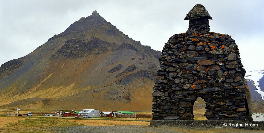
Bárður Snæfellsnes and Mt. Stapafell
Behind the statue of Bárður, you will see Mt. Stapafell, which is a peculiar 526 m high mountain and a volcano next to Snæfellsjökull glacier.
Mt. Stapafell is made of palagonite and in the shape of a pyramid.
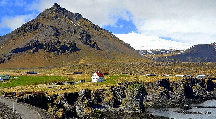
Arnarstapi and Mt. Stapafell
My photo above is one of the best-known photo motives from Arnarstapi; of Mt. Stapafell and the white house with the red roof and the bird cliffs in the foreground. We made a stop at the observation platform to take this special photo.
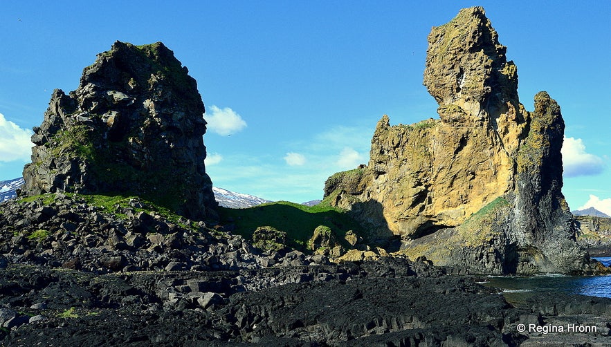
Lóndrangar volcanic plugs
Lóndrangar
Our 4th stop was only 5 minutes away from Arnarstapi, by Svalþúfa-Þúfubjarg, which is a crater that has been almost washed away by the sea through the ages.
A short hike takes you up to the top of the hill, which really is a sheer rock. In the summer of 2015, an observation platform was put up here. Before the observation platform was put up I used to stop walking up the hill when I started to smell the guano from the sea-birds in the cliff - that was the only indication that I was getting too close to the edge of the cliff!
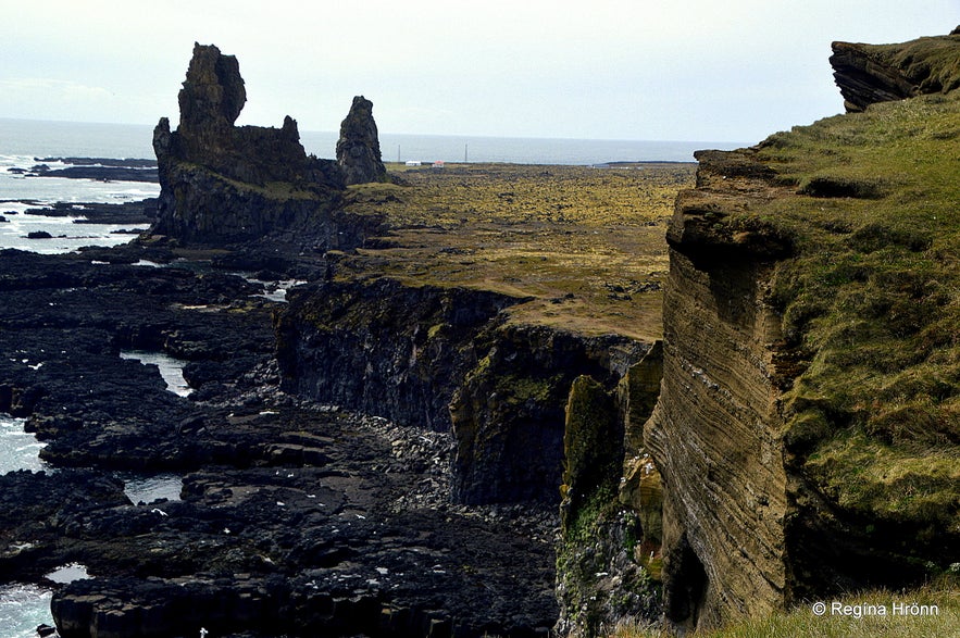
Þúfurbjarg and Lóndrangar
Now we are in elf territory and it is forbidden to mow the grass here because of the elves! From Svalþúfa-Þúfubjarg there is a beautiful view of Lóndrangar cliffs, which are 2 ancient volcanic plugs, 60 m and 75 m high, the higher one is called "Tröllkarlinn" or the Ogre.
One of the cliffs is believed to be the church of the elves and the other one to be their library, and one can understand why as their formation is very distinctive.
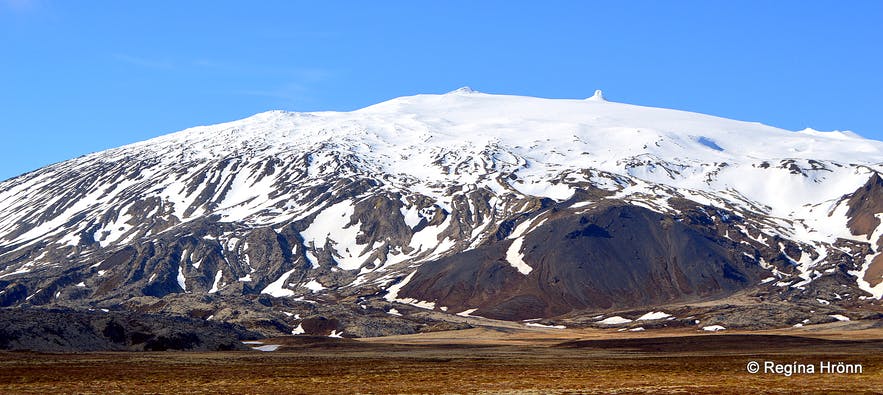
Snæfellsjökull glacier

Snæfellsjökull glacier
By now we were right by the famous Snæfellsjökull glacier, which is a dormant stratovolcano, 1446 m high. It is the main tourist attraction on the Snæfellsnes peninsula, towering over the National park at the west end of the peninsula. It was partly overcast when we visited and we could only see the lower part of Snæfellsjökull glacier, so I add a photo of the glacier which I took 3 days after the tour when I visited Snæfellsnes again.
Remember Jules Verne's science fiction "Journey to the Centre of the Earth" from 1864 about a group of scientists who ventured into the crater of Snæfellsjökull glacier?
There is a special energy at work by this glacier and some people get filled with energy here and cannot sleep when they are in the vicinity of the glacier, I included!
Djúpalónssandur
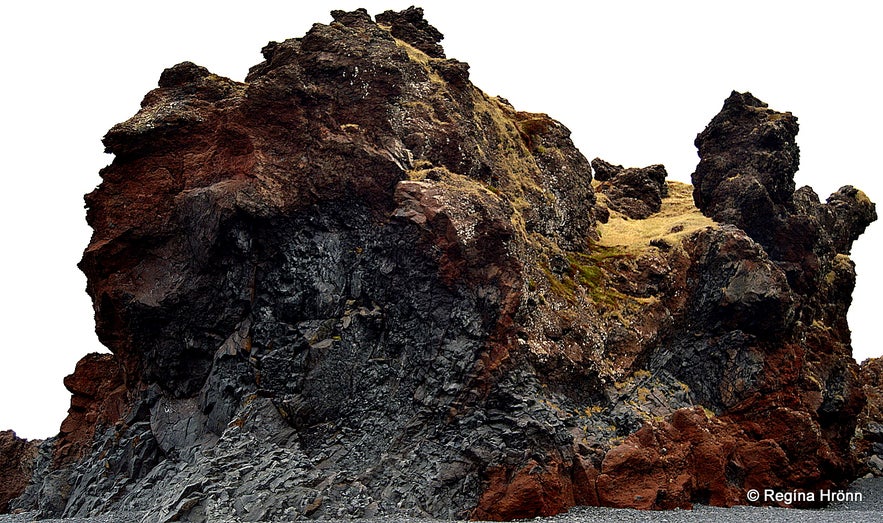
Söngklettur elf church at Djúpalónssandur
Our 5th stop was at Djúpalónssandur beach - I love this place - it is like stepping into lava wonderland!
From the parking lot, you walk down steps and up opens this beautiful black beach. The beach is made of small black smooth pebbles called Djúpalónsperlur or the Pearls of Djúpalón. These pebbles are protected.
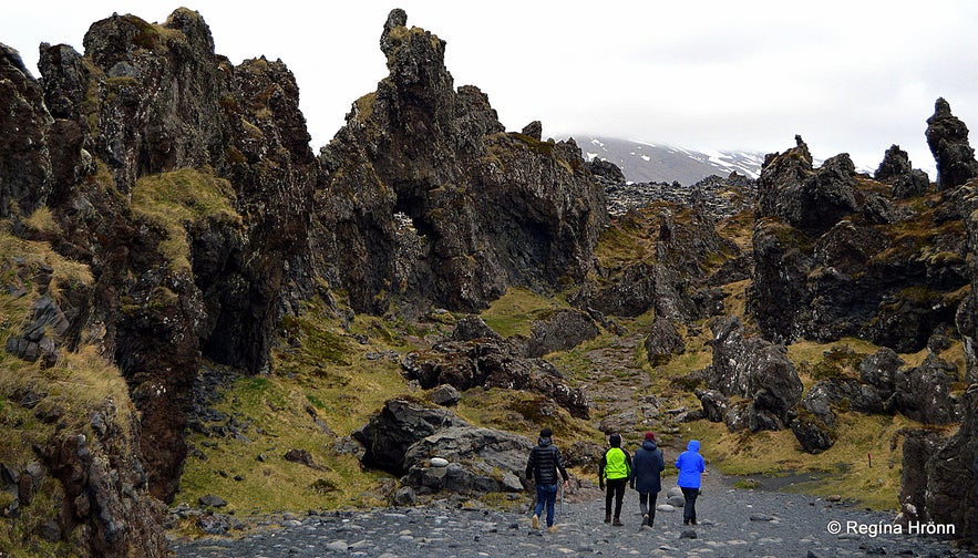
Lava wonderland at Djúpalónssandur
On the beach, you will see iron remains from the British trawler, the Epine GY7, which was wrecked east of Dritvík on the night of 13th March 1948. Fourteen men lost their lives and five were saved by Icelandic rescue teams.
The iron remains are protected and should not be touched.
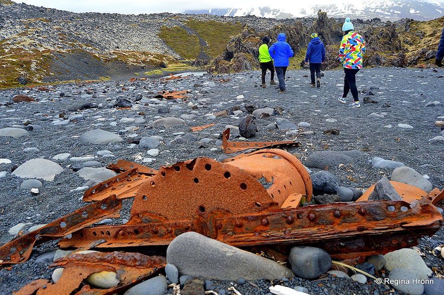
Iron remains from the wrecked ship
At Djúpalónssandur beach there are 4 stones. They are well-known lifting-stones "aflraunasteinar" here in Iceland. They were used to measure the strength of fishermen.
The biggest stone is called Full-Strength and weighs 154 kg. The second one is called Half-Strength and weighs 100 kg. The third one is called Weakling and weighs 54 kg and the fourth one is called Useless and weighs 23 kg.
All these names refer to how strong/weak the person is lifting them up on a plinth. If the fishermen could not lift the 54 kg stone they were not accepted on the fishing boats.
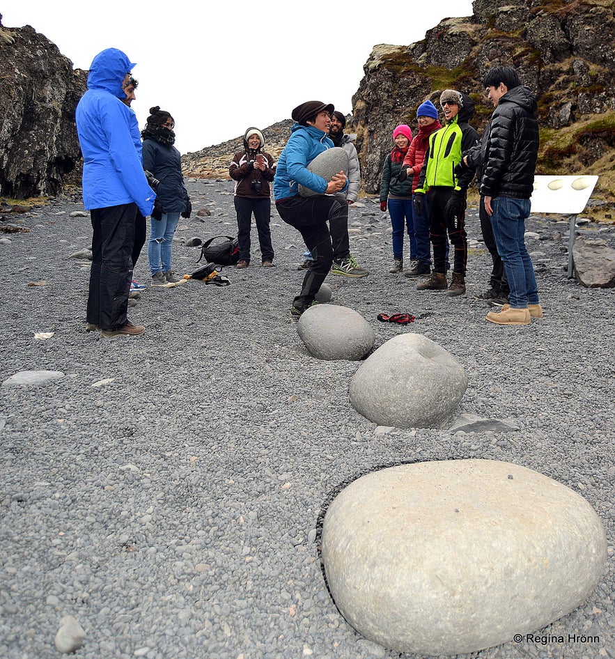
The lifting stones at Djúpalónssandur
Some of the people in the group tried to lift the stones, which caused quite a cheer amongst the other travellers. I didn't even try, I am far from being strong enough to lift these stones ;)
Be careful while visiting this beach - the suction of the sea in Djúpalónssandur is very powerful so please don't go too close to the sea.
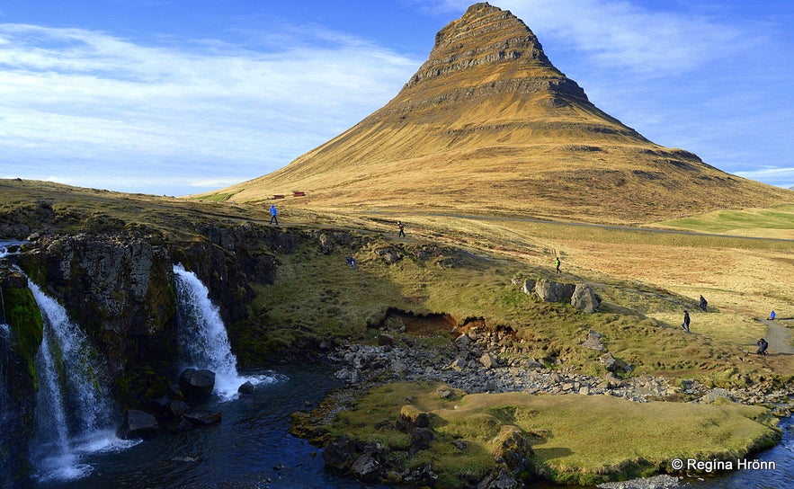
Mt. Kirkjufell and Kirkjufellsfoss waterfall
Mt. Kirkjufell and Kirkjufellsfoss waterfall
After stopping for early dinner in Ólafsvík town we headed for Grundarfjörður town, where my grandfather was raised. Now just recently Mt. Kirkjufell and Kirkjufellsfoss waterfall have become the most popular photo stop here in Grundarfjörður.
Everybody seems to want to take a photo like the one above, i.e. from this angle - so we made our final stop here. It is a beautiful photo spot.
Mt. Kirkjufell is the most prominent mountain in Grundarfjörður and a landmark of this fishing town. It is free-standing and referred to as the most beautiful mountain in Snæfellsnes.
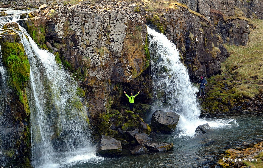
Our tour guide behind the waterfall
Antonio, the tour guide had found out that it is possible to walk behind one of the waterfalls, something I had not known about. There is something so special about walking behind waterfalls in my opinion. The path has now been closed due to too much traffic.
You can see Antonio in both the photo above and below, where we were trying to touch the top of Mt. Kirkjufell - we almost succeeded ;)
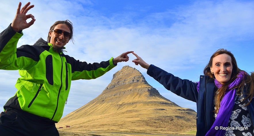
Almost touching the top of Mt. Kirkjufell
I loved this tour, the guides are so friendly and laid back that it felt like I was on a tour with my friends. The bus accommodates 12 people, which is a perfect size if you want to get to know your fellow travellers.
Antonio, one of the guides, is awesome, I have been twice on the Snæfellsnes tour with him and he loves Iceland - just like I do, so it is a delight travelling with him and we constantly swap stories about our travels around my country. A highly recommended tour. And now they are even offering a 2 Day Snaefellsnes Tour|The Wild West of Iceland!
Have a lovely time on the Snæfellsnes National Park Day Tour :)
其他有意思的博客
冰岛最浪漫的角落
对于很多人,遥远的冰岛有着世界尽头的神秘,有着区别于巴黎、马尔代夫、自成一体的浪漫。没有埃菲尔铁塔和蒂凡尼,没有热带沙滩,而是在冰川、火山、苔藓地的背景下蜜月旅拍、婚拍,甚至举办一场冰岛婚礼。来冰岛旅行,多是要跨千山万水、飞跃大洋大陆,很有一点“万水千山陪你走过”的史诗感。难怪很多人说,光是冰岛二字,就足够浪漫了。 冰岛虽然不大,但是地貌极其丰富,不同的自然景观自然有不同的气质。这一篇,就挑阅读更多从极光观测到摄影-到底该不该来冰岛看极光
很多朋友都想来冰岛看极光,但是冰岛到底适不适合看极光呢?几月、什么季节能看到极光?是不是一定要参加北极光旅行团?如何能拍摄出美丽的极光照片呢?在冰岛住了好几年了,从刚开始逢极光必出门,到如今家里阳台就能看极光,我对在冰岛看极光的了解和经验,也算得上大半个专家了,且听我娓娓道来吧。 到底该不该来冰岛看极光呢?最坦诚的答案是,不要只为了看极光而看极光。 极光原理 太阳活动→太阅读更多
迷失冰岛的米湖游览推荐|不只有温泉的地热宝藏区
我在冬夏秋均到访过米湖,看过米湖的不同面。一直以来,米湖到底值不值得去是很多游客争论的问题。有些人觉得这里是来冰岛旅行的必去目的地,有些人则说米湖“太丑了”,连照片都不想多拍几张。那米湖到底值不值得来呢?到底怎么玩呢? 米湖的风景 北部的米湖,因地理位置相距首都雷克雅未克略远,很多来冰岛的短途游客选择放弃,其实米湖应该是和黄金圈、南岸沿线至冰湖齐名的冰岛景色,这里冷热相融,可谓最冰岛,尤其阅读更多

将冰岛最大的旅行平台下载到您的手机中,一站式管理您的整个行程
使用手机摄像头扫描此二维码,然后点击显示的链接,将冰岛最大的旅行平台添加到您的手机中。输入您的电话号码或电子邮件地址,以接收包含下载链接的短信或电子邮件。

