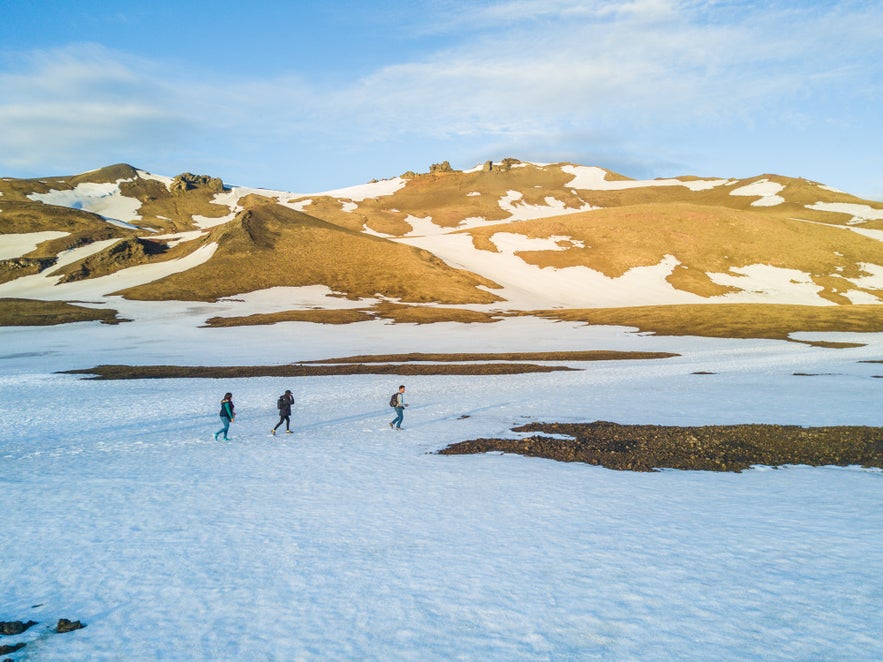
With so much unspoiled natural beauty and diversity, spending time in the Icelandic outdoors feels like a dream. Naturally, hiking is one of the most popular activities done in Iceland, as it lets you slow your pace, have a moment in nature, and enjoy up-close the iconic waterfall, glacier, mountain, and overall scenery that inspired such hike.
Iceland counts with hundreds of hiking options that range from a few short hours to a few weeks long. Since not everyone has the time to undertake a long hike on their vacation, here I’ll list five short hikes that’ll let you enjoy some of these enchanting spots hidden from view from the road or the city, but not so far out of reach that you can reach them in just a few hours.
Find Hiking Tours in Iceland here.
Sólheimasandur Plane Wreck
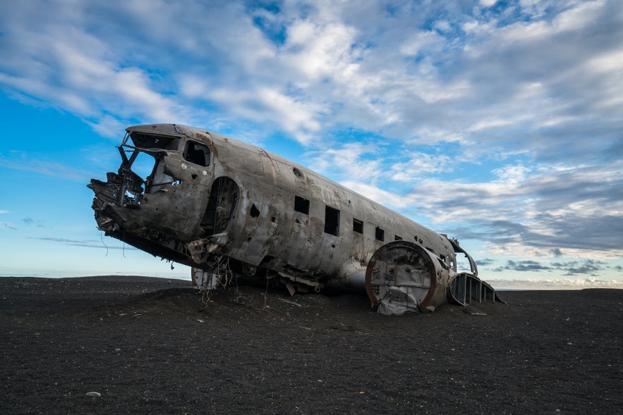
I’ll start with the easiest one, and probably the most unusual scenery on this list. This is not so much a hike, but more of a long leisure walk that extends 2-km each way. The landscape might be quite dull – an expanse of black sand and pebbles expanding as far as the eye can see – but once you reach the end on the trail, you’ll see one of the coolest human-made sights in Iceland. This sight was, of course, done unintentionally.
The surreal setting of a US Navy Douglas Super DC-3 airplane lying hollow and forgotten on a deserted black beach make for a perfect photo opportunity of something you usually don’t see laying around unattended. You can explore inside the hollow shell, but be careful, as this plane is falling into pieces and there are sharp metal edges.
This plane crash-landed on Sólheimasandur Beach on November 24th, 1973 when it ran out of fuel after the pilot pulled a switch that changed the fuel line to the wrong tank. All crew members survived the accident, but the fuselage was left there and never recovered.
I recommend looking for “Sólheimasandur Plane Wreck” on Google Maps to get the exact spot. To reach it, just park in the designated parking area off Road 1, and hike for 45 minutes towards the beach.
This South Coast Elements day tour takes you to the plane wreck, and provides fat bikes to ride to the wreck from the parking lot.
Svartifoss Waterfall
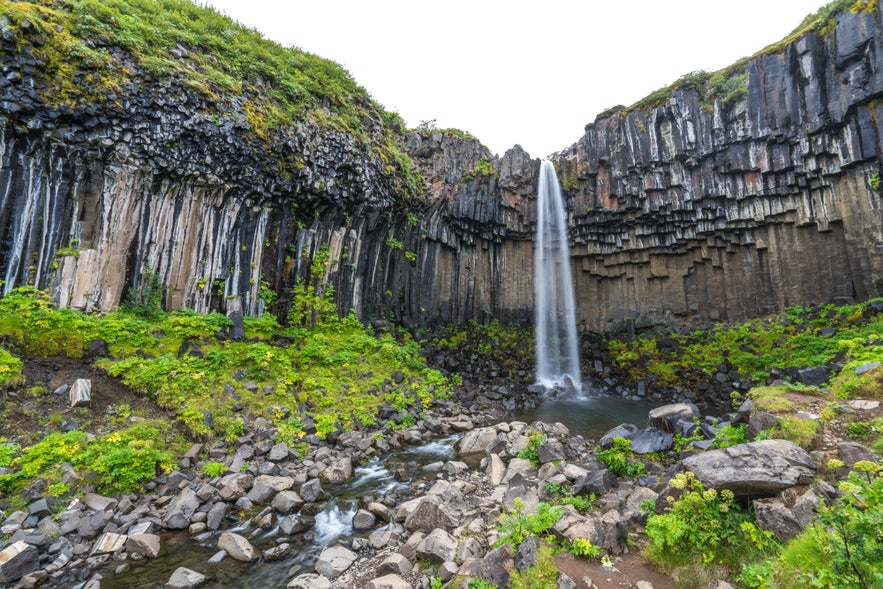
Svartifoss – which translates to Black Falls – is one of the most famous waterfalls in the country. In fact, it is said it was the inspiration behind the iconic Hallgrimskirkja church in Reykjavik. To reach this fall, you must hike for about 45 minutes from the parking lot in Skaftafell Nature Reserve inside Vatnajökull National Park.
This hike starts a bit steep for its first 15 minutes, but then it eases to a more gradual ascent until you reach the falls. Along the way, you’ll also see smaller falls as well as the glaciers in the distance. Once you reach the falls, you’ll be mesmerized by its beauty. With a 20-meter drop, it might not be the tallest waterfall nor the biggest, but its background of black basalt columns makes it one of the most visually appealing.
This hike takes roughly 45 minutes each way, but if you have the time and energy, there are more trails in the area, extending from Svartifoss, leading to other waterfalls higher on the mountain and towards the glacier’s edge.
Find Skaftafell Tours here.
Lake Öskjuvatn and Víti Crater
While the hike to Víti Lake in Askja might be short and sweet, the drive to Askja is the opposite. Deep in the highlands, Askja is located about three hours south of Road 1, on the northern region of Iceland. The problem’s not that it is far deep, it’s that to reach Askja you need a 4x4 to drive the F-road (F910) and do three river crossings, each way.
While the drive is challenging, the scenery is beyond surreal. Almost no tourists come this way, so you’ll have the area mostly to yourself. A trip worth doing if you have the time. Once you reach the end of the road, you’ll start the easy hike towards the lake and volcanic crater.
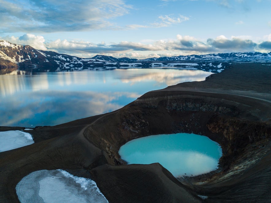
The hike to Víti takes about 45 minutes each way along a mostly flat volcanic valley. Due to the volcanic composition of the area, it was used during training for the Apollo program in the 60’s to prepare astronauts for the lunar missions. You’ll see how the dark valley turns into mountains of different shades of brown and red. Depending on when you go, it is very likely there will be layers of snow still covering most of the hike.
Once at the rim of Lake Öskjuvatn, you’ll witness one of the most stunning views in all of Iceland. If the weather is calm, you’ll see the Dyngjufjoll Mountains almost perfectly mirrored on the lake. And in the foreground, to your right, you’ll see the Víti crater – which translates to “hell.”
Depending on the ranger’s advice, you could go down the crater to bathe in its lukewarm waters. In this post, I write more details on the roads you must take to reach Askja, in addition to a few other tips.
Glymur Waterfall
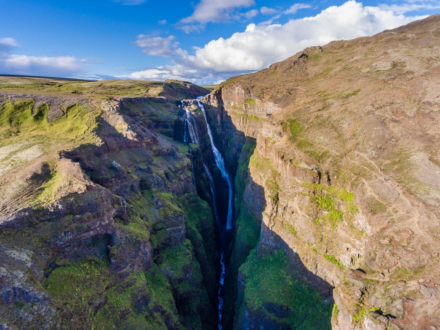
Just 45 minutes away from Reykjavik, you’ll find Glymur – Iceland’s second highest waterfall, standing 198 meters tall. Glymur was considered the highest waterfall in Iceland until Morsárfoss was measured in 2011 – with a height of 228 meters.
Even though Glymur is so close to the capital city, not too many tourists visit it. To get to it, you must hike for two to three hours round-trip, through green mossy cliffs, and along a beautiful, narrow canyon that’s always full of birds flying around. And far back in the canyon’s background, the stunning Glymur, sliding down the canyon walls.
The hike starts comfortable, on mostly flat terrain, but after the river crossing (depending on the water level you might get your feet wet), the hike gets steep and intense for about 30 minutes. After that, the terrain’s slope reduces, but the views get more breathtaking at each turn you take. You can finish your hike at the top of the falls and return, or continue the trail even further along the river. If you're doing a road trip across Iceland, make sure to not skip this one.
Hornstrandir Nature Reserve
As one of the most inaccessible parts of Iceland and the northernmost tip of the Westfjords, Hornstrandir is a place only a handful of people visit each year, and many of them are serious hikers who took a week or more to reach it.
Surprisingly, it’s not too hard to get there - if you take the ferry from Ísafjörður. If you take the boat, it will take you to the northernmost tip, from where you can hike for a few hours near cliffs and mountain passes. Some of the most beautiful views here are of the mountains climbing, then suddenly a sheer drop to the ocean appears as if the hill was sliced in the middle by a knife. If you want it even easier, Guide to Iceland offers day tours to Hornstrandir from the town Ísafjörður.
Hornstrandir has been uninhabited since the 1950’s due to its rough weather, remoteness, and lack of resources, but today it is a beautiful nature reserve where you can camp and hike for days. In addition to the gorgeous scenery, here you’ll also find Iceland’s biggest arctic fox colony.
Even if it is the middle of summer, you must go with proper winter clothing. This spot is less than 10 km from the Arctic Circle, so the wind drafts are pretty cold! Since there’s nothing in the area, you must also carry all your food and camping gear (if you decide to spend the night there).
Find out more by reading the article Hiking in Iceland.

