Iceland is well known for its countless beautiful sights that are easily accessible along the Ring Road. The Ring Road circles all around Iceland, leaving the highlands (or central region of the country) mostly untouched. In fact, there’s barely any development in the highlands, which makes it the perfect place to explore some of the most unspoiled landscapes you’ll ever see.
Among these landscapes is the famous Askja Caldera in the Dyngjufjoll Mountains – located on the northern side of the Vatnajökull National Park. Askja is a 50 square kilometers subsidence cauldron formed when a lava chamber just under the surface of the earth emptied in a volcanic eruption and the roof above it collapsed. In fact, Askja consists of three interlinked cauldrons, which makes it the best subsidence cauldron example in Iceland.
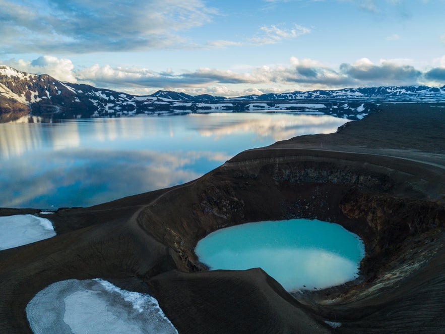
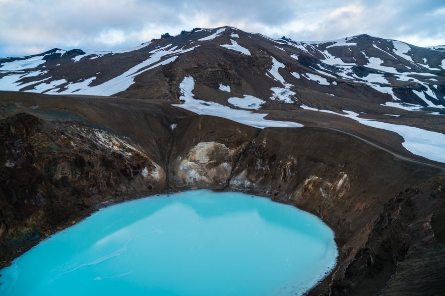
There you’ll find the Öskjuvatn Lake, which has an area of 11 square kilometers and is the deepest lake in the country with a depth of 217m. Additionally, you’ll see the beautiful Víti volcano, which contains a 60m deep geothermal lake filled with bright blue water at 22 degrees Celsius. It’s almost like a surreal, natural Blue Lagoon inside a volcano.
Witnessing this surreal landscape should be part of your trip in Iceland. While there are a few tours that can take you to Askja; if you're planning on traveling around Iceland on a budget, here's what you'll need to know to do this adventure on your own.
Driving to Askja
First of all, you need a 4x4 vehicle. Do not attempt this with a small car or even a small 4x4 (like a Suzuki Jimny) as the two river crossings require a decent clearance.
The easiest route to get there is taking the Ring Road (Road 1) past Akureyri and Myvatn, and getting off on Road 901. From the 901, you’ll turn right into the F905, which is where you’ll start the real driving adventure. After 21 kilometers, you’ll take the F910 until the end – an additional 62 kilometers. You’ll encounter your first river crossing around 5 kilometers after you enter the F910, with the second one following just a few minutes after. There is a total of three water crossings on this route, but the first one you’ll see is quite shallow and easy to pass, so it is not even marked on maps as a river crossing.
Pay attention though, as you’ll have a few road-forks with other F roads along the way. Stay on the F910 the entire time until you reach the shelter and camp site at the end of the road. Also important to note is that you will encounter two bridges with fences. It’s possible they might be closed, yet unlocked. Don’t be discouraged by this. Just get off, open it, cross the bridge, and shut the fence again.
Once at the shelter, I highly recommend getting off there to ask the ranger (or the shelter staff) about the current conditions at Víti and its trail. Once you’re informed, you’ll drive for another 20 minutes along F894 until you reach the parking area at the end of the road. From there, your hike to Viti will start.
Lastly, I highly recommend not taking the F88 route (which might come up on your google maps as an option to get to Askja from Road 1). This F road has several fords and river crossings that are not passable with a 4x4. You need a special vehicle with sufficient clearance and a snorkel to be able to cross them. Stick to the route shown above (F905/F910) as it is the easiest.
In all, the drive takes about three hours each way from Road 1 to the trailhead.
The Hike to Víti and Öskjuvatn Lake
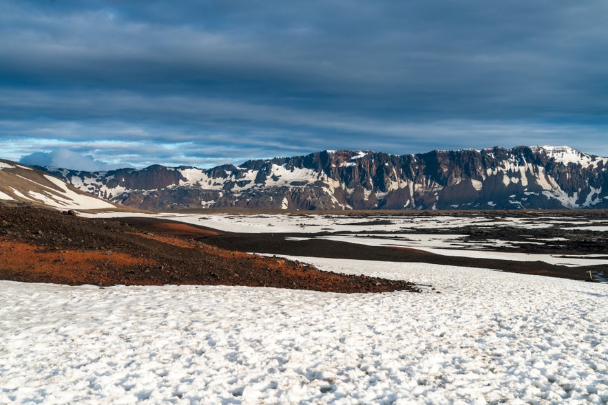
The hike to Víti takes about 45 minutes each way along a mostly flat volcanic valley. Due to the volcanic composition of the area, it was used during training for the Apollo program in the 60’s to prepare astronauts for the lunar missions. You’ll be able to witness the dark expanse as it turns into mountains of different shades of brown. Depending on when you go, it is very likely there will be layers of snow still covering most of the hike (even during mid-summer).
Take your time during the hike. Even though it is an easy stroll, the snow can make it slightly challenging if you don’t have proper shoes or boots. Look where you step on, as sometimes, as the ice melts, your feet can land on thin ice full of cold water under it. But don’t worry, it’s just a few inches of water –nothing dangerous– but that cold water doesn’t feel nice at all when it enters your shoes!
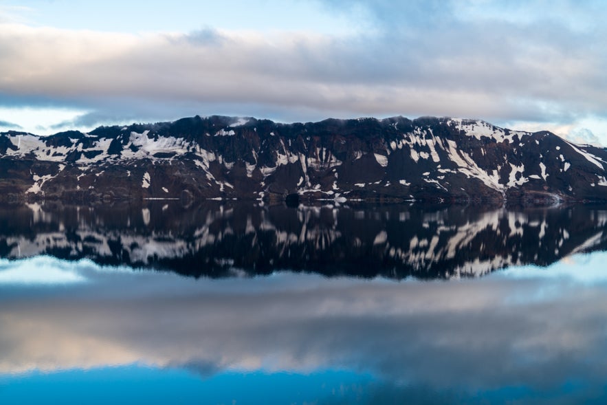
Once you reach the rim of Lake Öskjuvatn, you’ll witness one of the most stunning views in all Iceland. If the weather is good, you’ll see the Dyngjufjoll Mountains almost perfectly reflected on the lake. And in the foreground, to your right, you’ll see the crater – Víti. In fact, the name Víti means “hell.”
Depending on the ranger’s advice, you could go down the crater to bathe in its waters.
Bathing in Víti
This is something you can only do if allowed by the rangers. That’s why it is important to stop at the shelter to see the current status. Sometimes, rangers have to close access to the crater due to the terrain conditions. When it rains much, the steep slope down the crater becomes too muddy. While it is possible to descend, hiking up on mud becomes a serious challenge – too steep and slippery. When access is restricted, you’ll see some wooden “x” planted right on the trail that leads down the crater.
Should the trail conditions be right, why not head down the crater? Even though people can bathe in Víti, the water is not that warm, averaging around 22 degrees Celsius (vs. 38 degrees at the Blue Lagoon). But on a positive side, you’ll have a geothermal lake, inside a volcanic crater, almost to yourself! Due to the remote location of Askja, not a lot of people come here, so chances are you might even be there on your own for a while.
As expected, there are no lifeguards at the lake, so take care when bathing there. Stay close to the shore and always within easy reach.
When To Go
This trip can be done as part of your overall ring road trip around Iceland. Guide to Iceland has a few self-drive itineraries you could use as inspiration where you could fit this adventure.
The region is only accessible for a few months of the year, mostly from May to September. Sometimes the F Roads open a bit later or close a bit earlier in the season depending on the weather and road conditions. I recommend checking the road.is site to see the current road condition and whether it is open or not.
Weather in Iceland is mostly unpredictable as it changes so quickly, so often. I don’t recommend going to Askja if there’s severe weather conditions and it could be dangerous not only during the drive but also during the hike.
Since you’ll only be able to access Askja during the summer months, you can head there at any time of the day. If you head there late in the day (reaching Víti around 9 pm, as I did!), you might even have the beautiful experience of leaving Askja with the moon rising in the east while the sun still lingers on the west. That, plus the volcanic landscape makes it a completely surreal experience.

