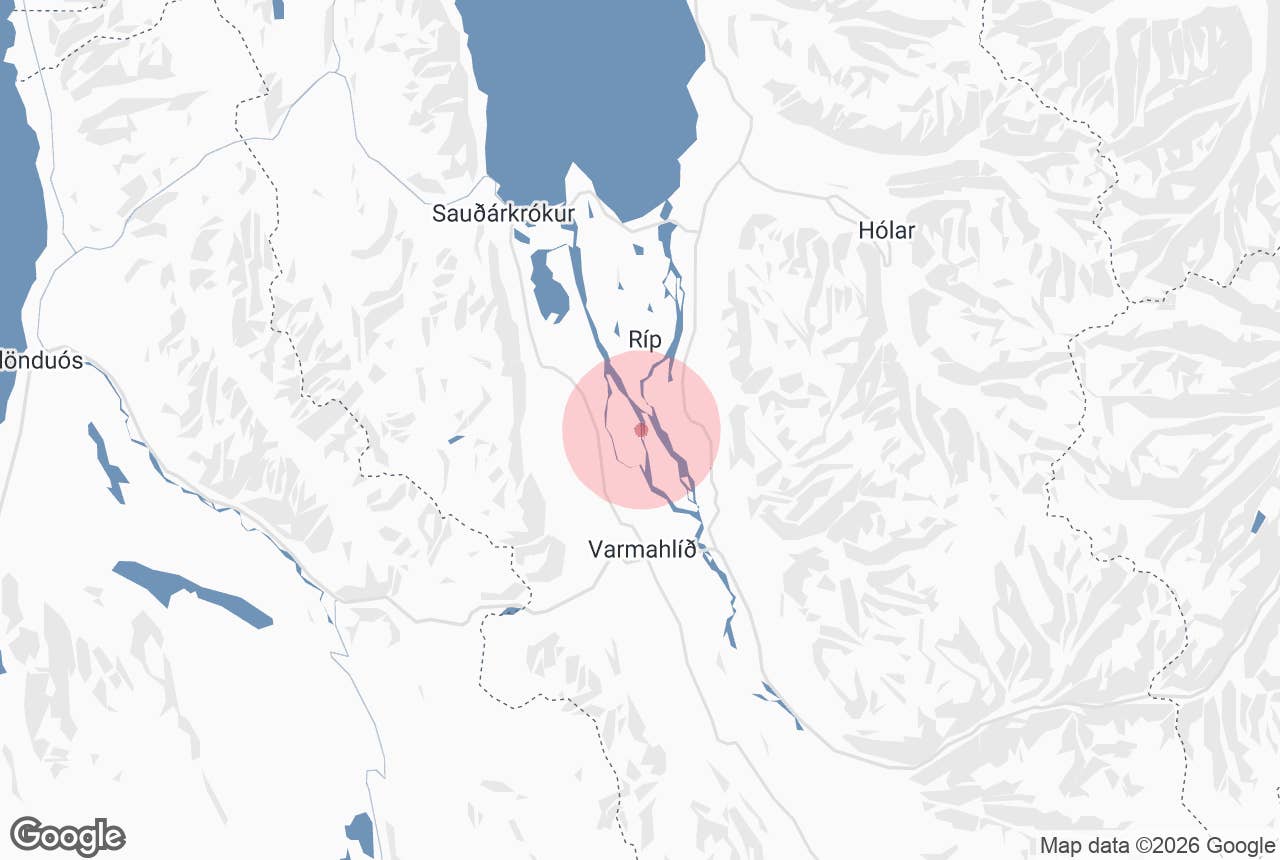
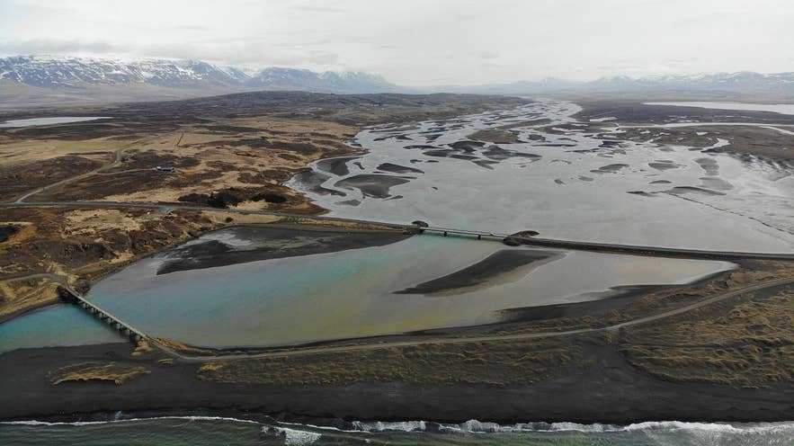
Mouth of Héraðsvötn near Sauðárkrókur. Photo: Backe0112, CC BY-SA 4.0
Héraðsvötn ("the district waters", usually just "Vötnin", the Waters, to locals) is the great glacial river of Skagafjörður in North Iceland.
It forms where the two Jökulsá rivers from Hofsjökull, Austari-Jökulsá and Vestari-Jökulsá, meet below the farm Tunguháls, and then spreads across the flat valley floor for about 40 km before splitting into two arms that reach the sea on either side of the Hegranes peninsula.
The braided lower river and its wetlands are the defining landscape of central Skagafjörður: wide meadows cut by shifting grey channels, with the mountains of Tröllaskagi on one side and the Skagi ridge on the other.
Key Takeaways About Héraðsvötn
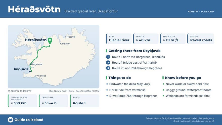
- Glacial river of central Skagafjörður, about 40 km long, formed where Austari- and Vestari-Jökulsá meet below Tunguháls.
- Splits in Blönduhlíð into two arms that reach the sea on either side of Hegranes; basin 3,650 km², mean flow about 111 m³/s.
- Seen from Route 1 (main bridge), Route 75 (bridges both arms via Hegranes) and Route 764 through Hegranes; no 4x4 needed.
- Varmahlíð is about 290 km (3.5-4 h) from Reykjavík; Sauðárkrókur 25 km further north.
- Delta wetlands (Austara-Eylendið) are on the Nature Conservation Register; best for birds late May to early July.
Why visit Héraðsvötn
Héraðsvötn is Iceland's classic lowland braided river, and it built the land it flows through.
Over thousands of years the river is thought to have filled in a former fjord with sand and silt; the lagoons by Hegranes and the lake Miklavatn in Borgarsveit are seen as the last remnants of that fjord.
The river still moves across its own delta, dropping coarse gravel upstream and fine silt downstream, which is why the channels look different every year.
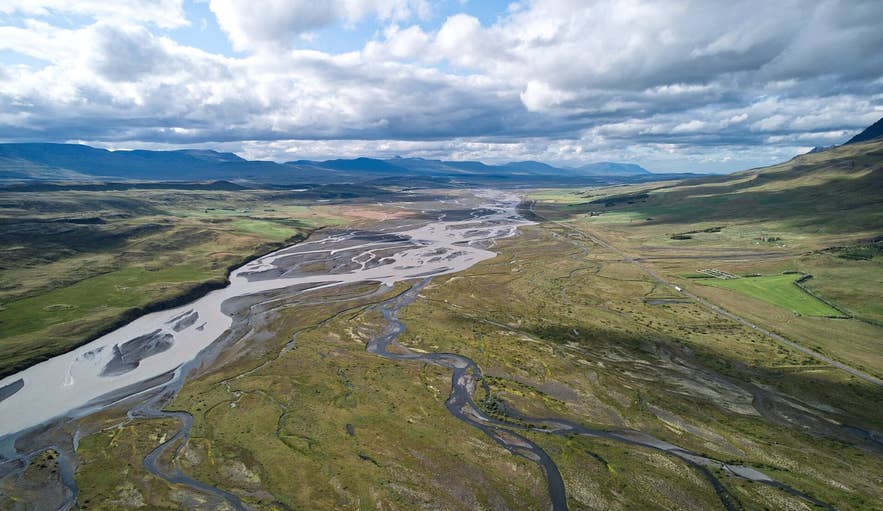
Braided channels of the Héraðsvötn. Photo: Eysteinn Guðni Guðnason, CC BY 4.0
The numbers are large for Iceland: a drainage basin of about 3,650 km² and an average flow of around 111 m³/s. Austari-Jökulsá alone averages near 40 m³/s at Skatastaðir and often approaches 100 m³/s in summer melt; Vestari-Jökulsá carries about half that. Measured from the sources of Austari-Jökulsá at Hofsjökull, the whole river system is about 130 km long.
Norðurá, Húseyjarkvísl and many smaller rivers off Tröllaskagi join along the way. In the middle of Blönduhlíð the river divides into Vestari- and Austari-Héraðsvötn, which carry similar volumes to their mouths, Vesturós and Austurós, 12-15 km from the sea on either side of Hegranes.
The flood-fed hay meadows of Vallhólmur and Eylendið were so rich that several farms in Staðarsveit and Blönduhlíð were rated as major estates (höfuðból) in the old land valuation, and the wetlands remain important.
Austara-Eylendið, the delta area south-east of Hegranes, is listed on the Icelandic Nature Conservation Register for its varied birdlife and vegetation. Hegranes itself is effectively a 15 km long island between the two arms, with rocky ridges, rich pastures, the medieval assembly site Hegranesþing at Garður and Viking-age excavations at Keldudalur.
The river has a darker reputation too: it is counted among the deadliest watercourses in the country, a legacy of the centuries when travellers had to ford or ferry across it before bridges were built.
How to get to Héraðsvötn
Héraðsvötn runs alongside the Ring Road (Route 1) through central Skagafjörður, so you see it simply by driving north.
The main bridge carries Route 1 over the river between Varmahlíð and Blönduhlíð; Route 75 (Sauðárkróksbraut) runs north from Varmahlíð along the west bank to Sauðárkrókur, then bridges the western arm, crosses Hegranes and bridges the eastern arm to meet Route 76 (Siglufjarðarvegur) on the east side of the fjord.
Route 764 (Hegranesvegur) runs through Hegranes between the two arms and is the best way to see the delta slowly.
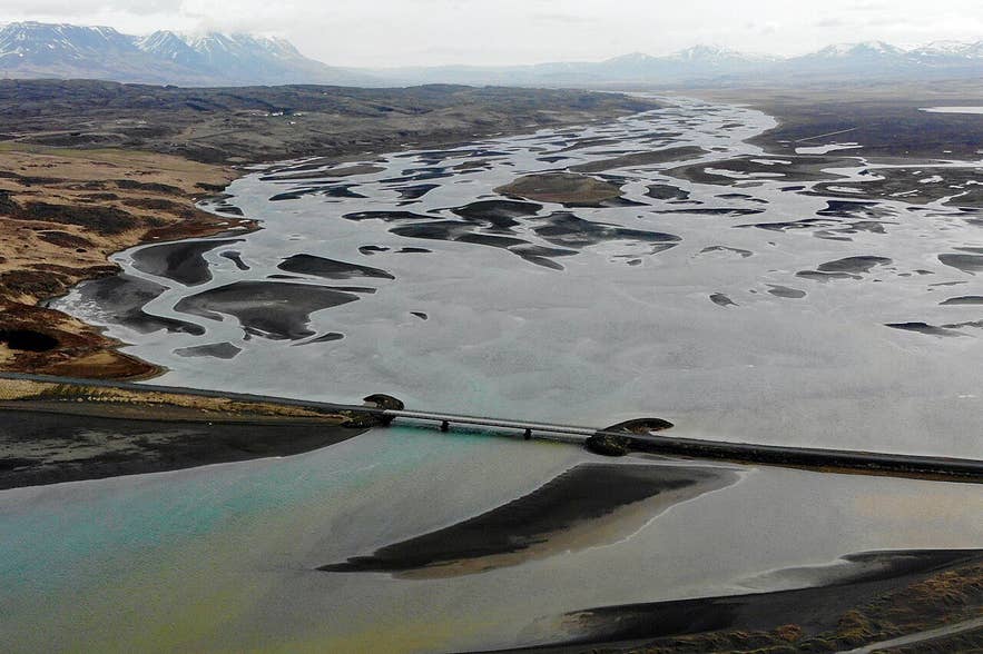
Bridge over the lower Héraðsvötn. Photo: Backe0112, CC BY-SA 4.0
Varmahlíð, the service village on Route 1, is about 290 km from Reykjavík, roughly 3.5 to 4 hours of driving on paved road. Sauðárkrókur, the main town of Skagafjörður, is 25 km north of Varmahlíð. None of these roads needs a 4x4.
Glaumbær museum and the Varmahlíð service area are the natural places to stop; on the smaller roads, pull off only where there is room to do so safely. The river's wetlands are farmland, so ask before walking far from the road.
Best time to visit
Late May to early July is the best period for birds, when waders, ducks and geese nest across Eylendið and the meadows are loud with activity.
July and August bring the highest flows, as glacier melt turns the river milky grey and the braids are at their widest; this is also horse-riding season in Skagafjörður, Iceland's horse country. September adds autumn colour and ripe crowberries on the heath.
In winter the delta can freeze and the light is low but fine for photography; roads stay open but check conditions.

Hegranes lighthouse between the Héraðsvötn arms. Photo: Bjorn.thorvaldsson.is, CC BY-SA 4.0
Safety and practical tips
- Never try to wade or swim in Héraðsvötn. It is a cold, fast glacial river with soft, shifting bottoms and a long history of drownings.
- Riding tours cross side channels with experienced guides and horses that know the water; follow the guide's line exactly.
- Wetland ground near the river is soft and boggy. Wear waterproof boots and stay on tracks.
- Bring binoculars for the birdlife, and insect repellent in July.
- Facilities are in Varmahlíð (fuel, shop, swimming pool, hotel) and Sauðárkrókur. There are no fees or opening hours for the river itself; Glaumbær museum has seasonal hours and an entry fee.
- Wind on the open valley floor can be strong; secure car doors and loose gear when stopping at viewpoints.
Nearby attractions
- Glaumbær Museum - turf farm and folk museum on the west bank, 3 km
- Varmahlíð - the Ring Road village and horse-riding base, 8 km
- Víðimýrarkirkja - 1834 turf church near Varmahlíð, 8 km
- Austari-Jökulsá - the main source river and one of Iceland's best-known whitewater rafting rivers, 8 km
- Ríp - the church site on Hegranes between the two river arms, 8 km
- Hólar in Hjaltadalur - the old bishopric, 20 km
- Hofsós - village with the fjord-edge swimming pool, 31 km
Tours that visit Héraðsvötn
- Small-Group 3-Hour Intermediate-Level Horse Riding Tour in North Iceland - a three-hour ride from Hestasport in Varmahlíð into the Héraðsvötn delta, passing Reykjafoss waterfall and crossing river channels, with time for birdwatching or crowberry picking depending on the season. For intermediate riders; runs May to September.