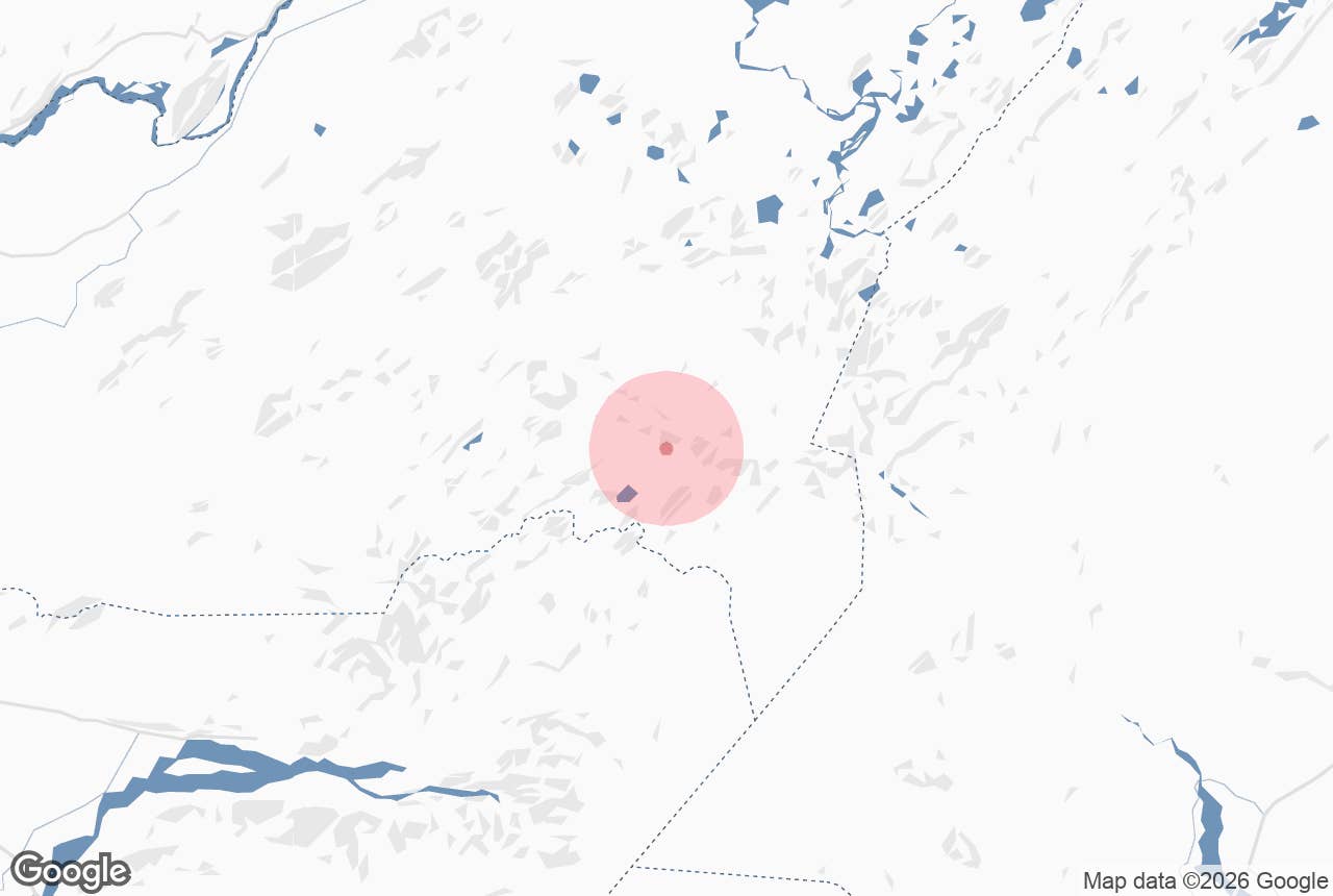
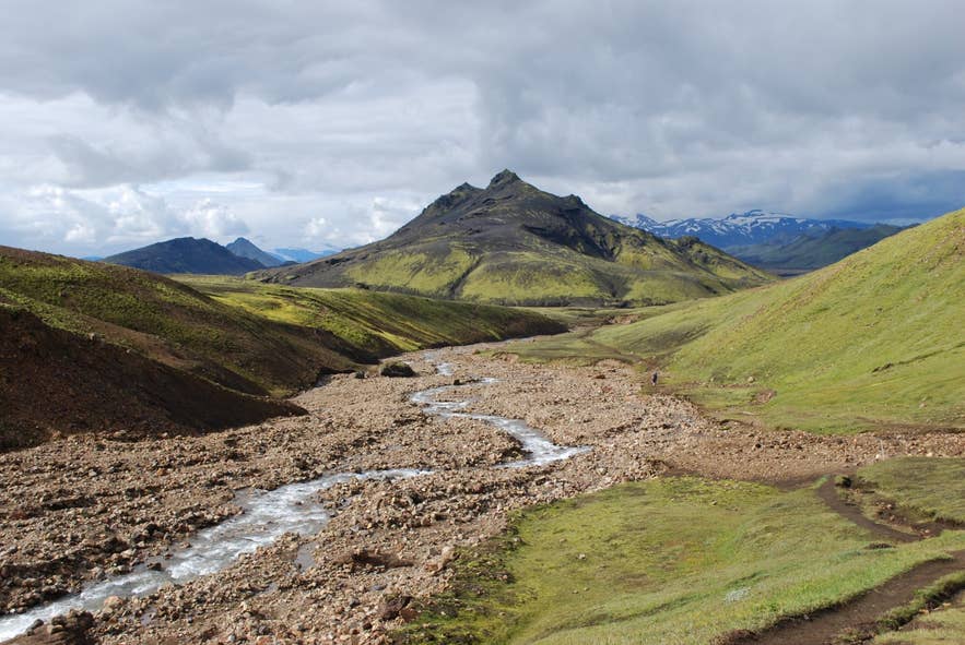
Grashagakvísl on the Laugavegur trail. Photo: Chmee2/Valtameri, CC BY 3.0
Grashagakvísl is a cold highland river on the Laugavegur trail in the southern highlands of Iceland, between the Hrafntinnusker plateau and the lake Álftavatn. It is the first unbridged river most Laugavegur hikers have to wade, and it sits at the bottom of the long descent from Jökultungur, in the Fjallabak area of Rangárþing ytra.
The name is made of Grashagi (a grassy pasture) and kvísl (a branch of a river), so it means roughly "the stream of the grassy pasture"; the Grashagi pasture, marked on the Landmælingar Íslands map, lies downstream to the west of the crossing.
Key Takeaways About Grashagakvísl
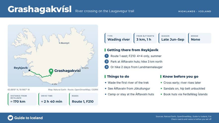
- First unbridged river most Laugavegur hikers wade, at the foot of the Jökultungur descent, about 3 km north of the Álftavatn huts
- Reached on foot only: two days from Landmannalaugar or about an hour from Álftavatn
- Usually a shallow but fast and very cold wade in July-August; early-summer snow bridges sometimes remain
- Cross early in the day, unbuckle your hip belt, use poles and wear sandals or river shoes
- No facilities or fees; book Hrafntinnusker and Álftavatn huts through Ferðafélag Íslands
Why visit Grashagakvísl
Grashagakvísl river is not a destination in itself but a moment every Laugavegur hiker remembers. It comes at the end of the second stage of the trail (Hrafntinnusker to Álftavatn, 12 km, 4-5 hours), after the trail leaves the snowfields and obsidian ridges of the Hrafntinnusker plateau and drops steeply through the ravines of Jökultungur.
From the top of the descent you look over the whole Álftavatn basin and south to the glaciers Tindfjallajökull, Eyjafjallajökull and Mýrdalsjökull. The river runs over a broad, grey gravel bed with mossy green slopes on either side and the pyramid shape of the mountain Stóra-Súla (Stórasúla) standing beyond it to the south-west.
For most people Grashagakvísl is the first real wade of the trek. Rangers at Ferðafélag Íslands describe it plainly: in early summer the river can sometimes be crossed on snow bridges, but it is usually crossed by wading on foot.
Hikers describe it as narrow but fast and very cold, and in a normal summer it is a shallow wade. Hikers have reported a cable strung across at the crossing point in some years.
Taking your boots off, finding the widest and shallowest stretch, and stepping into icy water is a small rite of passage, and good practice for the larger wades further south (Bláfjallakvísl on the way to Emstrur and Þröngá before Þórsmörk).
From the far bank, the trail joins a vehicle track across ash and cinder flats and reaches the Álftavatn huts and campsite on the lakeshore about an hour later.
How to get to Grashagakvísl
There is no road to Grashagakvísl. You reach it on foot on the Laugavegur trail:
- From Landmannalaugar (north): two days' hiking, roughly 12 km to the Hrafntinnusker hut and another 9-10 km over Jökultungur to the river. Landmannalaugar is roughly 180-190 km from Reykjavík via Route 26 and the F-roads F208 or F225 (4x4 only). Highland buses run from Reykjavík in the hiking season, late June to early September.
- From Álftavatn (south): about 3 km north of the Álftavatn huts, around an hour on foot. Álftavatn and Hvanngil can be reached by 4x4 on F-roads in summer, but most people arrive on foot.
- From Þórsmörk (south, full trail): two days north along the Laugavegur via Emstrur and Álftavatn.
There is no car park and no facilities at the river. The nearest huts, with wardens, toilets and campsites, are Hrafntinnusker to the north and Álftavatn to the south.
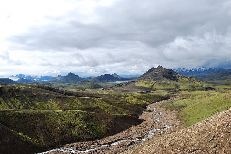
Grashagakvísl valley towards Álftavatn. Photo: Chmee2, CC BY 3.0
Best time to visit
The Laugavegur hiking season generally runs from late June to early September, depending on snow. In late June and early July the river may still be bridged by snow in places, but snow on the Jökultungur descent and the plateau makes the stage slower.
July and August are the most reliable months, with the highest water levels on warm afternoons when melt is strongest. Early morning crossings are usually lower. Outside the hut season the huts are closed and the trail is not maintained.
Safety and practical tips
- Crossing technique: unbuckle your hip belt, face upstream, use poles or link arms, and shuffle sideways. Never cross barefoot on sharp gravel; wear sandals or old trainers. Dry off and put dry socks on straight away; the water is a few degrees above freezing.
- Pick your spot: the widest, calmest stretch is the shallowest. Walk up or downstream rather than crossing where the trail happens to hit the bank. If there is a cable, use it.
- After rain or on hot days the river rises quickly. If the water is above your knees and fast, wait, or ask the Álftavatn wardens for advice.
- Weather: the Hrafntinnusker plateau above you is over 1,000 m and sees fog, sleet and strong wind in any summer month. Carry waterproofs, warm layers, a map and GPS; the trail is marked with stakes but visibility can drop to a few metres.
- No facilities, no fees: there is nothing at the river. Hut and campsite bookings are made through Ferðafélag Íslands, and Álftavatn and Hrafntinnusker often sell out well ahead in high season.
- Mobile signal is patchy on this stage. Register your plan at safetravel.is.
Nearby attractions
- Jökultungur - 1.4 km - the ridge the trail descends just before the river, with the best viewpoint of the stage.
- Álftavatn - 3.1 km - the lake and hut area where the second stage ends.
- Hvanngil Hut - 5.6 km - the quieter alternative hut south of Álftavatn.
- Hrafntinnusker Mountain Peak - 5.8 km - the obsidian mountain and plateau north of the river.
- Hrafntinnusker Hut - 5.9 km - the highest hut on the trail.
- Landmannalaugar - 13 km - the northern trailhead.
Tours that visit Grashagakvísl
- Guided 7-Day Laugavegur Trail Tour with Solheimajokull Glacier Hike from Reykjavik - wades Grashagakvísl on the Hrafntinnusker to Álftavatn stage.
- Exciting 5-Day Laugavegur Trekking with South Coast Tour and Glacier Hiking from Reykjavik - crosses the shallow river of Grashagakvísl on the way down to Álftavatn.