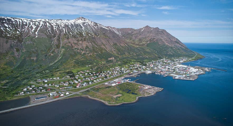
Siglufjörður and the mouth of Hólsdalur. Photo: Steinninn, CC BY 4.0
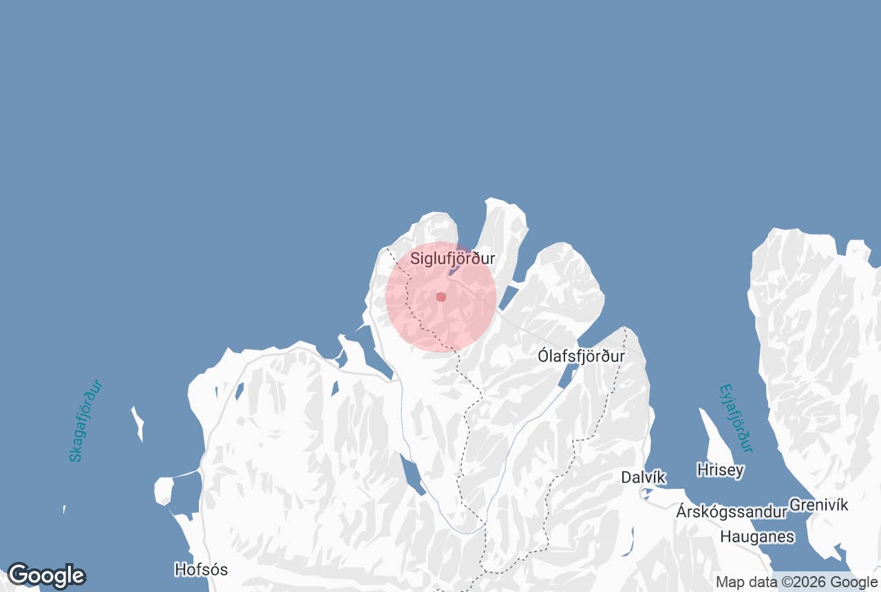
Hólsdalur (the "valley of Hóll", after the farm that once stood there) is the green valley that runs south from the head of Siglufjörður, one of Iceland's northernmost towns, on the Tröllaskagi peninsula in North Iceland.
The Fjarðará river flows down the valley floor to the fjord, and the side valley Skarðsdalur, with the town's ski area and planted forest, opens off it to the west.
For visitors it is Siglufjörður's back garden: a flat-bottomed, glacially carved valley with a golf course, walking and cycling tracks, cross-country ski trails in winter and, up Skarðsdalur, the old route over the Siglufjarðarskarð pass.
Key Takeaways About Hólsdalur
- U-shaped glacial valley running south from the head of Siglufjörður; Skarðsdalur with the ski area and forest opens off it to the west
- Named after Hóll, the last farm here, abandoned in 1927; its land is now the nine-hole Hólsvöllur golf course
- Skarðsdalur forest planted since 1951, with picnic areas, paths and the small Leyningsfoss waterfall
- Flat 2-3 km walk or ride from the town centre; gravel valley road, no 4x4 needed
- Visited, conditions allowing, by the three-hour Siglufjörður electric mountain bike tour
Why visit Hólsdalur
Siglufjörður is known for its harbour and herring history, but the valley behind the town shows a different side of the place. Hólsdalur is a textbook U-shaped glacial valley with very little lowland except the flat floor, hemmed in by the steep mountains of Tröllaskagi, and in summer it is unusually green for a town at 66° north.
Hóll, the farm that gave the valley its name, was the last farm in the valley to be abandoned, in 1927, though the town ran a dairy farm there until 1966. Today its land holds the nine-hole Hólsvöllur golf course, run by the Siglufjörður golf club, and the town's football pitches.
To the west, in Skarðsdalur, the Siglufjörður forestry society has been planting trees since 1951 (the society itself dates from 1940).
The result is one of the northernmost planted forests in Iceland, with Sitka spruce and other conifers, picnic areas, marked forest paths and the small waterfall Leyningsfoss (5 to 7 m high, also called Kotafoss) on the Leyningsá stream.
The Skarðsdalur ski area is the main ski area of Fjallabyggð; an older alpine ski area operated from 1975 to 1988 on the slopes of Hólshyrna, the peak on the east side of Hólsdalur, until avalanches damaged its lifts.
Hólsdalur is also where the local electric mountain bike tour heads when conditions allow, following gravel tracks past the forest and out into the open valley, with the chance of seeing seabirds along the fjord shore on the way.
An old hiking and riding route leads up Skarðsdalur and over Siglufjarðarskarð, the mountain pass whose summer road (built 1946) was the only road into Siglufjörður until the Strákagöng tunnel opened in 1967.
How to get to Hólsdalur
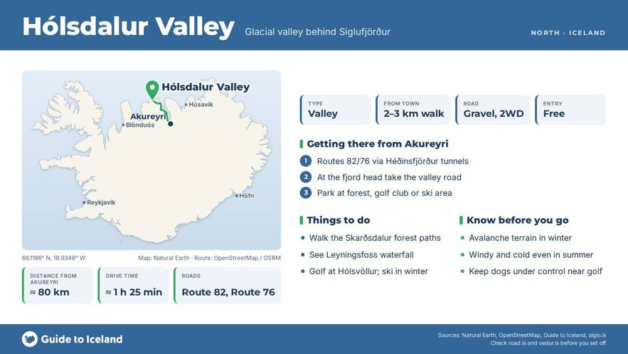
Siglufjörður is about 78 km (around 1 hour 20 minutes) from Akureyri by Route 82 and Route 76 through the Héðinsfjörður tunnels, and roughly 385 km (about 5.5 hours) from Reykjavík via the Ring Road (Route 1) and Route 76 along the Tröllaskagi coast.
The tunnels are open year-round; the old Route 82 over the Lágheiði pass is a summer-only road.
Hólsdalur begins at the southern edge of town, where Route 76 swings round the head of the fjord past the airstrip. A gravel road leaves the main road at the fjord head and runs south up the valley past the golf course (Hólsvöllur) and sports fields; a signed turning leads west into Skarðsdalur to the forestry area and ski lifts.
There is parking with a picnic area and toilet at the start of the Skógarstígur forest path, and parking at the golf club and the ski area. From the town centre it is about 2 to 3 km on foot or by bike to the golf course, on flat ground.
Best time to visit
June to September is best for walking, cycling and golf, when the valley floor is green, the forest paths are dry and the golf course is open (the midnight sun means you can play late into the evening in June and July). September brings autumn colours to the forest.
From roughly December to April the valley is a winter sports area: Skarðsdalur has alpine skiing and Hólsdalur has a groomed cross-country ski trail. Spring (April and May) is the muddiest time, when snow is melting and tracks can be soft.
Safety and practical tips
- Avalanche risk. The mountains around Siglufjörður are avalanche terrain and the ski areas in Skarðsdalur and Hólsdalur are monitored by the Icelandic Met Office. In winter stay on the groomed trails and check vedur.is before heading out.
- Weather. Even in summer the valley can be windy and cold; bring a windproof layer. The Fjarðará is a small river but tracks can be wet after rain.
- Facilities. Toilets and picnic tables at the Skarðsdalur forest car park; clubhouse at the golf course in season; the ski area has lifts and services in winter. Shops, cafés, restaurants and the swimming pool are in town.
- Fees. The valley, forest and paths are free. Golf and skiing are paid activities.
- Respect the land. The forest and valley are managed recreation areas; keep to tracks and keep dogs under control around the golf course and nesting birds.
Nearby attractions
- Siglufjörður – the herring town itself, 3.8 km
- The Herring Era Museum – Iceland's largest maritime and industrial museum, 3.3 km
- Siglufjörður Town Center – harbour, cafés and galleries, 3.7 km
- Strákagöng – the 1967 tunnel that replaced the Siglufjarðarskarð pass road, 7.4 km
- Héðinsfjörður – the uninhabited fjord between Siglufjörður and Ólafsfjörður, 9.1 km
- Ólafsfjörður – the neighbouring town through the tunnels, 13.7 km
Tours that visit Hólsdalur
- Electric Mountain Bike Tour from Siglufjordur in North Iceland – a three-hour easy e-bike ride starting at Aðalgata 32 in the town centre, along the fjord, through the planted forest and, conditions allowing, up into Hólsdalur and to the Hvanneyrarskál hollow above town; groups of up to five, minimum age 15, July to September.