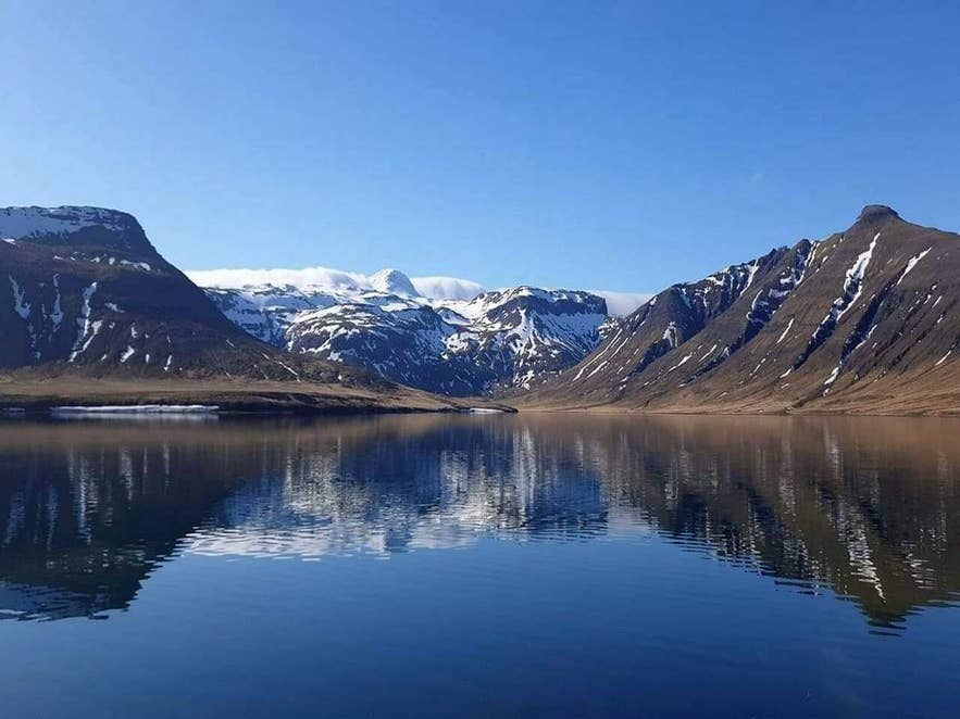
Hraunsfjörður with snowy peaks reflected. Photo: ArniGael, CC BY-SA 4.0
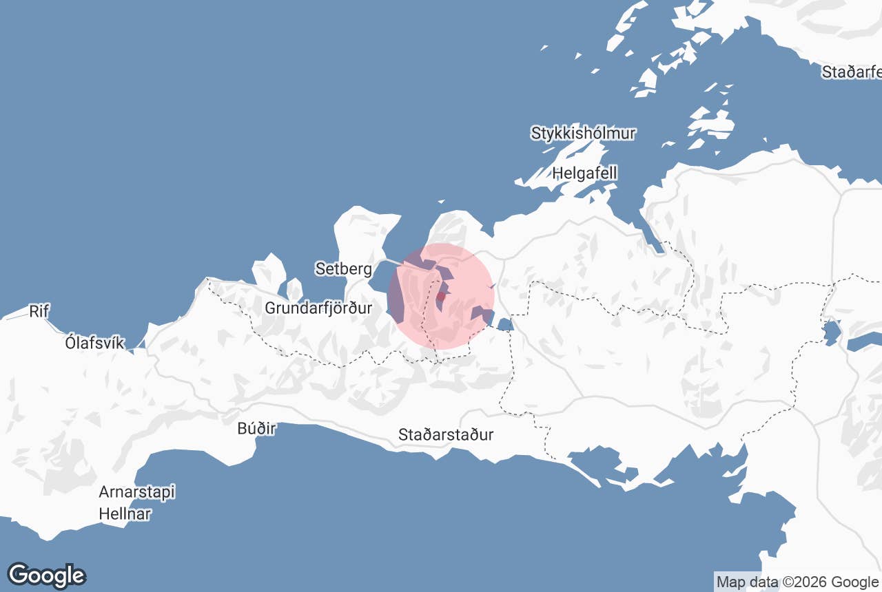
Hraunsfjörður fjord (the name means "lava fjord") is a narrow fjord on the north coast of the Snæfellsnes peninsula, West Iceland, between Stykkishólmur and Grundarfjörður.
It is the innermost arm of Kolgrafafjörður (also called Urthvalafjörður), a branching bay off Breiðafjörður: the outer part of the arm is known as Seljafjörður, and the inner fjord, Hraunsfjörður proper, runs south behind the narrows of Mjósund to its head at Árnabotn. The inner fjord is about 3 km long and covers roughly 1.8 km².
It takes its name from Berserkjahraun, the lava field that flowed into it and almost closed it off.
Key Takeaways About Hraunsfjörður
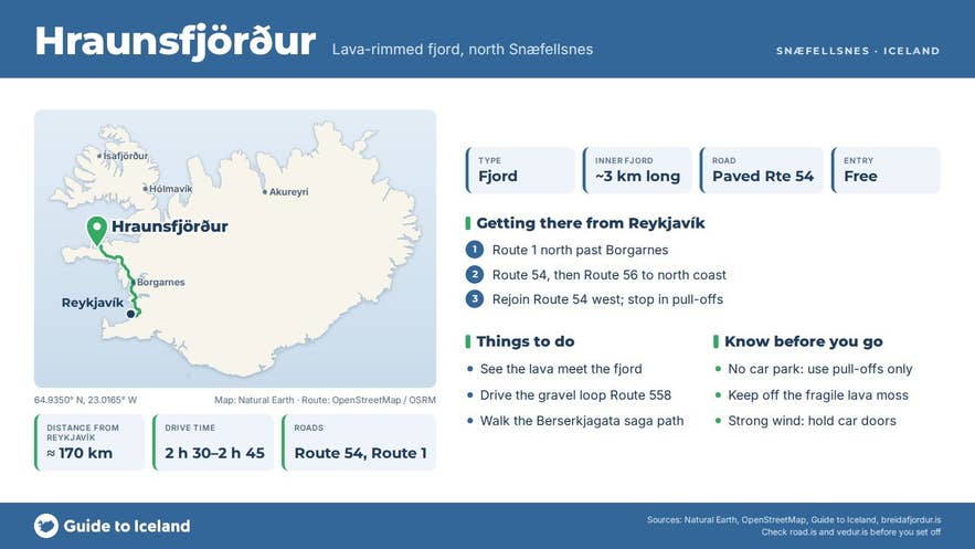
- Inner arm of Kolgrafafjörður bay on northern Snæfellsnes, about 3 km long, hemmed in by the Berserkjahraun lava field
- Site of Iceland's first fjord bridge (Mjósund, 1961); a 1986–89 causeway turned the inner fjord into a brackish lagoon
- Route 54 (paved, normally open all year) runs along the shore and crosses the outer fjord on a 1993 causeway and bridge
- About 170 km / 2 h 30 min from Reykjavík; Grundarfjörður about 16 km, Stykkishólmur about 28 km by road
- No facilities or fee; stop only in pull-offs and keep off the fragile lava moss
Why visit Hraunsfjörður
Hraunsfjörður fjord is where lava and sea meet most visibly on northern Snæfellsnes.
About 4,000 years ago the Berserkjahraun lava poured from a row of four scoria craters between the Kerlingarskarð pass and the hill Seljafell, part of the Ljósufjöll volcanic system, and ran down both sides of the mountain Bjarnarhafnarfjall to the sea, into Hraunsfjörður and the shore at Bjarnarhöfn farm.
The dark, jagged a'a lava reshaped the shoreline and left only a narrow channel, Mjósund ("the narrow sound"), connecting the inner fjord to the sea.
The lava field is also the setting of a saga: in Eyrbyggja saga two Swedish berserkers were made to clear a path through the lava and were killed when the work was done. Their path, Berserkjagata, can still be followed through the lava, and a grave mound beside it, Berserkjadys, is said to be theirs.
The fjord has a modern story too. In 1961 a bridge was built across Mjósund, the first bridge across a fjord in Iceland. Between 1986 and 1989 a causeway with a small outlet (about 1 to 1.5 m wide) was added just inside the bridge, cutting the inner fjord off from the tide.
In 1993 the main road was moved onto a new causeway and a 36 m bridge across Seljafjörður, the outer part of the fjord, which is the crossing Route 54 uses today.
Since 1987 the water inside has behaved like a brackish lagoon, with salinity swinging between almost fresh and fully marine depending on rain and leakage, and about 1.5 km² of tidal mudflats that birds used to feed on were lost.
In 2024 the Breiðafjörður Committee published a proposal to remove the causeway and restore the natural tide, so the fjord may look different again in future.
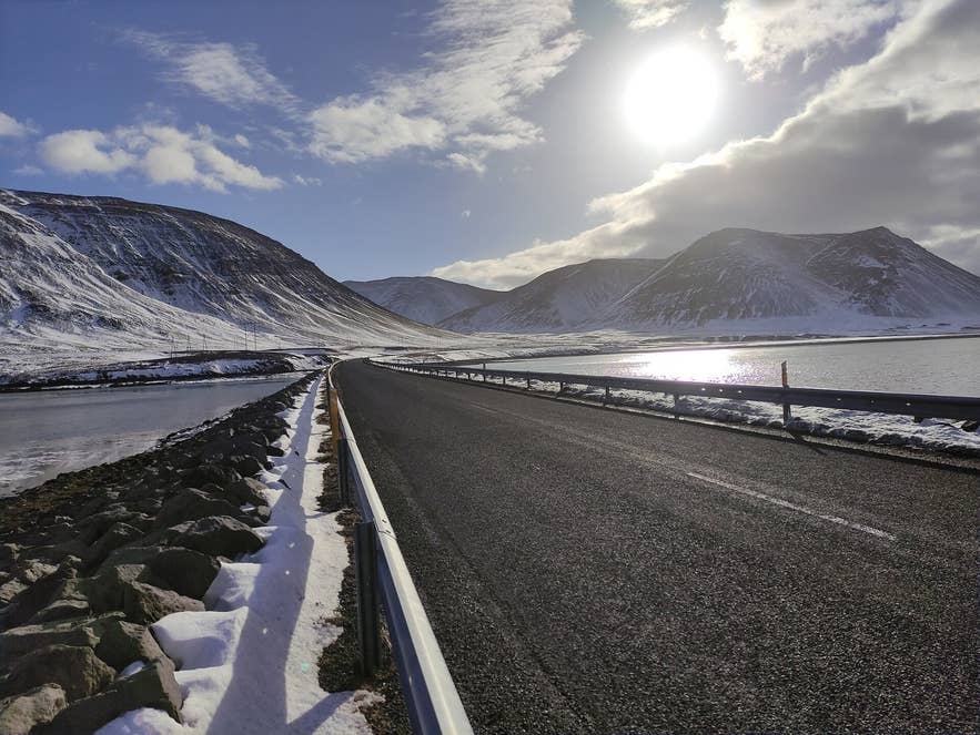
Route 54 causeway across Seljafjörður. Photo: ArniGael, CC BY-SA 4.0
What you see from the road is a sheet of calm water framed by steep mountains, with Bjarnarhafnarfjall rising to the north, the dark lava at the water's edge and Árnabotn at the head of the fjord.
The whole fjord lies within the Breiðafjörður protected area (established by law in 1995). Above it, in the hills to the south-east, are two fishing lakes, Hraunsfjarðarvatn and Baulárvallavatn.
How to get to Hraunsfjörður
Hraunsfjörður fjord is about 170 km from Reykjavík, around 2 hours 30 minutes to 2 hours 45 minutes of driving. Take the Ring Road (Route 1) north past Borgarnes, then Route 54 (Snæfellsnesvegur) onto the peninsula. The quickest way is to turn onto Route 56 (Vatnaleið) across the peninsula, then rejoin Route 54 heading west toward Grundarfjörður.
Route 54 runs along the shore and crosses the outer fjord, Seljafjörður, on the 1993 causeway and bridge; the old road to the 1961 Mjósund bridge branches off beside it. Alternatively, follow Route 54 the whole way around the north coast via Stykkishólmur.
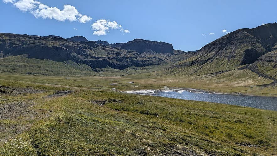
Árnabotn at the head of Hraunsfjörður. Photo: Steinninn, CC BY 4.0
Grundarfjörður, the nearest town, is about 16 km to the west by road; Stykkishólmur is about 28 km to the north-east. There is no formal car park or marked viewpoint for the fjord.
Drivers use the informal pull-offs on Route 54 along the shore, and the gravel loop Route 558 (Berserkjahraunsvegur) through Berserkjahraun offers views back over the lava and the fjord. Route 54 is paved and normally open all year; Route 558 is gravel and can be snow-covered in winter. No 4x4 is needed for Route 54.
Best time to visit
Summer gives long light and the best chance of calm water for reflections of Bjarnarhafnarfjall. Autumn turns the moss and grasses in the lava red and gold. In winter the road is normally open, the mountains are snow-covered and the fjord is a good dark-sky stop for the northern lights between Stykkishólmur and Grundarfjörður.
The neighbouring Kolgrafafjörður has at times drawn large herring shoals in winter (mass herring deaths there in December 2012 and February 2013 made national news), and seabirds follow the fish, so a winter drive along this coast can be rewarding.
Safety and practical tips
- Stop only in proper pull-offs; Route 54 is a through road with traffic in both directions, and the causeway has no shoulder.
- If you walk down to the shore, stay on rock and gravel. The moss on the lava is fragile and takes decades to recover.
- The lava is sharp and uneven. Wear sturdy shoes and watch your footing, especially in rain or frost.
- There are no toilets, shops or fees here. The nearest services are in Grundarfjörður and Stykkishólmur; the Bjarnarhöfn Shark Museum nearby has a bistro from June to August.
- Wind can be fierce along this coast. Hold car doors firmly when getting out.
Nearby attractions
- Kolgrafafjörður – about 5.4 km away
- Bjarnarhöfn (Shark Museum) – about 5.6 km away
- Berserkjahraun Lava Field – about 4.8 km away
- Bjarnarhafnarfjall – about 5.8 km away
- Grundarfjörður – about 11.5 km away
- Kirkjufell – about 13.7 km away
- Stykkishólmur – about 21.0 km away
- Helgafell Mountain – about 18.1 km away
Tours that visit Hraunsfjörður
- 10-Day Northern Lights Winter Self-Drive of Iceland's South Coast & Snaefellsnes Peninsula – the Snæfellsnes days of this self-drive itinerary follow Route 54 along Hraunsfjörður and Kolgrafafjörður.
- 2-in-1 Multi-Day Tour Discount Bundle | 3-Day South Coast & 2-Day Snaefellsnes Peninsula – the two-day Snæfellsnes part of this bundle passes Hraunsfjörður and Kolgrafafjörður on the north coast.
- 2-Day West Coast & Snaefellsnes Peninsula with Lava Caving & Northern Lights Tour – this two-day minibus tour drives through Hraunsfjörður on its way along the north coast of Snæfellsnes.