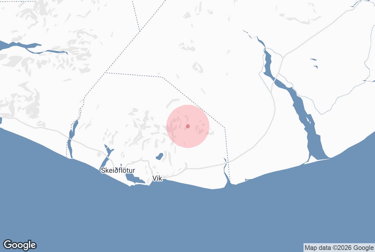
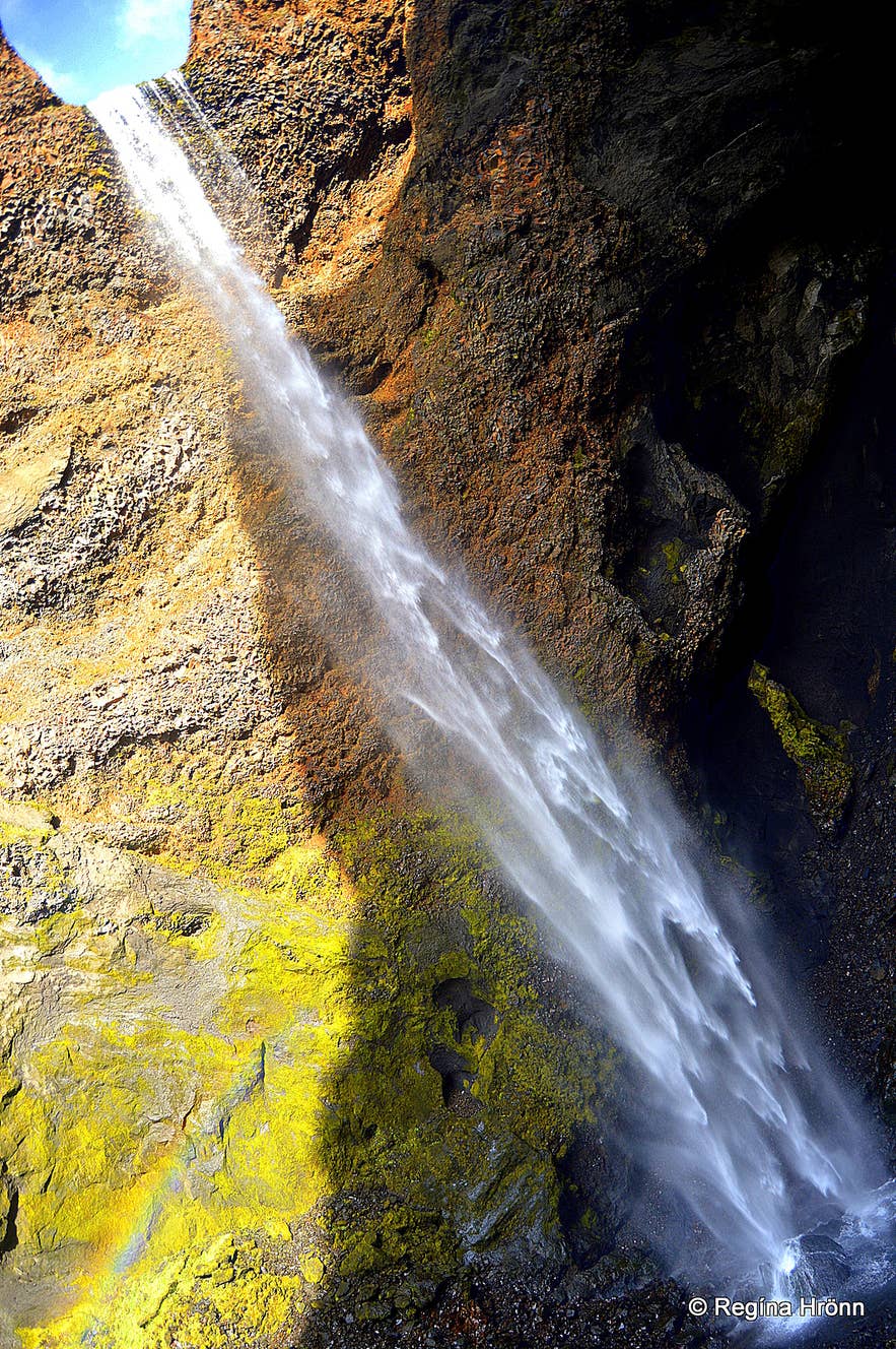
Remundargilsfoss. Photo: Regína Hrönn Ragnarsdóttir
Remundargil is a deep, narrow canyon on the heath north-east of Vík í Mýrdal in South Iceland, with a tall, slender waterfall called Remundargilsfoss at its head. It lies about 2 km east of the better-known Þakgil canyon and campsite, inside the Katla UNESCO Global Geopark.
A path of about an hour there and back takes you up the canyon floor, past moss-covered rock towers, to a ledge facing the waterfall.
Key Takeaways About Remundargil
- Narrow, moss-covered canyon ending at the waterfall Remundargilsfoss, about 2 km east of Þakgil
- About an hour's walk there and back from the gravel parking area at the canyon mouth, with some rock scrambling near the end
- Reached by Route 214, a gravel road (not an F-road) that leaves the Ring Road 5 km east of Vík; about 208 km from Reykjavík
- Part of the glacial flood from Katla's 1918 eruption ran through the canyon
- Best from June to September, when the Þakgil campsite is open
Why visit Remundargil
Remundargil is a deep canyon with tall cliff walls that close in as you walk upstream. At its head, the waterfall Remundargilsfoss pours through a notch in the rock into the back of the gorge. It's tall but narrow, a slender ribbon of water rather than a powerful fall, and on sunny days the spray can throw a small rainbow.
The walls are full of strange rock shapes: towers, pinnacles, small caves and overhangs, with bright green moss on every ledge that can hold it. The Icelandic hiking site Gönguleiðir calls it a place where you can easily linger for a long time, and the walk to the waterfall takes only about an hour there and back.
Remundargil is the next canyon east of Þakgil, the sheltered green canyon 2 km away where a small campsite runs in summer. It's easy to combine the two in one trip up from Vík. Both lie inside the Katla UNESCO Global Geopark, between Mýrdalsjökull glacier and the black sands of Mýrdalssandur.
History and the name
The quiet canyon has a violent past. When Katla volcano erupted under Mýrdalsjökull in 1918, part of the huge glacial flood that followed ran through Remundargil.
Nobody knows for certain where the name comes from. One suggestion links it to Rémundur, the hero of the 14th-century Rémundar saga keisarasonar, and some locals call the canyon Reðmundargil instead. Guide to Iceland local Regína Hrönn Ragnarsdóttir tells the story in her blog about Þakgil and Remundargil.
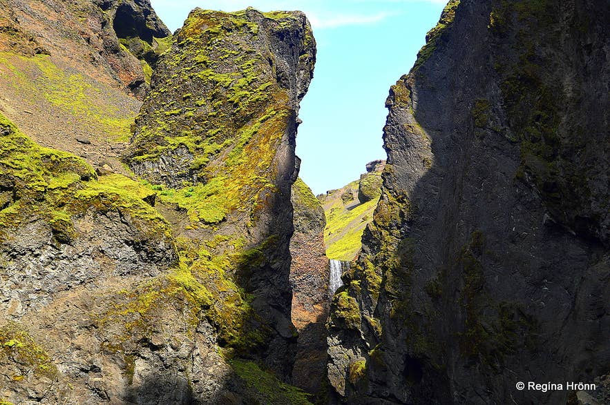
The walk into Remundargil. Photo: Regína Hrönn Ragnarsdóttir
How to get to Remundargil
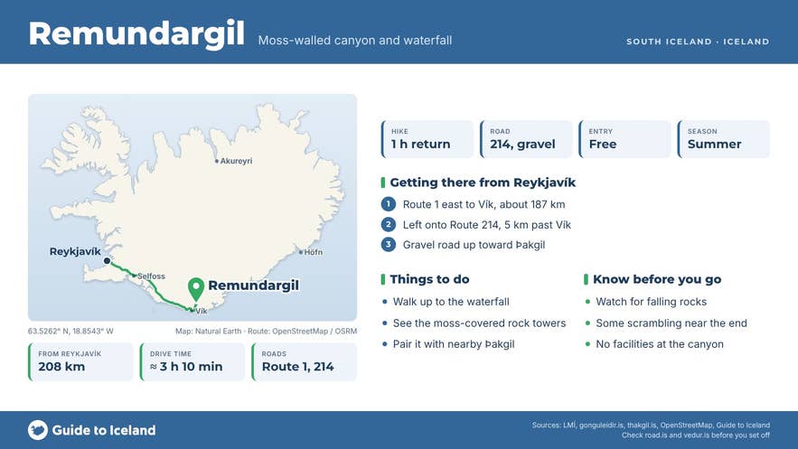
Remundargil is about 208 km from Reykjavík, roughly 3 hours 10 minutes' drive. Follow the Ring Road (Route 1) east to Vík, about 187 km, then continue 5 km east of the village and turn left onto Route 214 (Kerlingardalsvegur) at Höfðabrekka. The nearest town is Vík, about 21 km by road from the parking area.
Route 214 climbs onto the heath along the line of the old Ring Road, which ran this way until 1955. It's gravel all the way but isn't an F-road, and the Þakgil campsite says it's passable for all cars in summer. The drive from the Ring Road to Þakgil is 14 to 15 km and takes about 30 minutes.
The side track to Remundargil leaves the Þakgil road at Hvolhöfði: driving back out of Þakgil, it's on your left. After a few minutes it reaches the canyon mouth. You can drive a short way into the canyon, but it's better to leave the car at the plain gravel parking area and walk. There's no public transport to the area.
There are two ways to reach the waterfall on foot:
- From the canyon mouth (about 1 hour return): a good path follows the canyon floor to the waterfall, about 30 minutes each way. Near the end you climb over some rocks, and the path finishes on a small rock ledge with a clear view of the fall.
- From the Þakgil campsite: follow the purple-topped stakes out of Þakgil to where the road bends right, cross the ridge opposite Miðfellshellir cave and walk east down to Remundargil, then up the canyon. There's about 250 m of ascent, most of it on one hill. Return the same way, or arrange a pick-up at the canyon mouth to save a few kilometres.
Best time to visit
Come between June and September. The Þakgil campsite opens on 1 June, and its website gives the season as running to 30 September, extendable by arrangement. Regína's blog says the campsite closes on 31 August, so check with the campsite before you plan a late-season trip.
July and August bring the longest days and the greenest moss. In winter, check road.is before trying Route 214; the guided super jeep tour from Vík runs from May to October.
Safety and practical tips
- Watch for falling rocks, especially near the waterfall, and don't climb the canyon walls.
- Wear boots with good grip. The last stretch means scrambling over rocks, and the rocks by the fall get wet from the spray.
- There are no facilities at Remundargil. Toilets and showers are at the Þakgil campsite in season.
- Weather on the heath can be harsher than in Vík. Check vedur.is and leave a travel plan at safetravel.is.
- Stay on the path and off the moss, which takes many years to grow back.
- The canyon lies below Katla volcano. Follow any Civil Protection (almannavarnir.is) instructions if an alert is issued.
Nearby attractions
- Thakgil Canyon, about 2.9 km: the campsite canyon and trailhead for the area's marked walks.
- Höfðabrekkuheiði, about 3.2 km: the heath that Route 214 crosses, with views over the sands.
- Hafursey, about 3.9 km: a lone mountain standing on Mýrdalssandur.
- Kötlujökull Glacier, about 7.3 km: an outlet glacier of Mýrdalsjökull.
- Hjörleifshöfði, about 13 km: the headland on the sands with the Yoda Cave.
- Vík, about 14 km in a straight line (21 km by road): the nearest village, with fuel, food and places to stay.
- Reynisfjara Black Sand Beach, about 16.5 km: the famous basalt-column beach west of Vík.
For more gorges like this one, see our guide to the top canyons in Iceland.
Tours that visit Remundargil
This private super jeep tour from Vík stops at a viewpoint and a cave, then walks into Remundargil to the waterfall before continuing to Þakgil. It lasts about four hours.