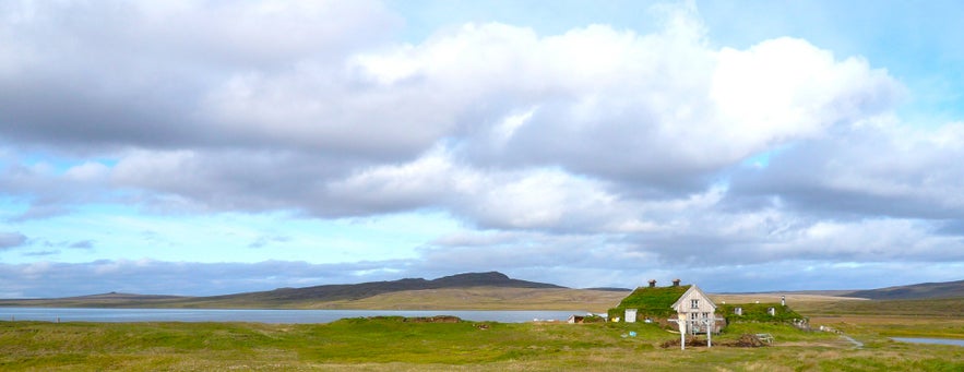
The Saenautavatn lake is one of the largest in the Jokuldalsheidi area in East Iceland. The ruins of the Rangalon farmstead are at its north end, abandoned in 1924. At the lake’s south end, the Saenautasel farmstead is now a fascinating museum that is open during summer.
Fishing and hiking enthusiasts will enjoy visiting the lake. A hiking trail runs parallel to Saenautavatn, and the lake is abundant in Arctic char.
Why You Can Trust Our Content
Guide to Iceland is the most trusted travel platform in Iceland, helping millions of visitors each year. All our content is written and reviewed by local experts who are deeply familiar with Iceland. You can count on us for accurate, up-to-date, and trustworthy travel advice.
Travelers who rent a four-wheel drive can visit Saenautavatn lake independently. It’s a 15-minute detour from Route 1, so those traveling the Ring Road can plan a stop to enjoy the lake’s tranquil beauty and visit the charming Saenautasel museum.
Travelers seeking a comprehensive exploration of Iceland can book this epic 14-day self-drive tour of the Ring Road. With a shorter time frame, this 6-day summer self-drive tour also travels around Route 1 with a convenient rental car. Both offer the freedom and flexibility to include a visit to Saenautavatn lake in your itinerary.
Photo from Flickr, Creative Commons, by Ellen van den Berg. No edits made
Saenautavatn Lake Location and How to Get There
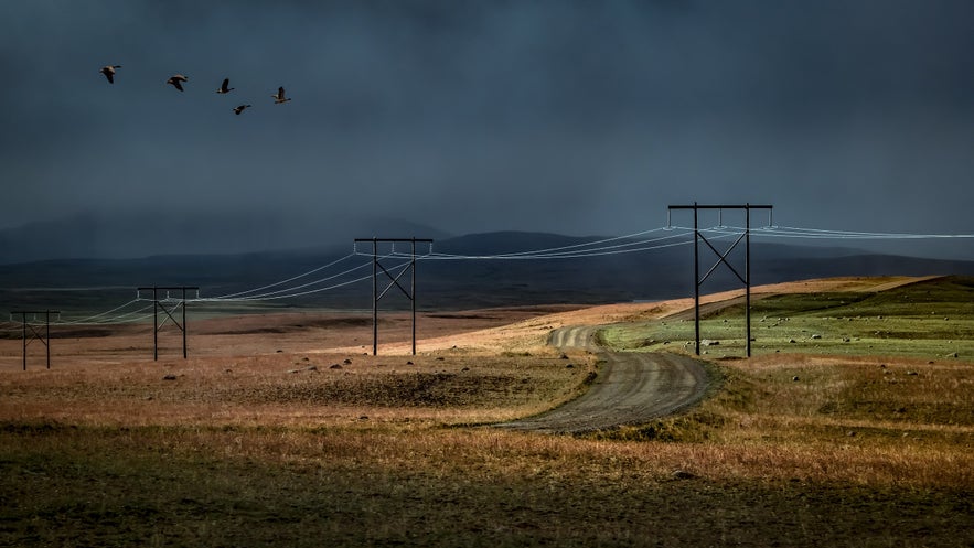
 Photo from Wikimedia, Creative Commons, by Bernd Thaller. No edits made. The Modrudalsleid road near Saenautavatn lake.
Saenautavatn lake is an off-the-beaten-track attraction in East Iceland. However, it’s only about 8 miles (13 kilometers) from the Ring Road and 45 miles (74 kilometers) west of Egilsstadir town.
From Route 1, turn onto Road 901, known as Modrudalsleid, then turn left onto F-907. Note that F-roads are unpaved and should only be driven with a four-wheel drive vehicle. You can access Saenautavatn from the Saenautasel museum at the lake’s south end.
Saenautavatn Lake Features and Information
Saenautavatn lake is 1722 feet (525 meters) above sea level. It’s one of several lakes in the Jokuldalsheidi area, part of a highland plateau with barren hills and marshlands.
Saenautavatn covers an area of 0.8 square miles (2.3 square kilometers) and has a canyon in the middle. At its deepest, the lake is 75 feet (23 meters). The Lonskvisl river, one of the Hofsa river’s smaller streams, originates at Saenautavatn lake.
Things to do at Saenautavatn Lake
Those seeking a remote destination far from the crowds will love visiting Saenautavatn lake. Whether you’re seeking a quiet spot for reflection, insights into the area’s history, or a fantastic place to fish or hike, there’s something for everyone.
Saenautasel History Museum
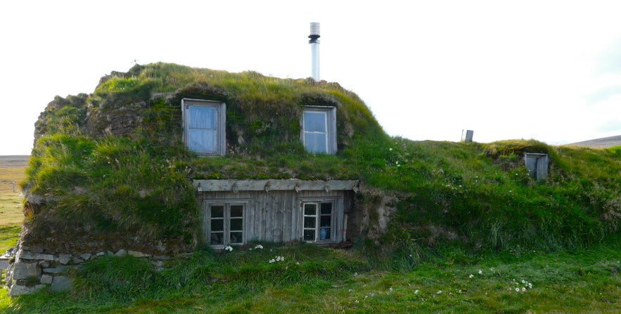
 Photo from Flickr, Creative Commons, by Ellen van den Berg. No edits made
The Saenautasel farm at the lake’s south end was inhabited from 1843 to 1942, with the exception of a five-year period during which ash from the 1875 Askja volcanic eruption forced inhabitants out.
Halldor Laxness, a Nobel prize-winning Icelandic author, stayed there in 1926 on his journey from East Iceland to Reykjavik. Saenautasel farm was a welcome haven for Laxness to shelter in during wild weather and may have inspired some of his work.
The farm was abandoned in 1942. In 1992 and 1993, it was rebuilt and converted into a museum. Visitors can take a guided tour through Saenautasel’s turf buildings, highlighting what life was like for previous generations of Icelanders.
Refreshments such as coffee, hot chocolate, and pancakes are available at the museum and are highly recommended.
Saenautafell - Saenautavatn Hiking Trail
 Photo from Flickr, Creative Commons, by Basheer Tome. No edits made
Saenautavatn lake has a 4.2-mile (6.9-kilometer) point-to-point hiking trail. This moderate-level track is ideal for hiking and running. It has a 935-foot (285-meter) elevation gain and takes an average of 2 hours and 15 minutes to complete (one-way).
The south end of the trail is close to the Saenautasel Museum. The trail goes over Saenautafell mountain, and its north end is at Road 901.
Fishing at Saenautavatn Lake
Saenautavatn offers excellent fishing opportunities during summer, with the early season (May and June) and low tide likely to provide the best catch. The lake is abundant in Arctic char, ranging from 1 to 6 pounds (0.4 to 2.7 kg).
Saenautavatn is shallow around the edges, with the drop-off point between shallow and deep areas offering an optimal fishing spot.
Know that you need a fishing permit to fish at Saenautavatn lake.
Attractions Near Saenautavatn Lake

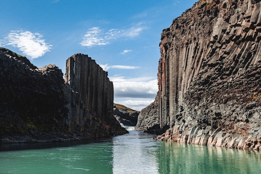
Picture from Pierre-Axel Cotteret. The Studlagil canyon is a 40-minute drive from Saenautavatn lake.
East Iceland is full of culture and natural beauty, so there is plenty to see and do near Saenautavatn lake.
An hour's drive away, you can stay in Egilsstadir. It's the region’s largest settlement and a welcome base for exploring the area. It lies on the shores of the picturesque Lagarfljot lake, which features the scenic Hallormsstadur forest and beautiful waterfalls like Litlanesfoss and Hengifoss.
Seydisfjordur, a vibrant town known for its pretty blue church and breathtaking fjord setting, is just 16.6 miles (26.7 kilometers) east of Egilsstadir. Therefore, it’s around 24.6 miles (39.6 kilometers) from Saenautavatn.
In Seydisfjordur, travelers can see natural treasures like the Fjardara lake, the Budareyrarfoss waterfall, and the Vestdalsfossar waterfalls. Don’t miss a visit to the Technical Museum of East Iceland, which highlights Iceland’s technological advancements and the area’s heritage.
The Studlagil canyon is a must-see attraction that is a 40-minute drive from Saenautavatn lake. It boasts dramatic basalt columns lining a blue-green river, creating an awe-inspiring landscape. Studlagil is on Jokuldalsvegur road, 44.3 miles (71.4 kilometers) from Egilsstadir.


