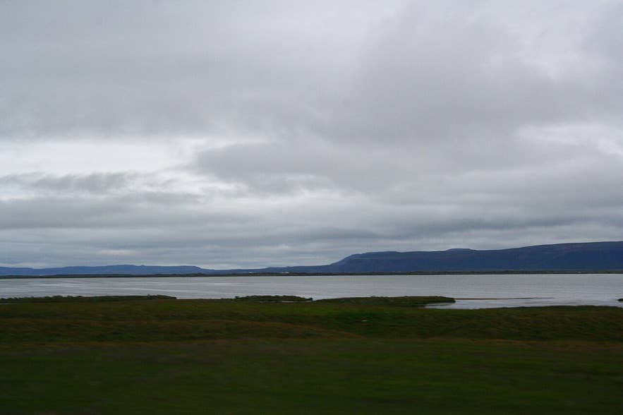
Skjálftavatn lake, Kelduhverfi. Photo: Ragnhild & Neil Crawford, CC BY-SA 2.0
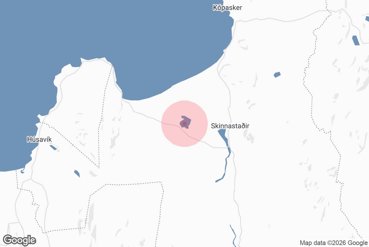
Skjálftavatn is a shallow lake of about 4 square kilometres in Kelduhverfi, the farming district at the head of Öxarfjörður in North-East Iceland, between Húsavík and Ásbyrgi.
Its name means "Quake Lake", and it is one of the youngest lakes in the country: it did not exist before the winter of 1975–1976, when earthquakes linked to the Krafla volcanic episode caused the land here to sink and groundwater flooded what had been a fenced area of sand and scrubby vegetation.
Today it is a quiet birding and fishing lake just off Route 85, and a clear example of how fast the ground moves on Iceland's plate boundary.
Key Takeaways About Skjálftavatn
- A shallow 4 km² lake that did not exist before the winter of 1975-76, when rifting earthquakes sank the ground in Kelduhverfi.
- Beside Route 85, about 50 km east of Húsavík and 12 km west of Ásbyrgi; paved road, no 4x4 needed.
- Arctic char and trout; its outlet river Litlaá is a noted sea-trout river. Fishing needs a permit (fly only, catch and release).
- Best for birds late May to July; no facilities at the lake, nearest at Gljúfrastofa in Ásbyrgi.
- Private farmland: keep to tracks and close gates.
Why visit Skjálftavatn
Most Icelandic lakes were carved by ice or dammed by lava thousands of years ago. Skjálftavatn was made by tectonics in living memory.
In December 1975 Krafla volcano, about 40 km to the south near Mývatn, began a nine-year sequence of rifting events known as the Krafla Fires, with nine eruptions and repeated episodes of uplift and subsidence before it ended in September 1984.
The rift zone runs north from Krafla straight through Kelduhverfi to the sea, and as magma moved along it the crust pulled apart.
In January 1976 an earthquake of magnitude 6.3 struck Kópasker, the village across the bay, damaging houses there; over the same winter part of the lowland in Kelduhverfi subsided, and a new lake formed in the sunken ground where there had been sandy, patchily vegetated land, most of it inside a soil-reclamation fence.
Life arrived quickly. The newly flooded soil and rotting vegetation made the water rich in nutrients, and trout and char ran up into the lake within a few years of its formation. The lake is fed by springs and drains through the Litlaá, a short spring-fed river that is a noted sea-trout and char fishery.
Many waterfowl nest around Skjálftavatn, which the North-East Iceland birding trail describes as a rich wetland, and whooper swans gather here to moult in summer. The Northeast Iceland Nature Research Centre (Náttúrustofa Norðausturlands) monitors waterbirds on the lake and runs an insect trap here each summer.
Skjálftavatn is also a good place to read the landscape. Fresh fissures and fault scarps from the 1970s cut across the flat sandy ground of Kelduhverfi, and a short distance to the east the Jökulsá á Fjöllum has carved Ásbyrgi and the Jökulsárgljúfur canyon. Together they show the two forces, rifting and glacial floods, that shaped this corner of Iceland.
How to get to Skjálftavatn
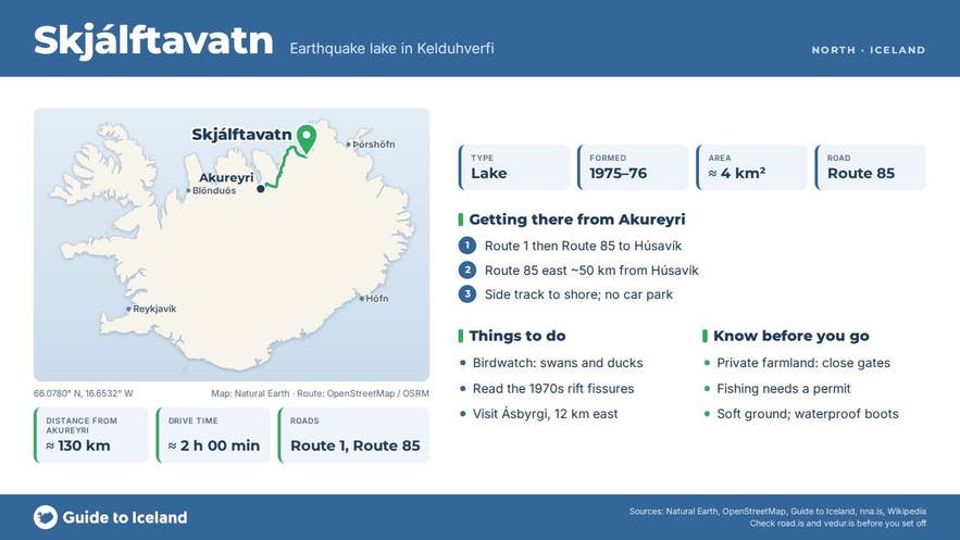
Skjálftavatn lies beside Route 85 (Norðausturvegur), the road that links Húsavík to Ásbyrgi and Kópasker. It is about 50 km east of Húsavík and 12 km west of the Ásbyrgi visitor centre, and roughly 510 km from Reykjavík by road (about 7.5 hours via Akureyri).
From Akureyri it is around 130 km via Route 1 and Route 85 through Húsavík; from Mývatn you can take Route 862 north past Dettifoss to Ásbyrgi and then turn west on Route 85, about 85 km.
Route 85 is paved and open all year, though it can close briefly in winter storms. The lake is visible from the road.
For a closer look, take the short side track from Route 85 towards a solitary house near a sheep fence, as described in the North-East Iceland birding trail, and walk the last stretch to the shore.
There is no formal car park; pull off the road onto firm ground and do not block farm gates. No 4x4 is needed.
Best time to visit
Late May to July is best for birds, when nesting is in full swing and the lake is busy with ducks.
The fishing season on Litlaá and the lake runs from 1 April to 10 October, and late summer and autumn are when sea trout run up from the sea. The long daylight of June and July suits a visit at any hour.
In winter the lake usually freezes, though Route 85 stays open most of the time.
Safety and practical tips
- The land around the lake is private farmland in Kelduhverfi. Keep to tracks, close gates behind you and give nesting birds a wide berth in spring and early summer.
- The ground is soft sand and wetland in places; stick to firm ground and wear waterproof footwear.
- Fishing in Skjálftavatn and Litlaá requires a permit sold through the river's agent; it is fly fishing only and all fish are released.
- There are no facilities at the lake. The nearest toilets, information and shop are at the Gljúfrastofa visitor centre in Ásbyrgi, about 12 km east by road.
- The area is exposed and wind off Öxarfjörður can be cold even in summer.
- There is no entrance fee and no opening hours.
- Kelduhverfi lies on an active rift zone; earthquakes are rare day to day but the terrain has open fissures. Watch your step away from paths.
Nearby attractions
- Vikingavatn – 9 km
- Asbyrgi – 9 km
- Gljufrastofa - Asbyrgi Visitor Centre – 9 km
- Litlaá – 11 km
- Hljóðaklettar – 17 km
- Tjornes Peninsula – 24 km
Tours that visit Skjálftavatn
- Private 4-Day North Iceland Tour of Akureyri, Myvatn, and the Diamond Circle from Reykjavik – on day 3 of this private tour, after Ásbyrgi, you learn how the volcanic events of the 1970s shaped nearby Skjálftavatn before driving west to Húsavík.