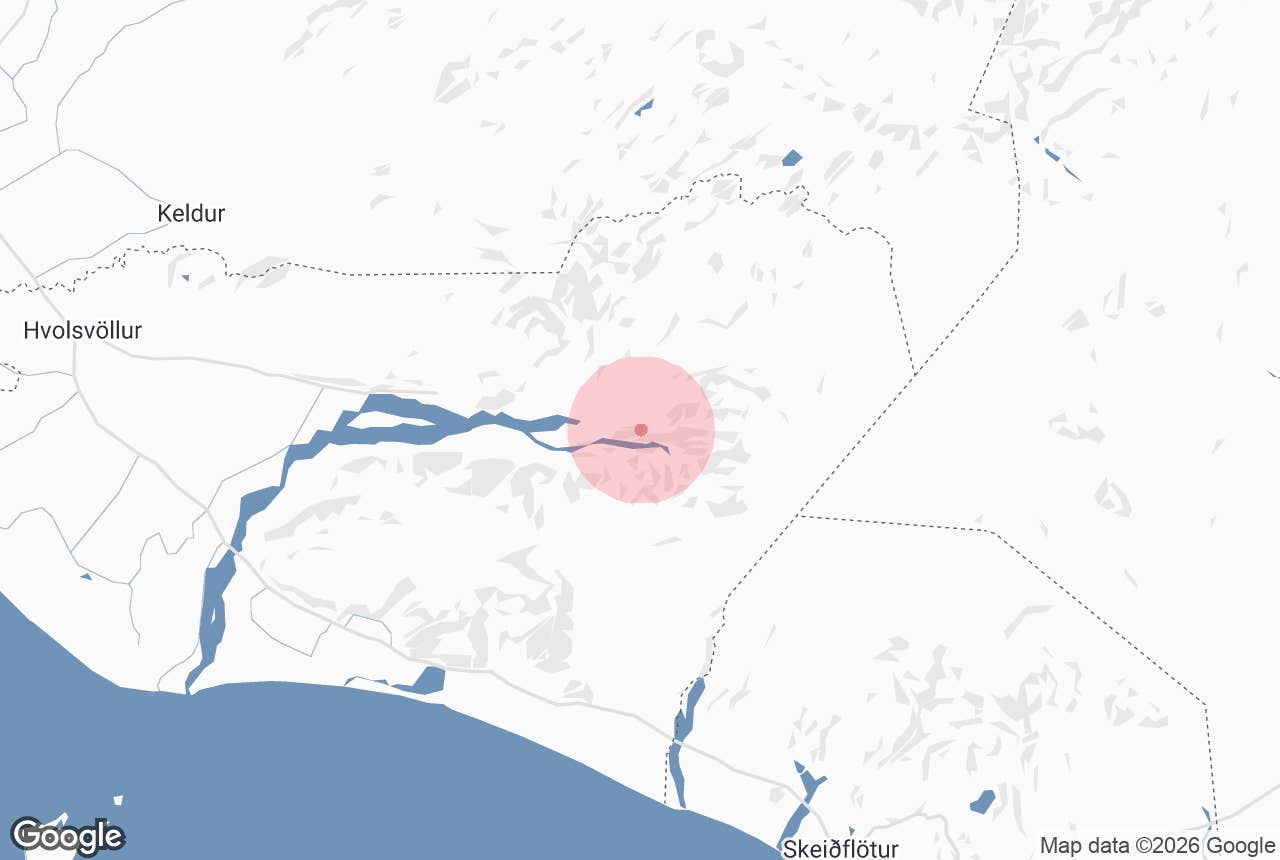
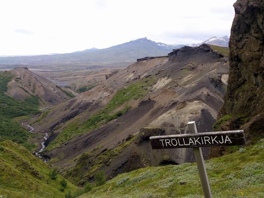
Tröllakirkja signpost above Þórsmörk. Photo: rheins, CC BY 3.0
The Tindfjallahringur trail ("the Tindfjöll circle") is the classic half-day loop hike in Þórsmörk, the birch-wooded valley between the glaciers Eyjafjallajökull, Mýrdalsjökull and Tindfjallajökull in South Iceland.
It circles Tindfjöll, the jagged little range of palagonite peaks on the north side of the Krossá river, climbing from the Langidalur hut through the Tindfjallagil ravine to open ground with views over the whole area before dropping back to the river.
It is the hike most people do on their first day in Þórsmörk, and for many it is the highlight.
Key Takeaways About Tindfjallahringur
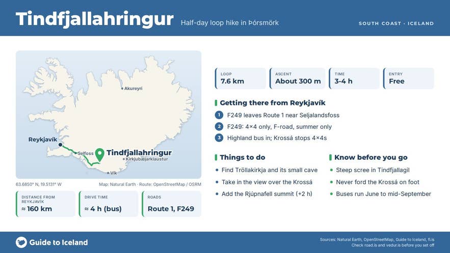
- Loop of 7.6 km, about 300 m ascent and 3-4 hours from Langidalur hut (Iceland Touring Association figures)
- Passes Tröllakirkja, a rock formation with a small cave, and ends with the steep Stangarháls descent
- Steep, loose scree traverse through Tindfjallagil - take care, and avoid it in bad weather
- Þórsmörk is reached by highland bus (June to mid-September, dates vary by operator) or guided tour; the Krossá stops ordinary 4x4s
- Optional extension to the summit of Rjúpnafell adds about 6 km and 2 hours
Why visit the Tindfjallahringur trail
The loop packs most of what Þórsmörk has into a few hours.
From Langidalur the marked trail climbs through dense birch and willow scrub into the Slyppugil ravine, then follows Tindfjallagil, the ravine that runs along the north side of Tindfjöll, on a firm path across steep scree slopes of grey and ochre tuff.
The Iceland Touring Association (Ferðafélag Íslands), which owns the Langidalur hut, warns that the path crosses steep, sliding scree here, and that the optional scramble onto the Tindfjöll summits is not for people with a fear of heights.
The walls above are carved into pinnacles and arches; the best known is Tröllakirkja, "the troll church", a tall rock formation with a small cave beneath it, signposted deep in the ravine.
Beyond Tindfjöll the ground opens out onto the Tindfjallaslétta plain and a junction offers the long side trip to the summit of Rjúpnafell.
The loop itself continues across the plain, with one of the finest views in the area: the braided Krossá and Markarfljót rivers far below, the three glaciers that frame the valley, Goðaland across the Krossá, and the pyramid of Rjúpnafell to the east.
The trail then drops down Stangarháls, a rounded ridge whose steep path has been rebuilt with steps and gravel, to the Krossá riverbed, and returns along the flats to Langidalur.
The whole area is a national forest managed by the Icelandic Forest Service, fenced off from grazing since 1924, and its birch woodland is among the closest to natural birch forest in Iceland. In late August the slopes turn red and gold and the blueberries are ripe.
How to get to the Tindfjallahringur trail
The loop starts and ends at the Langidalur hut (Skagfjörðsskáli), where the markers begin.
The Iceland Touring Association gives the circuit as 7.6 km with about 300 m of ascent and 3-4 hours of walking; other descriptions put it at 9.5-12 km and anywhere from 2.5 to 6 hours, depending on where you start and how long you linger.
From Volcano Huts in Húsadalur add about 2 km each way on the connecting trail; from Básar, cross the Krossá footbridge to Langidalur. Adding the Rjúpnafell summit makes the day about 6 km and 2 hours longer.
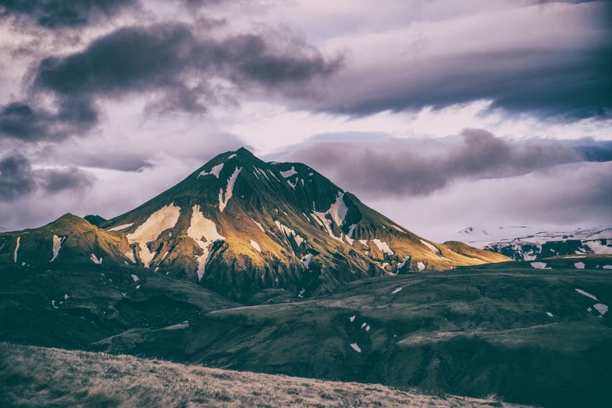
Rjúpnafell on the Tindfjallahringur loop. Photo: Jonatan Pie, CC0
Getting to Þórsmörk is the hard part. The access track F249 (Þórsmerkurvegur) leaves Route 1 near Seljalandsfoss and runs about 30 km up the Markarfljót valley with several unbridged glacial rivers, ending at the Krossá, which is too deep and shifting for ordinary 4x4s.
Leave your car and take one of the daily highland buses from Reykjavík (about 160 km and 4 hours; departures from BSÍ or the city centre depending on the operator), Selfoss, Hella or Hvolsvöllur (about 50 km); they run from June to mid-September, with exact dates varying by operator. Guided hiking tours include the transfer.
Best time to visit
Late June to early September, when the buses run, the huts are staffed and the snow has left the higher parts of the trail. July and August are the busiest and most reliable; late August has autumn colour.
Outside the bus season Þórsmörk is reachable only in modified 4x4s or on super-jeep tours, and the Tindfjallagil traverse can be icy and dangerous.
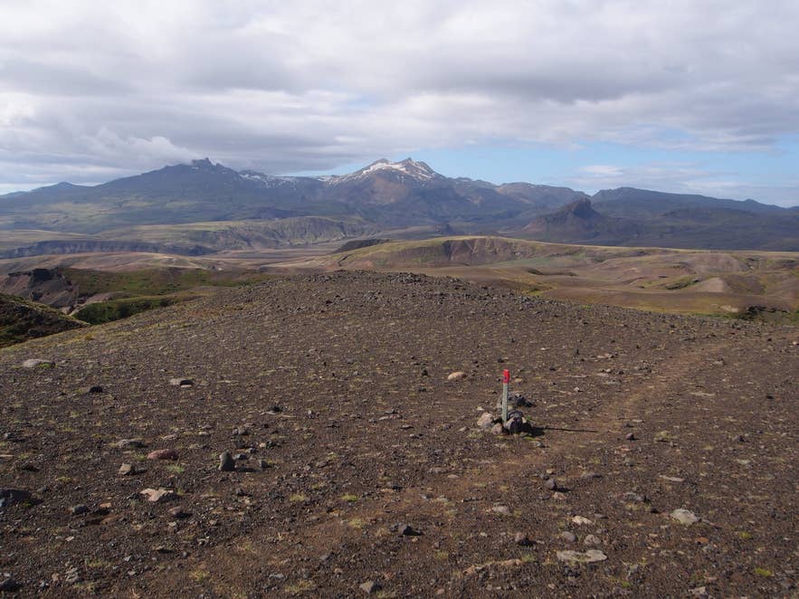
Trail east of Tindfjöll. Photo: rheins, CC BY 3.0
Safety and practical tips
- The traverse through Tindfjallagil crosses steep scree with long drops. Take care, and do not do it in high wind, fog or when the path is wet and slick; the optional scramble onto the Tindfjöll summits is not for people with a fear of heights.
- Follow the trail markers; side trails and sheep paths are common and the open ground above Tindfjöll is featureless in cloud. Carry a map (hiking maps of Þórsmörk are sold by the Iceland Touring Association) and a phone with GPS.
- Weather can turn from sun to sleet in an hour at any time of summer. Bring waterproofs, warm layers, a hat and gloves, and 1-2 litres of water; there is none on the ridge.
- Keep well away from the Krossá. It is cold, fast and changes channel daily; never try to ford it on foot.
- Facilities (toilets, drinking water, food) are only at the huts in Langidalur, Básar and Húsadalur. Hut beds should be booked in advance in summer.
- There is no fee to hike.
Nearby attractions
- Þórsmörk - 2 km, the valley the loop overlooks
- Básar, Þórsmörk - 2 km, huts on the south bank of the Krossá
- Rjúpnafell - 2 km, the optional summit extension
- Valahnúkur - 4 km, the short viewpoint hike above Langidalur
- Stakkholtsgjá canyon - 5 km, canyon with a waterfall at its head
- Fimmvörðuháls pass - 5 km, the pass to Skógar
Tours that visit the Tindfjallahringur trail
- Women-Focused 3-Day Thorsmork Hiking Tour with Meals and Mountain Huts - a three-day tour based at the Básar hut; day two is devoted to the Tindfjallahringur trail, about 12 km and 5-6 hours with a climb to roughly 500 m.
- All-Women Laugavegur Trail Hiking Tour for Six Days with Meals and Mountain Huts - after finishing the Laugavegur trek in Þórsmörk, the group hikes Tindfjallahringur, "the Circle of Tindfjöll Mountains", on day five, with the return to Reykjavík on day six.