The best Reykjavik walking routes link the city's landmarks, waterfront, and green valleys, all on foot in the famously compact capital. Read on for seven routes, from the downtown classic to quiet coastal paths, with how to reach each one, what to see along the way, and how long each takes.
Reykjavik is one of the most walkable capitals, with sights packed within a mile or two of each other. Most of these walks are also free, so they sit naturally alongside the city's parks and rank among the cheapest things to do in Reykjavik. Along the way, you pass plenty of hidden gems and centuries of Reykjavik history.
Why You Can Trust Our Content
Guide to Iceland is the most trusted travel platform in Iceland, helping millions of visitors each year. All our content is written and reviewed by local experts who are deeply familiar with Iceland. You can count on us for accurate, up-to-date, and trustworthy travel advice.
If you would rather follow a local storyteller, guided walking tours cover similar ground, and these routes slot easily into the wider list of things to do in Reykjavik. On your own, each route works just as well, letting you set the pace and linger wherever the city catches your eye.
This guide counts down seven routes, including green valleys on the edge of town and the essential downtown Reykjavik loop. Swap the car for your own two feet to reach the icons, the sea, and pockets of real wilderness, or pair any walk with a wider city sightseeing trip.
What To Know About Walking in Reykjavik
-
Most downtown sights sit within about a mile (1.6 kilometers) of each other, which is easy to cover in a morning or afternoon.
-
The downtown loop and the Sun Voyager to Grandi walk adjoin, so you can combine them into one waterfront-and-center outing.
-
For nature without leaving the city, head to Oskjuhlid Woods, Laugardalur Valley, or Ellidaardalur Valley.
-
Grotta Lighthouse sits on a tidal island, reachable on foot only at low tide and closed for nesting from May 1 to mid-July.
-
Most routes are walkable from the center or a short city bus (Straeto) ride away.
-
For a comfortable walk, pack layers and a waterproof jacket against the fast-changing weather.
7. Ellidaardalur Valley Nature Trails
Best for: Long nature walks or riverside runs without leaving town
Ellidaardalur Valley is a flat, wooded river valley inside Reykjavik's city limits, which makes it the capital's most low-effort nature walk. The Ellidaa River runs through its heart, with trails and footbridges threading between birch woods, lava rock, and small waterfalls.
Start at the old Ellidaarstod Power Station, built in 1921 and now an energy heritage museum. From there, riverside paths and footbridges loop around both branches of the river past the waterfalls below the Arbaer Dam. In late summer, watch for salmon, monitored by a counter near the station.
The valley is easy to reach by city bus or along the connected cycle paths, which carry on toward the Heidmork Conservation Area if you want a longer outing. A relaxed loop runs about 2 to 3 miles (3 to 5 kilometers) in one to two hours, while the full circuit of the river is closer to 6 miles (10 kilometers) and takes about 2.5 to 3 hours.
6. Laugardalur Valley Walking Path
Best for: Runners, walkers, and families out on a day of exploring
Laugardalur Valley is Reykjavik's largest green space and its most family-friendly walk, drawing a botanical garden, a zoo, and a geothermal pool into one flat, leafy area just east of the center.
Begin at Laugardalslaug, the city's largest geothermal pool, then loop through the Reykjavik Botanic Garden and its 3,000-plus plant species. From there, the path leads to Reykjavik Family Park and Zoo, where you can stop to see Icelandic animals.
Reach the valley on foot in about 30 minutes from the center, or take city bus route 14. Set aside one to two hours, or longer if you stop to wander the gardens or take a dip.
5. Oskjuhlid Hill to Nautholsvik Beach
Best for: City views, nature paths for walking, running, and biking, and geothermal sea swimming
The walk from Oskjuhlid Hill to Nautholsvik Beach runs downhill from Reykjavik's finest viewpoint to a geothermal beach. It begins at the Perlan Museum, whose mirrored glass dome crowns the hill and holds a Wonders of Iceland museum, an indoor ice cave, the Aurora Planetarium Show, and a 360-degree viewing deck.
From the top, wind down through Oskjuhlid's wooded trails, where WWII-era relics still hide among the trees, until you reach the beach below. At Nautholsvik, a man-made lagoon blends geothermal and seawater beside pale sand and open-air hot tubs.
Perlan sits about a 25-minute walk from the center, or a short ride on city bus routes 13 or 18. You can book admission to Perlan ahead to explore the museum first, then plan on roughly half a day for the full downhill walk.
4. Grotta Lighthouse Coastal Walk
Best for: Sunsets, birdwatching, northern lights hunting, and admiring stunning coastal views
Grotta Lighthouse is the finest coastal walk near Reykjavik, set on a tidal island at the western tip of the Seltjarnarnes Peninsula. A flat shoreline path leads out to it, opening onto wide ocean views, glowing sunsets, and one of the best northern lights spots near the capital in winter.
Partway along, you can rest your feet in the free Kvika Geothermal Foot Bath, and in summer, the shoreline fills with nesting Arctic terns. Because the lighthouse sits on a tidal island, you can only cross at low tide, and the reserve closes for nesting between May 1 and mid-July, so check closure dates before you set out.
The nearest bus stops to Grotta, like Eidistorg on route 11, are about a 30-minute walk away. The lighthouse is also best reached by car, by bike along the coastal path, or on foot from town.
3. Videy Island Walking Path (by Ferry)
Best for: A peaceful mix of cultural and historic sightseeing, nature walks, and sea views
Videy Island is Reykjavik's most distinctive walk, reached by a short ferry ride. Flat, easy trails cross this island of art, history, and birdlife. Along the way, you pass old ruins and open views that stretch to the Snaefellsnes Peninsula.
By the landing sits the 1755 Videyjarstofa, one of Iceland's oldest stone buildings. Yoko Ono's Imagine Peace Tower stands a short walk from the dock, lit each year from October 9 to December 31. Out west rise Richard Serra's Milestones, which are nine pairs of basalt columns.
The ferry crosses in five minutes from Skarfabakki Pier. It runs daily in summer and on weekends in winter. From the dock, the west-side loop out to Milestones and back is about 1.5 miles (2.4 kilometers), or 30 minutes to an hour at an easy pace.
2. Sun Voyager to Grandi Waterfront
Best for: Easy waterfront sightseeing with museums and coffee stops
This shoreline walk strings together Reykjavik's waterfront landmarks, from sculpture and concert hall to working docks and museums. The Saebraut path runs the whole way, with Mount Esja across the bay.
It begins at the Sun Voyager, unveiled in 1990, an ode to the sun that resembles a Viking ship. Then comes Harpa Concert Hall, with its glass facade designed by Ólafur Elíasson. Step inside to watch the light through the glass, or book a Volcano Express ticket to travel through Iceland's volcanic landscapes on an immersive screen.
Past it, the Old Harbor sends off whale-watching tours, while Grandi holds the FlyOver Iceland Experience and the Whales of Iceland Museum. On weekends, the Kolaportid Flea Market is a go-to for secondhand finds. The walk is flat and central, with the harbor-front Reykjavik Rost Cafe for a coffee stop, so allow an hour or two with stops.
1. Downtown Reykjavik Landmarks Loop
Best for: First-time sightseeing and the city's must-see landmarks
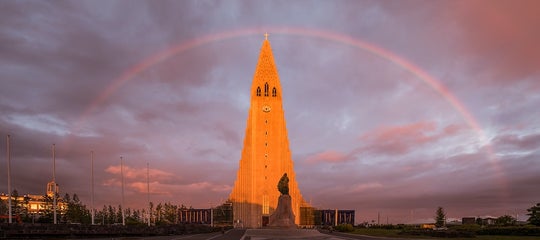
The downtown Reykjavik landmarks loop is the city's essential walk, gathering its icons into a couple of easy miles. Start at Hallgrimskirkja Church and ride the elevator up its 240-foot (73-meter) tower for the finest view across the colorful rooftops to the sea and mountains.
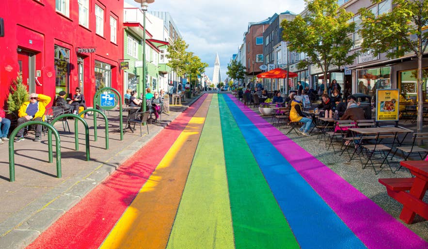
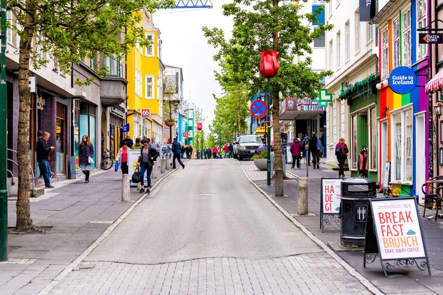
From the church, head down the rainbow-painted Skolavordustigur Street into the shops of Laugavegur Street, pausing for coffee at Prikid Cafe, one of the oldest cafes in town. Then carry on to the Parliament House and the Reykjavik Cathedral on Austurvollur Square.
Finish at Tjornin Pond, stopping by the City Hall and its giant 3D map of Iceland and the historic Idno Culture House. In deep winter, the pond freezes into a natural skating rink. Allow two to three hours for the full loop.
Planning Your Reykjavik Walks
Between the downtown loop, the waterfront, and the green valleys, Reykjavik rewards anyone willing to explore on foot. Start with the downtown stroll, then branch out to the coast, the island, or the woods as time allows.
When you are ready to venture further, the city is also the launch pad for guided day trips to nearby attractions like the Golden Circle, the South Coast, and the Blue Lagoon. Whichever you choose, the capital is a comfortable base for exploring the rest of the country.
雷克雅未克适合步行游览吗?
雷克雅未克最好的步行路线是哪条?
雷克雅未克市中心步行需要多久?
可以步行去格罗塔灯塔吗?
雷克雅未克有导览徒步团吗?
雷克雅未克晚上步行安全吗?
一年中什么时候最适合在雷克雅未克步行?
在雷克雅未克散步时能看到北极光吗?
探索雷克雅未克需要租车吗?
Which Reykjavik walk are you most tempted to lace up for? Share your favorite city stroll in the comments below.

I was born on the west side of Reykjavík and grew up downtown, so Iceland has been my back yard for most of my life. I'm a father of two, I've traveled on five continents, and I still haven't found a country that holds my attention the way this one does.
That's why I co-founded Guide to Iceland. We connect travelers directly with Icelandic operators, guides and hosts, so the advice and the services both come from people who actually live here.
I write about the practical side of a trip: what eating out in Reykjavík really costs, whether to pick Sky Lagoon or Hvammsvík, where to stop for food along the Ring Road, and which regions give you the best odds of clear skies for the northern lights. If you're planning a trip and something doesn't add up, message me.